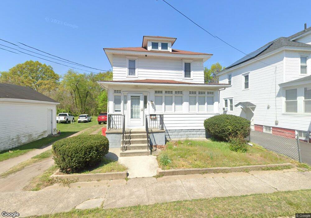
1006 Penn Line Rd Paulsboro, NJ 08066
Estimated Value: $184,663 - $226,000
--
Bed
--
Bath
1,248
Sq Ft
$165/Sq Ft
Est. Value
About This Home
This home is located at 1006 Penn Line Rd, Paulsboro, NJ 08066 and is currently estimated at $205,666, approximately $164 per square foot. 1006 Penn Line Rd is a home located in Gloucester County with nearby schools including Billingsport Elementary School, Loudenslager Elementary School, and Paulsboro High School.
Ownership History
Date
Name
Owned For
Owner Type
Purchase Details
Closed on
Jun 28, 2021
Sold by
Gattuso Eileen and Estate Of Anna Nancy Gattuso
Bought by
Lebron Melanie Rosario
Current Estimated Value
Home Financials for this Owner
Home Financials are based on the most recent Mortgage that was taken out on this home.
Original Mortgage
$120,000
Outstanding Balance
$108,981
Interest Rate
2.96%
Mortgage Type
New Conventional
Estimated Equity
$96,685
Purchase Details
Closed on
Jan 23, 1999
Sold by
Gattuso Annunziato and Gattuso Frances
Bought by
Gattuso Anna Nancy
Create a Home Valuation Report for This Property
The Home Valuation Report is an in-depth analysis detailing your home's value as well as a comparison with similar homes in the area
Home Values in the Area
Average Home Value in this Area
Purchase History
| Date | Buyer | Sale Price | Title Company |
|---|---|---|---|
| Lebron Melanie Rosario | $130,000 | Realsafe Title Llc | |
| Gattuso Anna Nancy | -- | Victorian Title Agency Inc |
Source: Public Records
Mortgage History
| Date | Status | Borrower | Loan Amount |
|---|---|---|---|
| Open | Lebron Melanie Rosario | $120,000 |
Source: Public Records
Tax History Compared to Growth
Tax History
| Year | Tax Paid | Tax Assessment Tax Assessment Total Assessment is a certain percentage of the fair market value that is determined by local assessors to be the total taxable value of land and additions on the property. | Land | Improvement |
|---|---|---|---|---|
| 2025 | $3,678 | $83,600 | $11,800 | $71,800 |
| 2024 | $3,675 | $83,600 | $11,800 | $71,800 |
| 2023 | $3,675 | $83,600 | $11,800 | $71,800 |
| 2022 | $3,608 | $83,600 | $11,800 | $71,800 |
| 2021 | $3,282 | $83,600 | $11,800 | $71,800 |
| 2020 | $3,516 | $83,600 | $11,800 | $71,800 |
| 2019 | $3,406 | $83,600 | $11,800 | $71,800 |
| 2018 | $3,211 | $83,600 | $11,800 | $71,800 |
| 2017 | $3,198 | $83,600 | $11,800 | $71,800 |
| 2016 | $3,046 | $83,600 | $11,800 | $71,800 |
| 2015 | $3,029 | $83,600 | $11,800 | $71,800 |
| 2014 | $3,088 | $91,700 | $15,500 | $76,200 |
Source: Public Records
Map
Nearby Homes
- 1043 Penn Line Rd
- 140 142 W Jefferson St
- 129 W Washington St
- 227 W Buck St
- 46 Roosevelt St
- 53-55 Roosevelt St
- 122 W Washington St
- 28 W Jefferson St
- 344 W Washington St
- 21 W Adams St
- 335 W Buck St
- 269 W Broad St
- 11 W Washington St
- 53 Capitol St
- L18 20 W Broad St
- 27 29 E Adams St
- 28 E Adams St
- 106 E Adams St
- 1519 Pine St
- 1534 Pine St
- 1006 Penn Line Rd
- 1004 Penn Line Rd
- 1000 Penn Line Rd
- 1022 Penn Line Rd
- 1001 Penn Line Rd
- 1003 Penn Line Rd
- 309 Olive St
- 1021 Penn Line Rd
- 1024 Penn Line Rd
- 926 Penn Line Rd
- 1025 Penn Line Rd
- 1026 Penn Line Rd
- 158 Mc Corkell Ave
- 171 Mc Corkell Ave
- 927 Penn Line Rd
- 158 McCorkell Ave
- 169 Mc Corkell Ave
- 1031 Penn Line Rd
- 167 Mc Corkell Ave
- 163 McCorkell Ave