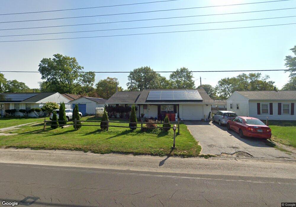
1006 S Duncan Rd Champaign, IL 61821
Estimated Value: $143,000 - $180,000
--
Bed
1
Bath
1,217
Sq Ft
$137/Sq Ft
Est. Value
About This Home
This home is located at 1006 S Duncan Rd, Champaign, IL 61821 and is currently estimated at $166,938, approximately $137 per square foot. 1006 S Duncan Rd is a home located in Champaign County with nearby schools including Centennial High School, St. John Lutheran School, and Swann Special Care Center-Elem/Secondary School.
Ownership History
Date
Name
Owned For
Owner Type
Purchase Details
Closed on
Sep 22, 2006
Sold by
Riley Marjorie W
Bought by
Acosta Rolano T and Albarracin Sharon B
Current Estimated Value
Home Financials for this Owner
Home Financials are based on the most recent Mortgage that was taken out on this home.
Original Mortgage
$97,000
Outstanding Balance
$57,966
Interest Rate
6.58%
Mortgage Type
Purchase Money Mortgage
Estimated Equity
$108,972
Purchase Details
Closed on
Jan 20, 2005
Sold by
Riley Marjorie W
Bought by
Trustee Of The Marjorie W Riley Trust
Create a Home Valuation Report for This Property
The Home Valuation Report is an in-depth analysis detailing your home's value as well as a comparison with similar homes in the area
Home Values in the Area
Average Home Value in this Area
Purchase History
| Date | Buyer | Sale Price | Title Company |
|---|---|---|---|
| Acosta Rolano T | $97,000 | None Available | |
| Trustee Of The Marjorie W Riley Trust | -- | -- |
Source: Public Records
Mortgage History
| Date | Status | Borrower | Loan Amount |
|---|---|---|---|
| Open | Acosta Rolano T | $97,000 |
Source: Public Records
Tax History Compared to Growth
Tax History
| Year | Tax Paid | Tax Assessment Tax Assessment Total Assessment is a certain percentage of the fair market value that is determined by local assessors to be the total taxable value of land and additions on the property. | Land | Improvement |
|---|---|---|---|---|
| 2024 | $3,066 | $43,920 | $9,860 | $34,060 |
| 2023 | $3,066 | $40,000 | $8,980 | $31,020 |
| 2022 | $2,842 | $36,900 | $8,280 | $28,620 |
| 2021 | $2,763 | $36,180 | $8,120 | $28,060 |
| 2020 | $2,702 | $35,470 | $7,960 | $27,510 |
| 2019 | $2,604 | $34,740 | $7,800 | $26,940 |
| 2018 | $2,538 | $34,200 | $7,680 | $26,520 |
| 2017 | $2,548 | $34,200 | $7,680 | $26,520 |
| 2016 | $2,274 | $33,490 | $7,520 | $25,970 |
| 2015 | $2,282 | $32,900 | $7,390 | $25,510 |
| 2014 | $2,263 | $32,900 | $7,390 | $25,510 |
| 2013 | $2,243 | $32,900 | $7,390 | $25,510 |
Source: Public Records
Map
Nearby Homes
- 901 Dogwood Dr
- 2908 W John St Unit B
- 610 S Duncan Rd Unit A
- 2808 Carrelton Dr
- 1309 Maplepark Dr
- 3311 Brentwood Dr
- 806 Scottsdale Dr
- 2501 Sheridan Dr
- 1402 Scottsdale Dr
- 2612 W Kirby Ave
- 1012 Waters Edge Rd
- 1407 Kenwood Rd
- 2605 Trafalgar Square
- 3804 Balmoral Dr
- 3334 Ridgewood Dr
- 3761 Thornhill Cir Unit 3761
- 1601 Carolyn Dr
- 1818 Tahoe Ct
- 2203 W Kirby Ave
- 3907 Aberdeen Dr
- 1008 S Duncan Rd
- 1002 S Duncan Rd
- 2911 W William St
- 1005 Maplepark Dr
- 1007 Maplepark Dr
- 1010 S Duncan Rd
- 1001 Maplepark Dr
- 1009 Maplepark Dr
- 1009 Maplepark Dr Unit 1
- 1012 S Duncan Rd
- 3001 W William St
- 1011 Maplepark Dr
- 910 S Duncan Rd
- 2912 W William St
- 1004 Maplepark Dr
- 1006 Maplepark Dr
- 1014 S Duncan Rd
- 909 Maplepark Dr
- 2905 W William St
- 1008 Maplepark Dr