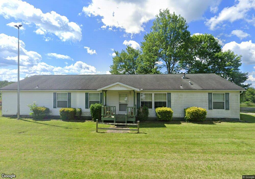
10060 Briar Rd Unit 26A Magnolia, OH 44643
Estimated Value: $342,055 - $540,000
3
Beds
2
Baths
2,432
Sq Ft
$171/Sq Ft
Est. Value
About This Home
This home is located at 10060 Briar Rd Unit 26A, Magnolia, OH 44643 and is currently estimated at $416,685, approximately $171 per square foot. 10060 Briar Rd Unit 26A is a home located in Carroll County with nearby schools including Sandy Valley Elementary School, Sandy Valley Middle School, and Sandy Valley High School.
Ownership History
Date
Name
Owned For
Owner Type
Purchase Details
Closed on
Jul 28, 2018
Sold by
Carlin Lawrence
Bought by
Poole Carlin June L
Current Estimated Value
Purchase Details
Closed on
Feb 9, 2006
Sold by
Estate Of George O Poole
Bought by
Poole June L
Create a Home Valuation Report for This Property
The Home Valuation Report is an in-depth analysis detailing your home's value as well as a comparison with similar homes in the area
Home Values in the Area
Average Home Value in this Area
Purchase History
| Date | Buyer | Sale Price | Title Company |
|---|---|---|---|
| Poole Carlin June L | -- | Alban Title | |
| Poole June L | -- | None Available |
Source: Public Records
Tax History Compared to Growth
Tax History
| Year | Tax Paid | Tax Assessment Tax Assessment Total Assessment is a certain percentage of the fair market value that is determined by local assessors to be the total taxable value of land and additions on the property. | Land | Improvement |
|---|---|---|---|---|
| 2024 | $2,968 | $73,520 | $17,710 | $55,810 |
| 2023 | $3,119 | $73,520 | $17,710 | $55,810 |
| 2022 | $3,138 | $61,010 | $14,690 | $46,320 |
| 2021 | $2,629 | $61,010 | $14,690 | $46,320 |
| 2020 | $2,584 | $61,010 | $14,690 | $46,320 |
| 2019 | $2,579 | $61,016 | $14,693 | $46,323 |
| 2018 | $2,289 | $51,970 | $10,300 | $41,670 |
| 2017 | $2,376 | $51,970 | $10,300 | $41,670 |
| 2016 | $2,227 | $47,680 | $9,450 | $38,230 |
| 2015 | $2,227 | $47,680 | $9,450 | $38,230 |
| 2014 | $2,365 | $47,680 | $9,450 | $38,230 |
| 2013 | $2,323 | $47,680 | $9,450 | $38,230 |
Source: Public Records
Map
Nearby Homes
- 1147 Hope Rd NW
- 853 Hartwood Rd NW
- 0 Magnolia Rd Unit 5164979
- 1201 Whispering Pines Ln SW Unit 12
- 5050 Miner St
- 1100 Fawn Rd SW Unit 12A
- 1121 Fiesta Rd SW Unit 12B
- 5218 Polen Rd NE
- 278 Bark Rd SW Unit 1A
- 910 Canal St
- 8737 N High St
- 9201 N Shore Dr NE
- 6234 Riggle Hill Rd NE
- 7009 Bachelor Rd NW
- 5416 M Ave
- 9204 Sandyville Rd NE
- 6170 Paradise Dr SW
- 1186 Lincoln St SW
- 2319 Camille Rd SW Unit 17
- 5219 N St NE
- 10084 Briar Rd Unit 26A
- 10096 Briar Rd
- 10112 Briar Rd Unit 26A
- 10022 Briar Rd Unit 26
- 0 Briar Rd Unit 4337537
- 1025 Indigo Rd NW Unit 27
- 9355 Briar Rd Unit 21
- 9357 Briar Rd
- 1035 Indigo Rd NW Unit 27
- 1043 Indigo Rd NW Unit 27
- 10145 Briar Rd NW Unit 27
- 9330 Briar Rd Unit 20
- 0 Indigo Rd
- 225 Thunder Rd NW
- 1043 Indigo Rd NW
- 9249 Briar Rd
- 276 Thunder Rd NW Unit 20
- 9237 Briar Rd
- 9237 Briar Rd Unit 40
- 1140 Indigo Rd NW