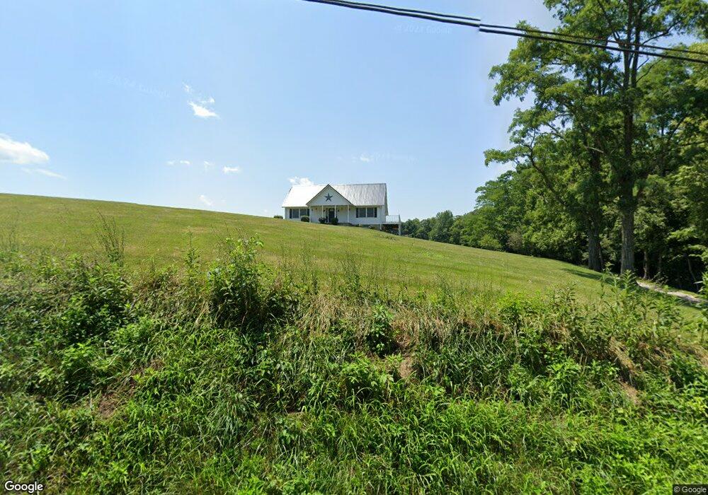
10061 W Fork Rd Georgetown, OH 45121
Estimated Value: $223,000 - $358,000
About This Home
This home is located at 10061 W Fork Rd, Georgetown, OH 45121 and is currently estimated at $307,871, approximately $161 per square foot. 10061 W Fork Rd is a home located in Brown County with nearby schools including Georgetown Elementary School and Georgetown Jr/Sr High School.
Ownership History
We collect this data history from publicly available records. To have your information removed, we recommend requesting removal directly through your county’s website.
Purchase Details
Home Financials for this Owner
Home Financials are based on the most recent Mortgage that was taken out on this home.Purchase Details
Purchase Details
Purchase Details
Home Financials for this Owner
Home Financials are based on the most recent Mortgage that was taken out on this home.Purchase History
We collect this data history from publicly available records. To have your information removed, we recommend requesting removal directly through your county’s website.
| Date | Buyer | Sale Price | Title Company |
|---|---|---|---|
| $168,000 | -- | ||
| $160,000 | -- | ||
| $160,000 | -- | ||
| $18,900 | -- |
Mortgage History
We collect this data history from publicly available records. To have your information removed, we recommend requesting removal directly through your county’s website.
| Date | Status | Borrower | Loan Amount |
|---|---|---|---|
| Open | $168,000 | ||
| Previous Owner | $16,500 |
Tax History
We collect this data history from publicly available records. To have your information removed, we recommend requesting removal directly through your county’s website.
| Year | Tax Paid | Tax Assessment Tax Assessment Total Assessment is a certain percentage of the fair market value that is determined by local assessors to be the total taxable value of land and additions on the property. | Land | Improvement |
|---|---|---|---|---|
| 2025 | $3,006 | $90,450 | $17,490 | $72,960 |
| 2024 | $3,006 | $90,450 | $17,490 | $72,960 |
| 2023 | $2,980 | $74,320 | $14,550 | $59,770 |
| 2022 | $2,548 | $74,320 | $14,550 | $59,770 |
| 2021 | $2,522 | $74,320 | $14,550 | $59,770 |
| 2020 | $2,271 | $64,620 | $12,650 | $51,970 |
| 2019 | $2,253 | $64,620 | $12,650 | $51,970 |
| 2018 | $2,235 | $64,620 | $12,650 | $51,970 |
| 2017 | $1,969 | $59,350 | $13,910 | $45,440 |
| 2016 | $1,968 | $59,350 | $13,910 | $45,440 |
| 2015 | $2,041 | $59,350 | $13,910 | $45,440 |
| 2014 | $2,041 | $58,090 | $12,650 | $45,440 |
| 2013 | $2,075 | $58,090 | $12,650 | $45,440 |
Map
- 10574 W Fork Rd
- 10104 W Fork Rd
- 40 Straight Dr
- 203 Lakewood Ln
- 5616 Camp Run Rd
- 10709 Day Hill-Arnheim Rd
- 37 Station Dr
- 15 Wahl St
- 11479 Brownstown Arnheim Rd
- 614 E Grant Ave
- 432 Kenwood Ave
- 60 New St
- 399 Elmwood Ct
- 708 E State St
- 405 N Main St
- 666 E State St
- 1787 Waynoka Dr
- 1655 Waynoka Dr
- 618 E State St
- B E State St
- 0 W Fork Rd Unit 1593853
- 0 W Fork Rd Unit 1278628
- 0 W Fork Rd Unit 1307692
- 0 W Fork Rd Unit 1446838
- 0 W Fork Rd Unit 1446832
- 0 W Fork Rd Unit 1447830
- 0 W Fork Rd Unit 1727618
- 0 W Fork Rd Unit 759695
- 5612 Wahlsburg East Rd
- 0 W Fork Rd Unit Lt 11 1134615
- 0 W Fork Rd Unit Lt 11 1232729
- 0 W Fork Rd Unit 1344395
- 11 W Fork Rd Unit 11
- 1 W Fork Rd
- 10088 W Fork Rd
- 5610 Wahlsburg East Rd
- 10073 W Fork Rd
- 9890 Baker Hanselman Rd
- 10079 W Fork Rd
- 5582 Wahlsburg East Rd
Ask me questions while you tour the home.