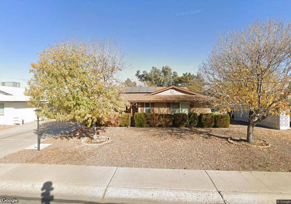
10064 W Peoria Ave Sun City, AZ 85351
Estimated Value: $223,491 - $345,000
--
Bed
2
Baths
1,482
Sq Ft
$188/Sq Ft
Est. Value
About This Home
This home is located at 10064 W Peoria Ave, Sun City, AZ 85351 and is currently estimated at $279,123, approximately $188 per square foot. 10064 W Peoria Ave is a home located in Maricopa County with nearby schools including Ombudsman - Northwest Charter and Peoria Accelerated High School.
Ownership History
Date
Name
Owned For
Owner Type
Purchase Details
Closed on
Jul 5, 2025
Sold by
Ralston Raymond R and Ralston Barbara A
Bought by
Ralston Eric
Current Estimated Value
Purchase Details
Closed on
Mar 23, 2021
Sold by
Ralston Raymond R and Ralston Barbara A
Bought by
Ralston Raymond R and Ralston Barbara A
Home Financials for this Owner
Home Financials are based on the most recent Mortgage that was taken out on this home.
Original Mortgage
$164,827
Interest Rate
2.9%
Mortgage Type
VA
Purchase Details
Closed on
Jan 18, 2018
Sold by
Ralston Raymond R and Ralston Barbara A
Bought by
Ralston Raymond R and Ralston Barbara A
Purchase Details
Closed on
Mar 19, 2016
Sold by
Ralston Raymond Robert and Ralston Barbara Ann
Bought by
Ralston Raymond Robert and Ralston Barbara Ann
Home Financials for this Owner
Home Financials are based on the most recent Mortgage that was taken out on this home.
Original Mortgage
$108,409
Interest Rate
3.65%
Mortgage Type
VA
Purchase Details
Closed on
Feb 24, 2014
Sold by
Ralston Raymond Robert and Ralston Barbara Ann
Bought by
The Butterfly Trust
Home Financials for this Owner
Home Financials are based on the most recent Mortgage that was taken out on this home.
Original Mortgage
$102,473
Interest Rate
4.34%
Mortgage Type
VA
Purchase Details
Closed on
Dec 6, 2012
Sold by
Ralston Raymond Robert and Ralston Barbara Ann
Bought by
Ralston Raymond Robert and Ralston Barbara Ann
Home Financials for this Owner
Home Financials are based on the most recent Mortgage that was taken out on this home.
Original Mortgage
$81,924
Interest Rate
3.35%
Mortgage Type
VA
Purchase Details
Closed on
Aug 29, 2011
Sold by
Ralston Raymond and Ralston Barbara A
Bought by
Ralston Raymond Robert and Ralston Barbara Ann
Purchase Details
Closed on
Apr 12, 2001
Sold by
Mills Betty H
Bought by
Ralston Raymond and Ralston Barbara A
Home Financials for this Owner
Home Financials are based on the most recent Mortgage that was taken out on this home.
Original Mortgage
$72,000
Interest Rate
6.98%
Mortgage Type
Seller Take Back
Purchase Details
Closed on
Mar 16, 1994
Sold by
Jenks Glenrae E
Bought by
Mills Betty H
Create a Home Valuation Report for This Property
The Home Valuation Report is an in-depth analysis detailing your home's value as well as a comparison with similar homes in the area
Home Values in the Area
Average Home Value in this Area
Purchase History
| Date | Buyer | Sale Price | Title Company |
|---|---|---|---|
| Ralston Eric | -- | None Listed On Document | |
| Ralston Raymond R | -- | Amrock Inc | |
| Ralston Raymond R | -- | Amrock Inc | |
| Ralston Raymond R | -- | None Available | |
| Ralston Raymond Robert | -- | Nations Title Agency Inc | |
| The Butterfly Trust | -- | None Available | |
| Ralston Raymond Robert | -- | None Available | |
| Ralston Raymond Robert | -- | Title Source | |
| Ralston Raymond Robert | -- | Title Source | |
| Ralston Raymond Robert | -- | None Available | |
| Ralston Raymond | $82,000 | First American Title | |
| Mills Betty H | $73,000 | First American Title |
Source: Public Records
Mortgage History
| Date | Status | Borrower | Loan Amount |
|---|---|---|---|
| Previous Owner | Ralston Raymond R | $164,827 | |
| Previous Owner | Ralston Raymond Robert | $108,409 | |
| Previous Owner | Ralston Raymond Robert | $102,473 | |
| Previous Owner | Ralston Raymond Robert | $81,924 | |
| Previous Owner | Ralston Raymond | $72,000 |
Source: Public Records
Tax History Compared to Growth
Tax History
| Year | Tax Paid | Tax Assessment Tax Assessment Total Assessment is a certain percentage of the fair market value that is determined by local assessors to be the total taxable value of land and additions on the property. | Land | Improvement |
|---|---|---|---|---|
| 2025 | $988 | $11,716 | -- | -- |
| 2024 | $895 | $11,158 | -- | -- |
| 2023 | $895 | $20,260 | $4,050 | $16,210 |
| 2022 | $834 | $15,610 | $3,120 | $12,490 |
| 2021 | $860 | $15,070 | $3,010 | $12,060 |
| 2020 | $838 | $13,460 | $2,690 | $10,770 |
| 2019 | $841 | $12,410 | $2,480 | $9,930 |
| 2018 | $811 | $11,160 | $2,230 | $8,930 |
| 2017 | $786 | $9,780 | $1,950 | $7,830 |
| 2016 | $389 | $8,980 | $1,790 | $7,190 |
| 2015 | $693 | $8,150 | $1,630 | $6,520 |
Source: Public Records
Map
Nearby Homes
- 10076 W Peoria Ave
- 10102 W Deanne Dr Unit 6
- 10013 W Lakeview Cir N
- 10635 N 103rd Ave
- 10010 W Deanne Dr
- 10002 W Deanne Dr
- 10614 N 103rd Ave
- 10027 W Tarrytown Ave Unit 6
- 10219 W Snead Cir S
- 10314 W Deanne Dr
- 10351 W Pinehurst Dr
- 10425 N Balboa Dr
- 10222 W Snead Cir S
- 10232 W Snead Cir S
- 10345 W Peoria Ave Unit 5
- 11054 N Coggins Dr
- 10279 W Snead Cir N
- 10318 W Corte Del Sol Este Unit 21
- 10323 W Deanne Dr
- 10034 W Concord Ave
- 10058 W Peoria Ave
- 10070 W Peoria Ave
- 10052 W Peoria Ave
- 10110 W Pinehurst Dr
- 10046 W Peoria Ave
- 10116 W Pinehurst Dr
- 10065 W Peoria Ave
- 10425 N 101st Ave
- 10102 W Peoria Ave
- 10040 W Peoria Ave
- 10122 W Pinehurst Dr
- 10109 W Pinehurst Dr
- 10045 W Peoria Ave
- 10057 W Peoria Ave
- 10419 N 101st Ave
- 10110 W Peoria Ave
- 10034 W Peoria Ave
- 10119 W Pinehurst Dr Unit 4
- 10101 W Peoria Ave
- 10128 W Pinehurst Dr Unit 4