Estimated Value: $169,000 - $194,510
4
Beds
1
Bath
1,635
Sq Ft
$113/Sq Ft
Est. Value
About This Home
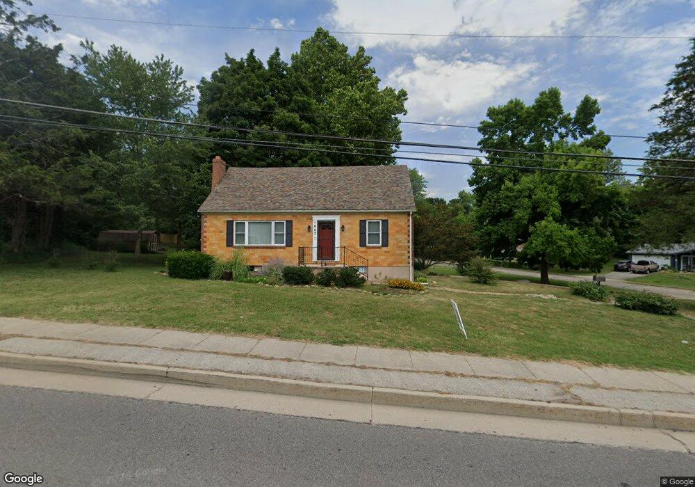
This home is located at 1007 E State Route 72, Rolla, MO 65401 and is currently estimated at $184,170, approximately $112 per square foot. 1007 E State Route 72 is a home with nearby schools including Rolla Junior High School, Rolla Senior High School, and Rolla Seventh-Day Adventist School.
Ownership History
Date
Name
Owned For
Owner Type
Purchase Details
Closed on
Nov 12, 2024
Sold by
Thurman Melody K and Thurman Lance B
Bought by
Huck Michelle
Current Estimated Value
Home Financials for this Owner
Home Financials are based on the most recent Mortgage that was taken out on this home.
Original Mortgage
$54,000
Outstanding Balance
$53,462
Interest Rate
6.12%
Mortgage Type
Construction
Estimated Equity
$130,708
Purchase Details
Closed on
Mar 31, 2014
Purchase Details
Closed on
Jun 15, 1978
Create a Home Valuation Report for This Property
The Home Valuation Report is an in-depth analysis detailing your home's value as well as a comparison with similar homes in the area
Home Values in the Area
Average Home Value in this Area
Purchase History
| Date | Buyer | Sale Price | Title Company |
|---|---|---|---|
| Huck Michelle | $67,500 | Wiggins Abs Co | |
| -- | $91,500 | -- | |
| -- | -- | -- |
Source: Public Records
Mortgage History
| Date | Status | Borrower | Loan Amount |
|---|---|---|---|
| Open | Huck Michelle | $54,000 |
Source: Public Records
Tax History
| Year | Tax Paid | Tax Assessment Tax Assessment Total Assessment is a certain percentage of the fair market value that is determined by local assessors to be the total taxable value of land and additions on the property. | Land | Improvement |
|---|---|---|---|---|
| 2025 | $977 | $18,720 | $3,210 | $15,510 |
| 2024 | $881 | $16,380 | $2,280 | $14,100 |
| 2023 | $886 | $16,380 | $2,280 | $14,100 |
| 2022 | $753 | $16,380 | $2,280 | $14,100 |
| 2021 | $758 | $16,380 | $2,280 | $14,100 |
| 2020 | $689 | $14,540 | $2,280 | $12,260 |
| 2019 | $685 | $14,140 | $2,280 | $11,860 |
| 2018 | $661 | $14,140 | $2,280 | $11,860 |
| 2017 | $660 | $14,140 | $2,280 | $11,860 |
| 2016 | $638 | $14,140 | $2,280 | $11,860 |
| 2015 | -- | $14,140 | $2,280 | $11,860 |
| 2014 | -- | $14,140 | $2,280 | $11,860 |
| 2013 | -- | $14,140 | $0 | $0 |
Source: Public Records
Map
Nearby Homes
- 403 Hutchinson Dr
- 687 Salem Ave
- 654 Holmes Ln
- 814 Oxford Dr
- 821 Cambridge Dr
- 708 E State Route 72
- 60 Richard Dr
- 38 Johnson Dr
- 63 Rose Ct
- 35 Green Acres Dr
- 56 Rolla Gardens Dr
- 816 Laurel Dr
- 5 Rolla Gardens Dr
- 45 Mcfarland Dr
- 1102 Sycamore Dr
- Lot 74 B Cedar Hill Ct
- Lot 74 A Cedar Hill Ct
- 0 Sherwood Unit MIS25076064
- 0 Redbud Ln
- 100 N Walnut St
- 1007 Missouri 72
- 1007 Highway O Unit 72
- 919 E State Route 72
- 8 Gano Dr
- 400 Sheron Ave
- 2 Gano Dr
- 916 Highway 72
- 916 E State Route 72
- 4 Gano Dr
- 915 E State Route 72
- 402 Sheron Ave
- 1 Gano Dr
- 6 Gano Dr
- 8 Summit Ave
- 1008 E State Highway 72
- 914 E State Route 72
- 14 King Dr
- 400 Bill Ave
- 15 King Dr
- 5 Gano Dr
Your Personal Tour Guide
Ask me questions while you tour the home.