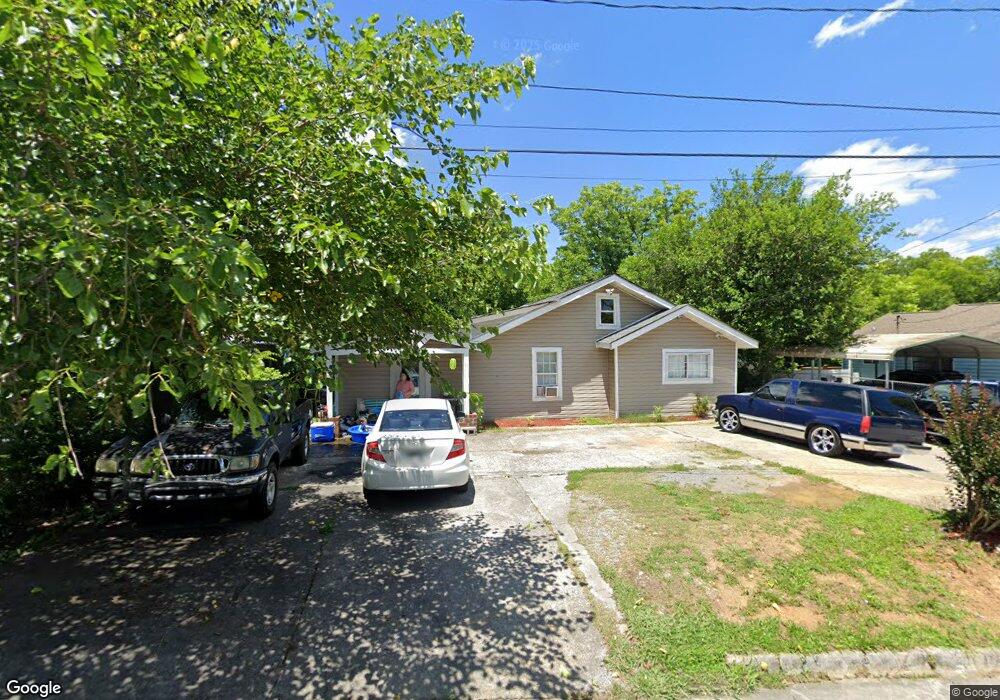
1007 Foster St Dalton, GA 30721
Estimated Value: $176,000 - $226,000
--
Bed
1
Bath
1,680
Sq Ft
$116/Sq Ft
Est. Value
About This Home
This home is located at 1007 Foster St, Dalton, GA 30721 and is currently estimated at $195,385, approximately $116 per square foot. 1007 Foster St is a home located in Whitfield County with nearby schools including Roan Elementary School, Dalton Middle School, and Dalton High School.
Ownership History
Date
Name
Owned For
Owner Type
Purchase Details
Closed on
Dec 19, 2013
Sold by
Joaquin Bernardino Lozano
Bought by
Joaquin Griselda
Current Estimated Value
Purchase Details
Closed on
May 15, 2008
Sold by
Lozano Bernardino Joaquin
Bought by
Lozano Bernardino Joaquinn and Joaquin Romelia
Home Financials for this Owner
Home Financials are based on the most recent Mortgage that was taken out on this home.
Original Mortgage
$63,000
Interest Rate
5.86%
Mortgage Type
New Conventional
Purchase Details
Closed on
Mar 1, 2001
Sold by
Crutchfield Charlotte A
Bought by
Davis John E
Create a Home Valuation Report for This Property
The Home Valuation Report is an in-depth analysis detailing your home's value as well as a comparison with similar homes in the area
Home Values in the Area
Average Home Value in this Area
Purchase History
| Date | Buyer | Sale Price | Title Company |
|---|---|---|---|
| Joaquin Griselda | -- | -- | |
| Lozano Bernardino Joaquinn | -- | -- | |
| Lozano Bernardino Joaquin | $78,750 | -- | |
| Davis John E | $96,000 | -- |
Source: Public Records
Mortgage History
| Date | Status | Borrower | Loan Amount |
|---|---|---|---|
| Previous Owner | Lozano Bernardino Joaquin | $63,000 |
Source: Public Records
Tax History Compared to Growth
Tax History
| Year | Tax Paid | Tax Assessment Tax Assessment Total Assessment is a certain percentage of the fair market value that is determined by local assessors to be the total taxable value of land and additions on the property. | Land | Improvement |
|---|---|---|---|---|
| 2024 | $1,544 | $73,624 | $8,400 | $65,224 |
| 2023 | $1,544 | $47,702 | $5,400 | $42,302 |
| 2022 | $872 | $32,696 | $5,400 | $27,296 |
| 2021 | $873 | $32,696 | $5,400 | $27,296 |
| 2020 | $895 | $32,696 | $5,400 | $27,296 |
| 2019 | $1,208 | $32,696 | $5,400 | $27,296 |
| 2018 | $1,226 | $32,696 | $5,400 | $27,296 |
| 2017 | $1,180 | $32,696 | $5,400 | $27,296 |
| 2016 | $1,017 | $28,001 | $3,150 | $24,851 |
| 2014 | $924 | $28,001 | $3,150 | $24,851 |
| 2013 | -- | $28,001 | $3,150 | $24,851 |
Source: Public Records
Map
Nearby Homes
- 301B Fields Ave
- 204 N Bogle St
- 825 Martin Luther King jr Blvd
- 303 Janice St
- 1118 Dozier St
- 711 E Morris St
- 502 E Woodland Dr
- 519 Abigail St
- 533 Underwood St
- 606 Virginia Ave
- 503 Harris St
- 432 4th Ave
- 0 Robinwood Dr
- 230 Henderson St
- 404 Paige St
- 311 Shady Ln
- 540 Stillwood Dr
- 0 Dogwood Dr
- 601 Stillwood Dr
- 429 S Glenwood Ave