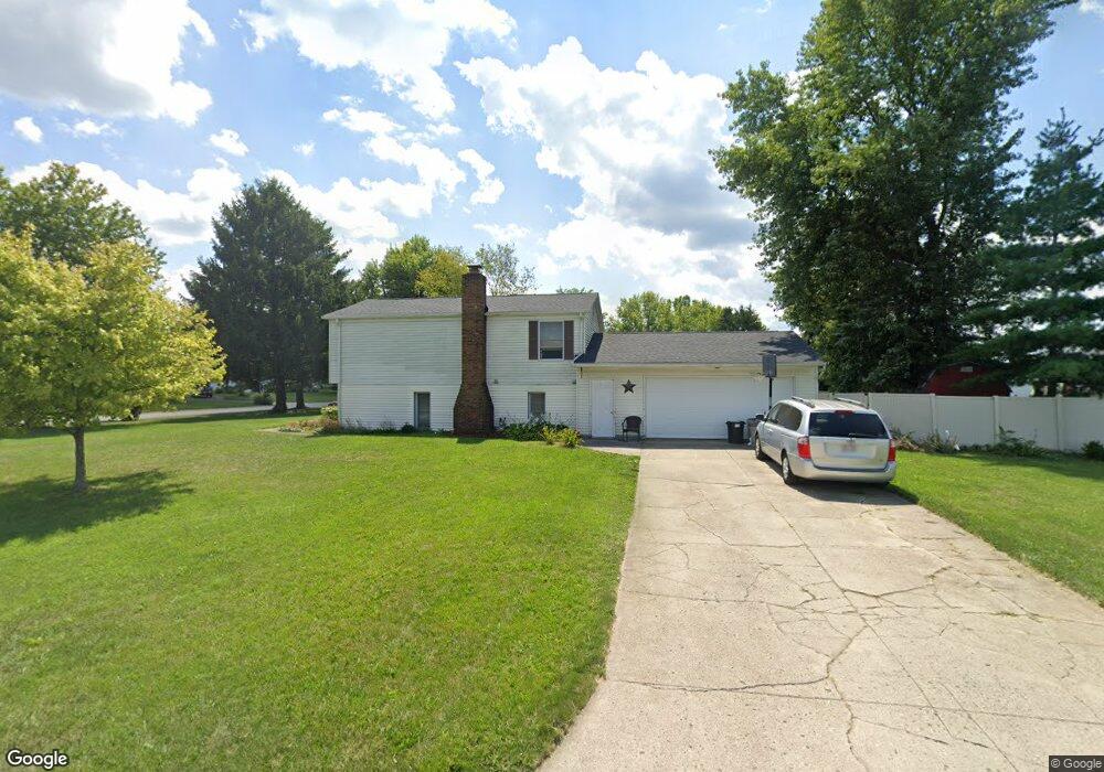
1007 Southland Dr Bucyrus, OH 44820
Estimated Value: $239,007 - $323,000
3
Beds
3
Baths
2,040
Sq Ft
$132/Sq Ft
Est. Value
About This Home
This home is located at 1007 Southland Dr, Bucyrus, OH 44820 and is currently estimated at $269,502, approximately $132 per square foot. 1007 Southland Dr is a home located in Crawford County with nearby schools including Bucyrus Elementary School, Bucyrus Secondary School, and Wayside Christian School.
Ownership History
Date
Name
Owned For
Owner Type
Purchase Details
Closed on
Sep 12, 2018
Sold by
Nichols Sherri L
Bought by
Nichols Todd N
Current Estimated Value
Purchase Details
Closed on
Jul 27, 2015
Sold by
Nichols Todd M and Nichols Sherri L
Bought by
Maxfield Victoria
Home Financials for this Owner
Home Financials are based on the most recent Mortgage that was taken out on this home.
Original Mortgage
$132,500
Interest Rate
3.96%
Mortgage Type
Seller Take Back
Create a Home Valuation Report for This Property
The Home Valuation Report is an in-depth analysis detailing your home's value as well as a comparison with similar homes in the area
Home Values in the Area
Average Home Value in this Area
Purchase History
| Date | Buyer | Sale Price | Title Company |
|---|---|---|---|
| Nichols Todd N | -- | None Available | |
| Maxfield Victoria | $132,500 | Attorney |
Source: Public Records
Mortgage History
| Date | Status | Borrower | Loan Amount |
|---|---|---|---|
| Closed | Maxfield Victoria | $132,500 |
Source: Public Records
Tax History Compared to Growth
Tax History
| Year | Tax Paid | Tax Assessment Tax Assessment Total Assessment is a certain percentage of the fair market value that is determined by local assessors to be the total taxable value of land and additions on the property. | Land | Improvement |
|---|---|---|---|---|
| 2024 | $2,962 | $65,670 | $9,100 | $56,570 |
| 2023 | $2,962 | $51,150 | $7,000 | $44,150 |
| 2022 | $2,729 | $51,150 | $7,000 | $44,150 |
| 2021 | $2,723 | $51,150 | $7,000 | $44,150 |
| 2020 | $2,299 | $40,930 | $7,000 | $33,930 |
| 2019 | $2,350 | $40,930 | $7,000 | $33,930 |
| 2018 | $2,339 | $40,930 | $7,000 | $33,930 |
| 2017 | $2,376 | $40,110 | $7,000 | $33,110 |
| 2016 | $2,303 | $40,110 | $7,000 | $33,110 |
| 2015 | $2,284 | $40,110 | $7,000 | $33,110 |
| 2014 | $2,262 | $40,110 | $7,000 | $33,110 |
| 2013 | $2,262 | $40,110 | $7,000 | $33,110 |
Source: Public Records
Map
Nearby Homes
- 1149 Farmview Dr
- 1145 Lynne Ave
- 1112 Hillcrest Dr
- 0 Lynne Ave
- 1123 Hillcrest Dr
- 1315 Lynne Ave
- 130 Brentwood St
- 2440 Wyandot Rd
- 275 Brentwood St
- 1555 Rosedale Ave
- 452 Pleasant Ln
- 900 S Spring St
- 325 W Liberty St
- 1211 S Sandusky Ave
- 1021 S Sandusky Ave
- 2273 Kerstetter Rd
- 708 S Sandusky Ave
- 317 S Spring St
- 316 W Warren St
- 550 S Walnut St
- 1027 Southland Dr
- 1127 W Southern Ave
- 1102 Victoria Dr
- 1118 Victoria Dr
- 1002 Southland Dr
- 1139 W Southern Ave
- 1022 Southland Dr
- 1128 Victoria Dr
- 1040 Victoria Dr
- 1217 W Southern Ave
- 1025 W Southern Ave
- 1208 Victoria Dr
- 1115 Victoria Dr
- 1020 Victoria Dr
- 1123 Victoria Dr
- 1221 W Southern Ave
- 1035 Victoria Dr
- 1015 W Southern Ave
- 1216 Victoria Dr
- 1000 Victoria Dr