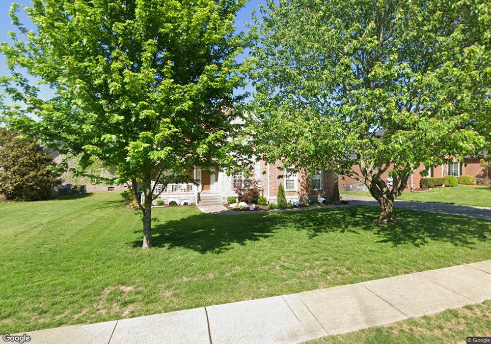
1007 St Hubbins Dr Spring Hill, TN 37174
Estimated Value: $729,791 - $752,000
4
Beds
4
Baths
3,288
Sq Ft
$227/Sq Ft
Est. Value
About This Home
This home is located at 1007 St Hubbins Dr, Spring Hill, TN 37174 and is currently estimated at $745,198, approximately $226 per square foot. 1007 St Hubbins Dr is a home located in Williamson County with nearby schools including Longview Elementary School, Primrose School of Spring Hill, and Columbia Academy at Spring Hill.
Ownership History
Date
Name
Owned For
Owner Type
Purchase Details
Closed on
Jan 9, 2014
Sold by
Branham Peter and Branham Kathleen
Bought by
Thompson Micky L and Thompson Layla B
Current Estimated Value
Home Financials for this Owner
Home Financials are based on the most recent Mortgage that was taken out on this home.
Original Mortgage
$285,120
Outstanding Balance
$214,943
Interest Rate
4.43%
Mortgage Type
New Conventional
Estimated Equity
$530,255
Purchase Details
Closed on
Apr 15, 2005
Sold by
Concord Homes Llc
Bought by
Branham Peter and Branham Kathleen
Home Financials for this Owner
Home Financials are based on the most recent Mortgage that was taken out on this home.
Original Mortgage
$295,476
Interest Rate
5.74%
Mortgage Type
Fannie Mae Freddie Mac
Create a Home Valuation Report for This Property
The Home Valuation Report is an in-depth analysis detailing your home's value as well as a comparison with similar homes in the area
Home Values in the Area
Average Home Value in this Area
Purchase History
| Date | Buyer | Sale Price | Title Company |
|---|---|---|---|
| Thompson Micky L | $316,800 | Foundation Title & Escrow Ll | |
| Branham Peter | $369,812 | -- | |
| Concord Homes Llc | -- | -- |
Source: Public Records
Mortgage History
| Date | Status | Borrower | Loan Amount |
|---|---|---|---|
| Open | Thompson Micky L | $285,120 | |
| Previous Owner | Branham Peter | $295,476 | |
| Closed | Branham Peter | $55,401 |
Source: Public Records
Tax History
| Year | Tax Paid | Tax Assessment Tax Assessment Total Assessment is a certain percentage of the fair market value that is determined by local assessors to be the total taxable value of land and additions on the property. | Land | Improvement |
|---|---|---|---|---|
| 2025 | $908 | $185,400 | $42,500 | $142,900 |
| 2024 | $908 | $122,850 | $22,500 | $100,350 |
| 2023 | $908 | $122,850 | $22,500 | $100,350 |
| 2022 | $2,248 | $122,850 | $22,500 | $100,350 |
| 2021 | $2,248 | $122,850 | $22,500 | $100,350 |
| 2020 | $2,085 | $96,525 | $16,250 | $80,275 |
| 2019 | $2,085 | $96,525 | $16,250 | $80,275 |
| 2018 | $2,017 | $96,525 | $16,250 | $80,275 |
| 2017 | $1,998 | $96,525 | $16,250 | $80,275 |
| 2016 | $0 | $96,525 | $16,250 | $80,275 |
| 2015 | -- | $80,075 | $15,000 | $65,075 |
| 2014 | -- | $80,075 | $15,000 | $65,075 |
Source: Public Records
Map
Nearby Homes
- 3027 Auld Tatty Dr
- 301 Heroit Ct
- 3006 Auld Tatty Dr
- 1183 Mccoury Ln
- 2062 N Amber Dr
- 1098 Misty Morn Cir
- 1046 Misty Morn Cir
- 2091 Hemlock Dr
- 2021 Hemlock Dr
- 3030 Liverpool Dr
- 0 O'Hallorn Dr
- 0 Campbell Station Pkwy
- 4979 Paddy Trace
- 2799 New Port Royal Rd
- 1060 Auldridge Dr
- 1007 Cashmere Dr
- 2938 Churchill Ln
- 5012 Paddy Trace
- 2934 Churchill Ln
- 5017 Paddy Trace
- 1009 St Hubbins Dr
- 1001 St Hubbins Dr
- 1011 St Hubbins Dr
- 1008 St Hubbins Dr
- 1006 St Hubbins Dr
- 1010 St Hubbins Dr
- 1004 St Hubbins Dr
- 1002 St Hubbins Dr
- 1002 St Hubbins Dr Unit 340
- 1013 St Hubbins Dr
- 1000 St Hubbins Dr
- 1012 St Hubbins Dr
- 1195 Mccoury Ln
- 306 Heroit Ct
- 307 Heroit Ct #21
- 304 Heroit Ct
- 306 Heroit Ct
- 1015 St Hubbins Dr
- 307 Heroit Ct
- 307 Heroit Ct Unit 21
Your Personal Tour Guide
Ask me questions while you tour the home.