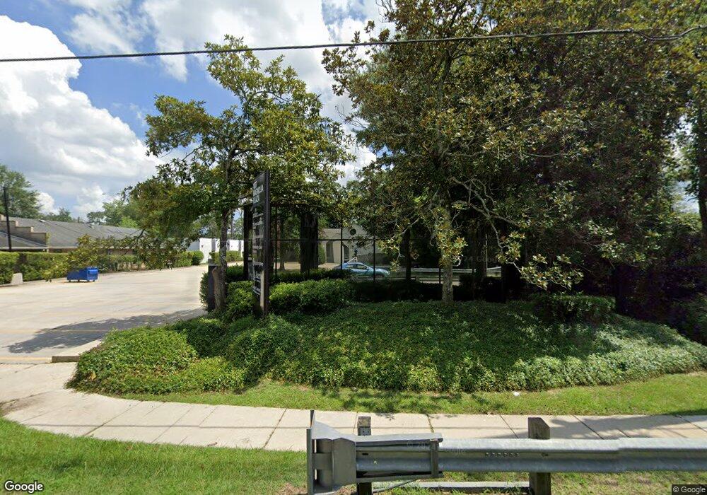
1007 W Thomas St Hammond, LA 70401
Estimated Value: $38,000
Studio
--
Bath
3,385
Sq Ft
$11/Sq Ft
Est. Value
About This Home
This home is located at 1007 W Thomas St, Hammond, LA 70401 and is currently estimated at $38,000, approximately $11 per square foot. 1007 W Thomas St is a home located in Tangipahoa Parish with nearby schools including Woodland Park Magnet, Greenville Park Leadership Academy, and Hammond High Magnet School.
Ownership History
Date
Name
Owned For
Owner Type
Purchase Details
Closed on
Apr 14, 2025
Sold by
Loranger Land Company Llc
Bought by
Prevost Culbreath Tammy and Prevost Keith Culbreath
Current Estimated Value
Purchase Details
Closed on
Aug 1, 2024
Sold by
Loranger Land Company Llc
Bought by
Rios Colten
Purchase Details
Closed on
Feb 1, 2023
Sold by
Loranger Land Company Llc
Bought by
Vicknair Donald Ray and Vicknair Katie Lynn
Purchase Details
Closed on
Nov 22, 2022
Sold by
Loranger Land Company Llc
Bought by
Bell Douglas Eugene and Bell Crystal Lynne
Purchase Details
Closed on
Oct 6, 2022
Sold by
Loranger Land Company Llc
Bought by
Mmm3 Llc
Home Financials for this Owner
Home Financials are based on the most recent Mortgage that was taken out on this home.
Original Mortgage
$474,050
Interest Rate
5.22%
Mortgage Type
New Conventional
Purchase Details
Closed on
Sep 22, 2022
Sold by
Loranger Land Company Llc
Bought by
Culbreath Tammy Prevost and Culbreath Darren Keith
Home Financials for this Owner
Home Financials are based on the most recent Mortgage that was taken out on this home.
Original Mortgage
$474,050
Interest Rate
5.22%
Mortgage Type
New Conventional
Purchase Details
Closed on
Sep 21, 2022
Sold by
Loranger Land Company Llc
Bought by
Perkins Randal Keith and Perkins Pamela S
Home Financials for this Owner
Home Financials are based on the most recent Mortgage that was taken out on this home.
Original Mortgage
$474,050
Interest Rate
5.22%
Mortgage Type
New Conventional
Purchase Details
Closed on
Sep 1, 2022
Sold by
Loranger Land Company Llc
Bought by
Reichard Kimberly Culbreath and Reichard Brach Daniel
Home Financials for this Owner
Home Financials are based on the most recent Mortgage that was taken out on this home.
Original Mortgage
$474,050
Interest Rate
5.22%
Mortgage Type
New Conventional
Create a Home Valuation Report for This Property
The Home Valuation Report is an in-depth analysis detailing your home's value as well as a comparison with similar homes in the area
Home Values in the Area
Average Home Value in this Area
Purchase History
| Date | Buyer | Sale Price | Title Company |
|---|---|---|---|
| Prevost Culbreath Tammy | $35,000 | None Listed On Document | |
| Prevost Culbreath Tammy | $35,000 | None Listed On Document | |
| Rios Colten | $98,975 | None Listed On Document | |
| Vicknair Donald Ray | $41,625 | -- | |
| Bell Douglas Eugene | $41,625 | Oak Street Title | |
| Mmm3 Llc | $139,687 | -- | |
| Culbreath Tammy Prevost | $32,652 | New Title Company Name | |
| Perkins Randal Keith | $499,000 | -- | |
| Reichard Kimberly Culbreath | $69,318 | None Listed On Document |
Source: Public Records
Mortgage History
| Date | Status | Borrower | Loan Amount |
|---|---|---|---|
| Previous Owner | Perkins Randal Keith | $474,050 |
Source: Public Records
Tax History
| Year | Tax Paid | Tax Assessment Tax Assessment Total Assessment is a certain percentage of the fair market value that is determined by local assessors to be the total taxable value of land and additions on the property. | Land | Improvement |
|---|---|---|---|---|
| 2024 | -- | $253 | $253 | $0 |
| 2023 | $0 | $358 | $358 | $0 |
| 2022 | $1,369 | $17,701 | $2,035 | $15,666 |
| 2021 | $826 | $18,708 | $3,043 | $15,665 |
| 2020 | $1,361 | $18,708 | $3,043 | $15,665 |
| 2019 | $1,361 | $18,708 | $3,043 | $15,665 |
| 2018 | $1,361 | $18,708 | $3,043 | $15,665 |
| 2017 | $1,361 | $18,708 | $3,043 | $15,665 |
| 2016 | $1,361 | $18,708 | $3,043 | $15,665 |
| 2015 | $867 | $19,352 | $3,043 | $16,309 |
| 2014 | $866 | $19,352 | $3,043 | $16,309 |
Source: Public Records
Map
Nearby Homes
- 109 N Linden St
- 1011 W Robert St
- 205 N Linden St
- 208 S Mooney Ave
- 112 N Scanlan St
- 306 N Linden St
- 301 S General Pershing St
- 200 N Scanlan St
- 311 N Linden St
- 703 Edwin Neill Way
- 206 W Clark St
- 213 N Scanlan St
- 1309 W Church St
- 206 Maryland St
- 208 N Carter St
- 201 Natchez St
- 501 N Linden St
- 1018 W Thomas St
- 1000 W Thomas St
- 107 E Stanley St
- 1007 W Thomas St Unit K
- 1007 W Thomas St Unit A
- 1007 W Thomas St Unit M
- 1003 W Thomas St Unit A
- 1003 W Thomas St Unit 1
- 1003 W Thomas St
- 1003 W Thomas St Unit 3
- 1003 W Thomas Street Suite 1 St
- 104 S Laurel St
- 110 S Laurel St
- 1006 W Thomas St
- 1004 W Thomas St
- 1107 W Thomas St
- 1107 W Thomas (Us Hwy 190) St
- 1001 W Morris Ave
- 1001 W Morris Ave
- 911 W Thomas St
- 912 W Morris Ave
- 1101 W Morris Ave
- 1101 W Morris Ave Unit A
Your Personal Tour Guide
Ask me questions while you tour the home.
