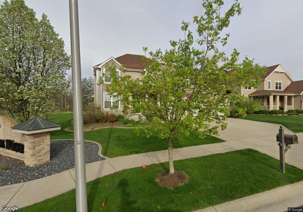
10070 Mathews St Crown Point, IN 46307
Estimated Value: $574,000 - $634,000
4
Beds
4
Baths
3,143
Sq Ft
$193/Sq Ft
Est. Value
About This Home
This home is located at 10070 Mathews St, Crown Point, IN 46307 and is currently estimated at $605,694, approximately $192 per square foot. 10070 Mathews St is a home located in Lake County with nearby schools including Kolling Elementary School, Hal E Clark Middle School, and Lake Central High School.
Ownership History
Date
Name
Owned For
Owner Type
Purchase Details
Closed on
Sep 25, 2015
Sold by
Drh Cambridge Homes Inc
Bought by
Comparon Bryan M and Comparon Amy V
Current Estimated Value
Home Financials for this Owner
Home Financials are based on the most recent Mortgage that was taken out on this home.
Original Mortgage
$370,490
Interest Rate
3.91%
Mortgage Type
New Conventional
Purchase Details
Closed on
Apr 21, 2011
Sold by
Ajp Custom Homes Inc
Bought by
Whcc Llc
Create a Home Valuation Report for This Property
The Home Valuation Report is an in-depth analysis detailing your home's value as well as a comparison with similar homes in the area
Home Values in the Area
Average Home Value in this Area
Purchase History
| Date | Buyer | Sale Price | Title Company |
|---|---|---|---|
| Comparon Bryan M | -- | Chicago Title Insurance Co | |
| Whcc Llc | $2,785,666 | None Available |
Source: Public Records
Mortgage History
| Date | Status | Borrower | Loan Amount |
|---|---|---|---|
| Previous Owner | Comparon Bryan M | $370,490 |
Source: Public Records
Tax History Compared to Growth
Tax History
| Year | Tax Paid | Tax Assessment Tax Assessment Total Assessment is a certain percentage of the fair market value that is determined by local assessors to be the total taxable value of land and additions on the property. | Land | Improvement |
|---|---|---|---|---|
| 2024 | $10,888 | $499,200 | $68,000 | $431,200 |
| 2023 | $5,052 | $478,800 | $68,000 | $410,800 |
| 2022 | $4,880 | $412,900 | $68,000 | $344,900 |
| 2021 | $4,653 | $403,800 | $68,000 | $335,800 |
| 2020 | $4,452 | $382,300 | $62,400 | $319,900 |
| 2019 | $4,721 | $377,400 | $56,100 | $321,300 |
| 2018 | $4,604 | $361,600 | $56,100 | $305,500 |
| 2017 | $4,160 | $344,200 | $56,100 | $288,100 |
| 2016 | $4,401 | $360,800 | $56,100 | $304,700 |
| 2014 | $7,689 | $379,500 | $56,200 | $323,300 |
| 2013 | $5 | $200 | $200 | $0 |
Source: Public Records
Map
Nearby Homes
- 1667 Chalone Ct
- 5496 W 107th Ct
- 10729 Hanley St
- 10710 Porter St
- 3604 W 104th Place
- 3725 W 105th Ave
- 7830 W 106th Ln
- 7770 W 106th Ln
- 10813 Lane St
- 9251 Clark Place
- 841 Veterans Ln
- 9195 Williams St
- 4229 W 92nd Place
- 5012 W 92nd Ave
- 4862 W 92nd Ave
- 9204 Wright St
- 771 Kenmare Pkwy
- 767 Kenmare Pkwy
- 700 Meadow Ln
- 10735 Sherman St
- 10050 Mathews St
- 5095 W 100th Ln
- 10040 Mathews St
- 10044 Mathews St
- 5097 W 100th Ln
- 5090 W 100th Ln
- 5208 W 101st Ave
- 5085 W 100th Ln
- 5105 W 101st Ave
- 5080 W 100th Ln
- 5075 W 100th Ln
- 10034 Mathews St
- 5109 W 101st Ave
- 5205 W 101st Ave
- 5070 W 100th Ln
- 5011 W 101st Ave
- 10011 Mathews St
- 5209 W 101st Ave
- 5215 W 101st Ave
- 5055 W 100th Ln