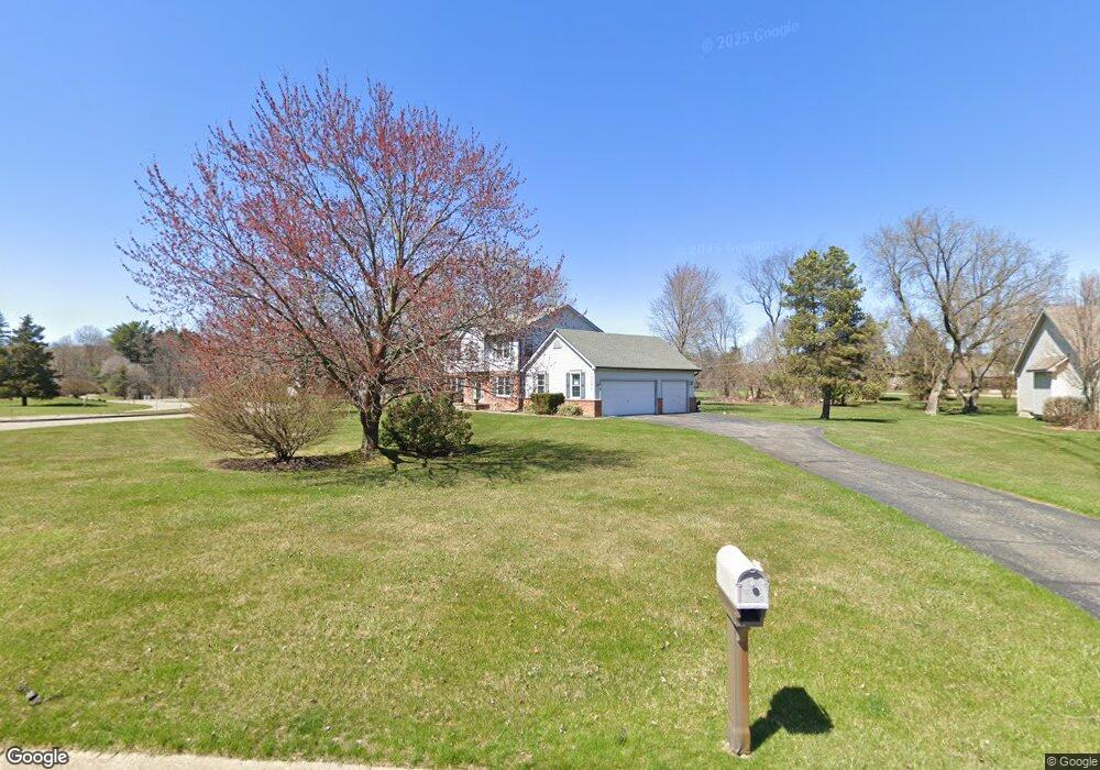
10075 Abrams Fork Brighton, MI 48114
Estimated Value: $439,224 - $522,000
4
Beds
3
Baths
2,168
Sq Ft
$219/Sq Ft
Est. Value
About This Home
This home is located at 10075 Abrams Fork, Brighton, MI 48114 and is currently estimated at $474,806, approximately $219 per square foot. 10075 Abrams Fork is a home located in Livingston County with nearby schools including Hartland High School, Maple Tree Montessori Academy, and Cornerstone Christian School.
Ownership History
Date
Name
Owned For
Owner Type
Purchase Details
Closed on
Sep 1, 2022
Sold by
Osdras Stanley T and Osdras Cathie E
Bought by
Osdras Stanley T and Osdras Stanley T
Current Estimated Value
Purchase Details
Closed on
Feb 19, 1996
Sold by
Farrell Thomas H
Bought by
Osdras Stanley T and Osdras E
Home Financials for this Owner
Home Financials are based on the most recent Mortgage that was taken out on this home.
Original Mortgage
$130,000
Interest Rate
7.36%
Mortgage Type
New Conventional
Create a Home Valuation Report for This Property
The Home Valuation Report is an in-depth analysis detailing your home's value as well as a comparison with similar homes in the area
Home Values in the Area
Average Home Value in this Area
Purchase History
| Date | Buyer | Sale Price | Title Company |
|---|---|---|---|
| Osdras Stanley T | -- | -- | |
| Osdras Stanley T | $197,450 | -- |
Source: Public Records
Mortgage History
| Date | Status | Borrower | Loan Amount |
|---|---|---|---|
| Previous Owner | Osdras Stanley T | $130,000 |
Source: Public Records
Tax History
| Year | Tax Paid | Tax Assessment Tax Assessment Total Assessment is a certain percentage of the fair market value that is determined by local assessors to be the total taxable value of land and additions on the property. | Land | Improvement |
|---|---|---|---|---|
| 2025 | $1,837 | $189,200 | $0 | $0 |
| 2024 | $1,785 | $184,200 | $0 | $0 |
| 2023 | $1,706 | $166,600 | $0 | $0 |
| 2022 | $4,026 | $141,500 | $0 | $0 |
| 2021 | $4,026 | $154,700 | $0 | $0 |
| 2020 | $4,013 | $148,900 | $0 | $0 |
| 2019 | $3,636 | $141,500 | $0 | $0 |
| 2018 | $3,400 | $115,700 | $0 | $0 |
| 2017 | $2,858 | $115,700 | $0 | $0 |
| 2016 | $2,805 | $116,200 | $0 | $0 |
| 2014 | $2,374 | $114,040 | $0 | $0 |
| 2012 | $2,374 | $101,250 | $0 | $0 |
Source: Public Records
Map
Nearby Homes
- 10493 Spring Grove
- 10056 Rosemarie Run Unit 8
- LOT 51 Rosemarie Run
- V/L Lot #2 Sweetheart Ln
- 10310 Sweetheart Ln
- 2321 Pine Hollow Trail
- 10050 Hyne Rd
- 2218 Pine Hollow Trail
- 00 VL Waterside
- 00 VL2 Waterside
- 8984 S Christine Dr
- 1111 S Old Us Highway 23
- 8969 Hyne Rd
- 2702 Sligo Ln
- 0 Hunter Rd
- 11245 Guyn Dr
- 1290 Hunter Rd
- 9112 Meadowdale Dr
- 3761 Christopher Dr
- 3638 Deer Run Dr
- 10093 Abrams Fork
- 10111 Abrams Fork
- 10032 Newfound Gap
- 10100 Abrams Fork
- 10050 Newfound Gap
- 10129 Abrams Fork
- 10068 Newfound Gap
- 10147 Abrams Fork
- 10086 Newfound Gap
- 10170 Abrams Fork
- 10103 Newfound Gap
- 2290 S Old Us Highway 23
- 10098 Newfound Gap
- 10165 Abrams Fork
- 10115 Newfound Gap
- 10110 Newfound Gap
- 10183 Abrams Fork
- 10126 Abrams Fork
- 2350 S Old Us Highway 23
- 9950 Birch Run
Your Personal Tour Guide
Ask me questions while you tour the home.