Estimated Value: $359,000 - $413,000
4
Beds
3
Baths
1,936
Sq Ft
$194/Sq Ft
Est. Value
About This Home
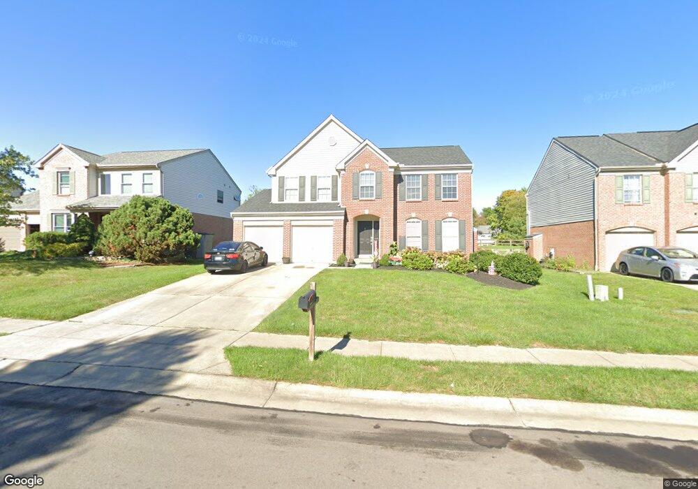
This home is located at 10078 Brandsteade Ct, Union, KY 41091 and is currently estimated at $376,518, approximately $194 per square foot. 10078 Brandsteade Ct is a home located in Boone County with nearby schools including Shirley Mann Elementary School, Gray Middle School, and Larry A. Ryle High School.
Ownership History
Date
Name
Owned For
Owner Type
Purchase Details
Closed on
Feb 14, 2012
Sold by
Federal National Mortgage Association
Bought by
Marshall James and Patton Donald
Current Estimated Value
Purchase Details
Closed on
May 3, 2011
Sold by
Light Devin A and Light Tanya M
Bought by
Federal National Mortgage Association
Purchase Details
Closed on
Aug 14, 2000
Sold by
Drees Co
Bought by
Light Devin A and Light Tanya M
Home Financials for this Owner
Home Financials are based on the most recent Mortgage that was taken out on this home.
Original Mortgage
$159,600
Interest Rate
8.23%
Mortgage Type
New Conventional
Create a Home Valuation Report for This Property
The Home Valuation Report is an in-depth analysis detailing your home's value as well as a comparison with similar homes in the area
Home Values in the Area
Average Home Value in this Area
Purchase History
| Date | Buyer | Sale Price | Title Company |
|---|---|---|---|
| Marshall James | $120,000 | -- | |
| Federal National Mortgage Association | $134,000 | None Available | |
| Light Devin A | $168,000 | -- |
Source: Public Records
Mortgage History
| Date | Status | Borrower | Loan Amount |
|---|---|---|---|
| Previous Owner | Light Devin A | $159,600 |
Source: Public Records
Tax History Compared to Growth
Tax History
| Year | Tax Paid | Tax Assessment Tax Assessment Total Assessment is a certain percentage of the fair market value that is determined by local assessors to be the total taxable value of land and additions on the property. | Land | Improvement |
|---|---|---|---|---|
| 2024 | $2,640 | $233,500 | $35,000 | $198,500 |
| 2023 | $2,657 | $233,500 | $35,000 | $198,500 |
| 2022 | $2,389 | $212,800 | $35,000 | $177,800 |
| 2021 | $2,469 | $212,800 | $35,000 | $177,800 |
| 2020 | $2,298 | $200,730 | $35,000 | $165,730 |
| 2019 | $2,325 | $200,730 | $35,000 | $165,730 |
| 2018 | $2,365 | $200,730 | $35,000 | $165,730 |
| 2017 | $2,290 | $200,730 | $35,000 | $165,730 |
| 2015 | $2,262 | $200,730 | $35,000 | $165,730 |
| 2013 | -- | $180,000 | $30,000 | $150,000 |
Source: Public Records
Map
Nearby Homes
- 10067 Hempsteade Dr
- 2011 Holderness Dr
- 943 Lakepointe Ct
- 1110 Mount Zion Rd
- 10002 Irish Way
- 10077 Russwill Ln
- 1449 R J Ln
- 3832 Sonata Dr
- 3 Lots Tiburon Dr
- 9807 Cherbourg Dr
- 1134 Donner Dr
- 2030 Stonewall Trail
- 2029 Stonewall Trail
- 10445 Jasons Bluff
- 3010 Danbury Dr
- 760 Oakridge Dr
- 1802 Mimosa Trail
- 1628 Ashley Ct Unit 302
- 1616 Ashley Ct Unit 303
- 1337 Retriever Way
- 10082 Brandsteade Ct
- 10074 Brandsteade Ct
- 10086 Brandsteade Ct
- 10070 Brandsteade Ct
- 10079 Hempsteade Dr
- 10066 Brandsteade Ct
- 10085 Hempsteade Dr
- 10077 Brandsteade Ct
- 10081 Brandsteade Ct
- 10091 Hempsteade Dr
- 10073 Brandsteade Ct
- 10062 Brandsteade Ct
- 10085 Brandsteade Ct
- 10094 Brandsteade Ct
- 10069 Brandsteade Ct
- 10089 Brandsteade Ct
- 10097 Hempsteade Dr
- 10058 Brandsteade Ct
- 10100 Brandsteade Ct
- 10065 Brandsteade Ct