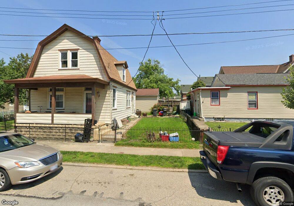
1008 Mill St Cincinnati, OH 45215
Estimated Value: $120,000 - $162,000
3
Beds
1
Bath
1,254
Sq Ft
$118/Sq Ft
Est. Value
About This Home
This home is located at 1008 Mill St, Cincinnati, OH 45215 and is currently estimated at $148,250, approximately $118 per square foot. 1008 Mill St is a home located in Hamilton County with nearby schools including Reading Community High School, Saints Peter and Paul Academy, and Mount Notre Dame High School.
Ownership History
Date
Name
Owned For
Owner Type
Purchase Details
Closed on
Jun 28, 2005
Sold by
Graves Berl E and Graves Karen
Bought by
Owens James E and Owens Tanya M
Current Estimated Value
Home Financials for this Owner
Home Financials are based on the most recent Mortgage that was taken out on this home.
Original Mortgage
$71,600
Outstanding Balance
$36,492
Interest Rate
5.69%
Mortgage Type
Unknown
Estimated Equity
$111,758
Purchase Details
Closed on
Aug 11, 1998
Sold by
Graves Berl E
Bought by
Graves Berl E and Graves Karen
Create a Home Valuation Report for This Property
The Home Valuation Report is an in-depth analysis detailing your home's value as well as a comparison with similar homes in the area
Home Values in the Area
Average Home Value in this Area
Purchase History
| Date | Buyer | Sale Price | Title Company |
|---|---|---|---|
| Owens James E | $89,500 | None Available | |
| Graves Berl E | -- | -- |
Source: Public Records
Mortgage History
| Date | Status | Borrower | Loan Amount |
|---|---|---|---|
| Open | Owens James E | $71,600 |
Source: Public Records
Tax History
| Year | Tax Paid | Tax Assessment Tax Assessment Total Assessment is a certain percentage of the fair market value that is determined by local assessors to be the total taxable value of land and additions on the property. | Land | Improvement |
|---|---|---|---|---|
| 2025 | $1,384 | $26,111 | $4,540 | $21,571 |
| 2024 | $1,351 | $26,111 | $4,540 | $21,571 |
| 2023 | $1,372 | $26,111 | $4,540 | $21,571 |
| 2022 | $1,042 | $15,369 | $3,651 | $11,718 |
| 2021 | $870 | $15,369 | $3,651 | $11,718 |
| 2020 | $879 | $15,369 | $3,651 | $11,718 |
| 2019 | $852 | $13,602 | $3,231 | $10,371 |
| 2018 | $853 | $13,602 | $3,231 | $10,371 |
| 2017 | $804 | $13,602 | $3,231 | $10,371 |
| 2016 | $1,000 | $16,975 | $3,423 | $13,552 |
| 2015 | $1,009 | $16,975 | $3,423 | $13,552 |
| 2014 | $883 | $16,975 | $3,423 | $13,552 |
| 2013 | $895 | $17,322 | $3,493 | $13,829 |
Source: Public Records
Map
Nearby Homes
- 435 Pearl St
- 306 Pearl St
- 329 Walnut St
- 129 Pike St
- 314 Elm St
- 1401 Jefferson Ave
- 1421 Jefferson Ave
- 415 Arlington Ave
- 321 Southern Ave
- 311 Southern Ave
- 217 W Wyoming Ave
- 654 3rd St
- 310 E Vine St
- 1521 Hunt Rd
- 454 Hillside Ave
- 313 Pershing Ave
- 0 Hill St Unit 1616370
- 9350 Reading Rd
- 20 Clark Rd
- 68 Gorman Ln
Your Personal Tour Guide
Ask me questions while you tour the home.