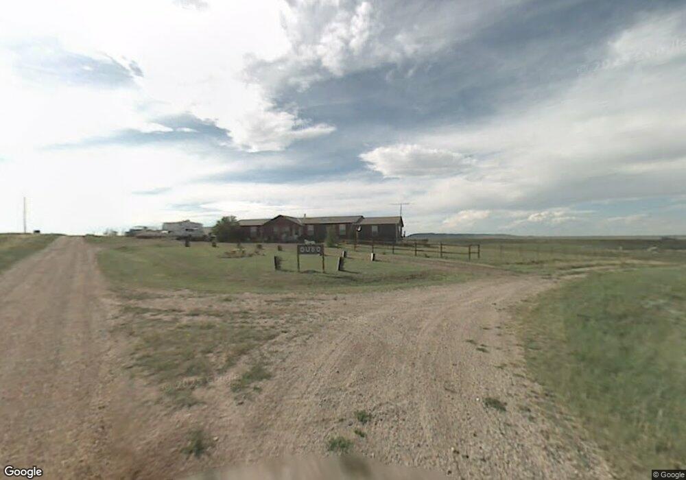
1008 New York Rd Cheyenne, WY 82009
Estimated Value: $466,110 - $572,000
3
Beds
2
Baths
2,408
Sq Ft
$214/Sq Ft
Est. Value
About This Home
This home is located at 1008 New York Rd, Cheyenne, WY 82009 and is currently estimated at $515,703, approximately $214 per square foot. 1008 New York Rd is a home located in Laramie County with nearby schools including Gilchrist Elementary School, McCormick Junior High School, and Central High School.
Ownership History
Date
Name
Owned For
Owner Type
Purchase Details
Closed on
Mar 18, 2019
Sold by
Baber Andrea C
Bought by
Johnson Brenda S
Current Estimated Value
Home Financials for this Owner
Home Financials are based on the most recent Mortgage that was taken out on this home.
Original Mortgage
$235,653
Outstanding Balance
$207,179
Interest Rate
4.4%
Mortgage Type
FHA
Estimated Equity
$308,524
Purchase Details
Closed on
Dec 13, 2010
Sold by
Baber Frank
Bought by
Baber Frank M and Frank M Baber Revocable Living Trust
Purchase Details
Closed on
Mar 1, 2010
Sold by
Duso Peggy and Duso Lawrence C
Bought by
Baber Frank
Home Financials for this Owner
Home Financials are based on the most recent Mortgage that was taken out on this home.
Original Mortgage
$127,271
Interest Rate
5.05%
Mortgage Type
Purchase Money Mortgage
Purchase Details
Closed on
Dec 18, 1981
Sold by
P D and T
Bought by
Mitchell Mary Deon
Create a Home Valuation Report for This Property
The Home Valuation Report is an in-depth analysis detailing your home's value as well as a comparison with similar homes in the area
Home Values in the Area
Average Home Value in this Area
Purchase History
| Date | Buyer | Sale Price | Title Company |
|---|---|---|---|
| Johnson Brenda S | -- | First American Title | |
| Baber Frank M | -- | None Available | |
| Baber Frank | -- | None Available | |
| Mitchell Mary Deon | -- | -- |
Source: Public Records
Mortgage History
| Date | Status | Borrower | Loan Amount |
|---|---|---|---|
| Open | Johnson Brenda S | $235,653 | |
| Previous Owner | Baber Frank | $127,271 |
Source: Public Records
Tax History Compared to Growth
Tax History
| Year | Tax Paid | Tax Assessment Tax Assessment Total Assessment is a certain percentage of the fair market value that is determined by local assessors to be the total taxable value of land and additions on the property. | Land | Improvement |
|---|---|---|---|---|
| 2025 | $2,674 | $30,789 | $6,259 | $24,530 |
| 2024 | $2,674 | $39,792 | $8,345 | $31,447 |
| 2023 | $2,561 | $38,978 | $8,345 | $30,633 |
| 2022 | $2,170 | $32,306 | $6,406 | $25,900 |
| 2021 | $1,892 | $28,099 | $4,256 | $23,843 |
| 2020 | $1,619 | $24,107 | $3,011 | $21,096 |
| 2019 | $1,552 | $23,096 | $2,845 | $20,251 |
| 2018 | $1,449 | $21,780 | $2,845 | $18,935 |
| 2017 | $1,427 | $21,245 | $2,508 | $18,737 |
| 2016 | $1,412 | $21,007 | $2,441 | $18,566 |
| 2015 | $1,391 | $20,696 | $2,441 | $18,255 |
| 2014 | $1,396 | $20,618 | $2,460 | $18,158 |
Source: Public Records
Map
Nearby Homes
- 1113 Indiana Rd
- Tract 234 Samoa Rd
- 1100 Brundage Rd
- 0 Range Line Rd
- 985 Range Line Rd
- Tract 295 S Carolina Rd
- Lot 346 Carribean Rd
- Lot 340 Carribean Rd
- Lot 366 Carribean Rd
- Tract 300 S Carolina Rd
- 1102 Dusty Rd
- Lot 99 Tennessee Rd
- Tract 334 Bering Rd
- Tract 291 Boundary Rd
- TBD Boundary Rd
- TBD Bade Rd
- 1092 Bade Rd
- 1015 Bade Rd
- Tract 29 Latigo Loop
- TBD Vada Rae Ct
- 1016 New York Rd
- 1007 New York Rd
- 1020 Illinois Rd
- 1021 Illinois Rd
- 1031 New York Rd
- 1024 New York Rd
- 1035 Illinois Rd
- 1032 New York Rd
- TBD New York Rd
- 1035 New York Rd
- 1030 Illinois Rd
- 1034 Illinois Rd
- 1039 New York Rd
- 1045 Illinois Rd
- 1011 Road 110
- 984 Road 110a
- 1046 Illinois Rd
- 992 Road 110a
- 1047 New York Rd