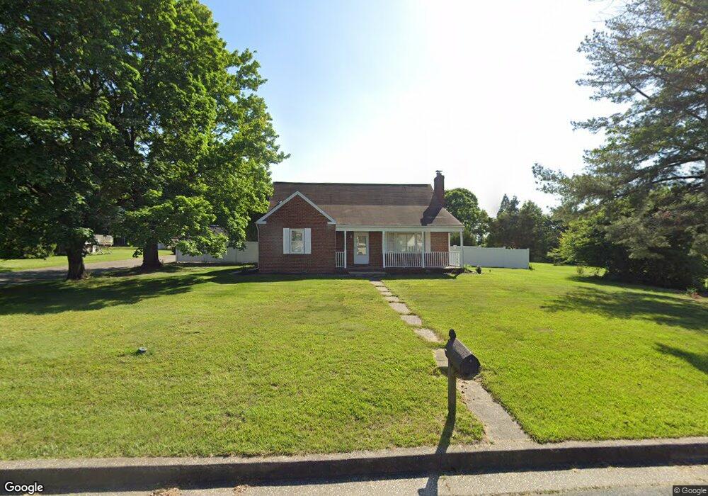
1008 Rohe Farm Ln Middle River, MD 21220
Estimated Value: $417,000 - $445,000
4
Beds
1
Bath
--
Sq Ft
0.78
Acres
About This Home
This home is located at 1008 Rohe Farm Ln, Middle River, MD 21220 and is currently estimated at $429,337. 1008 Rohe Farm Ln is a home located in Baltimore County with nearby schools including Vincent Farm Elementary, Middle River Middle School, and Kenwood High.
Ownership History
Date
Name
Owned For
Owner Type
Purchase Details
Closed on
Aug 14, 2000
Sold by
Federal National Mortgage Association
Bought by
Price William and Price Lori
Current Estimated Value
Purchase Details
Closed on
Feb 23, 2000
Sold by
Kersey Larry E
Bought by
Federal National Mortgage Association
Purchase Details
Closed on
Dec 16, 1994
Sold by
Dabkowski Martin B
Bought by
Kersey Larry E
Home Financials for this Owner
Home Financials are based on the most recent Mortgage that was taken out on this home.
Original Mortgage
$180,500
Interest Rate
9.03%
Create a Home Valuation Report for This Property
The Home Valuation Report is an in-depth analysis detailing your home's value as well as a comparison with similar homes in the area
Home Values in the Area
Average Home Value in this Area
Purchase History
| Date | Buyer | Sale Price | Title Company |
|---|---|---|---|
| Price William | $178,600 | -- | |
| Federal National Mortgage Association | $166,500 | -- | |
| Kersey Larry E | $190,000 | -- |
Source: Public Records
Mortgage History
| Date | Status | Borrower | Loan Amount |
|---|---|---|---|
| Previous Owner | Kersey Larry E | $180,500 |
Source: Public Records
Tax History Compared to Growth
Tax History
| Year | Tax Paid | Tax Assessment Tax Assessment Total Assessment is a certain percentage of the fair market value that is determined by local assessors to be the total taxable value of land and additions on the property. | Land | Improvement |
|---|---|---|---|---|
| 2025 | $4,351 | $290,333 | -- | -- |
| 2024 | $4,351 | $270,967 | $0 | $0 |
| 2023 | $2,139 | $251,600 | $110,400 | $141,200 |
| 2022 | $4,068 | $246,367 | $0 | $0 |
| 2021 | $3,713 | $241,133 | $0 | $0 |
| 2020 | $3,713 | $235,900 | $110,400 | $125,500 |
| 2019 | $3,683 | $235,900 | $110,400 | $125,500 |
| 2018 | $3,447 | $235,900 | $110,400 | $125,500 |
| 2017 | $3,802 | $237,700 | $0 | $0 |
| 2016 | $4,042 | $237,700 | $0 | $0 |
| 2015 | $4,042 | $237,700 | $0 | $0 |
| 2014 | $4,042 | $239,700 | $0 | $0 |
Source: Public Records
Map
Nearby Homes
- 9907 Oxon Creek Ct
- 1108 Muddy Branch Ct
- 1112 Muddy Branch Ct
- 1102 Muddy Branch Ct
- 10006 Campbell Blvd
- 10002 Campbell Blvd
- 10000 Campbell Blvd
- 10018 Campbell Blvd
- 1111 Muddy Branch Ct
- Summit Plan at Creekside Estates
- BROWLYN Plan at Creekside Estates
- JADE Plan at Creekside Estates
- Hampshire Plan at Creekside Estates
- ALEC Plan at Creekside Estates
- HADLEY Plan at Creekside Estates
- 1113 Muddy Branch Ct
- 9900 Bird River Rd
- 909 Morgan Run Rd
- 0 Bird River Rd Unit MDBC2136640
- 9814 Dee Way
- 1006 Rohe Farm Ln
- 1004 Rohe Farm Ln
- 1010 Rohe Farm Ln
- 1003 Rohe Farm Ln
- 1001 Rohe Farm Ln
- 1005 Rohe Farm Ln
- 999 Rohe Farm Ln
- 23 Oldfield Ct
- 23 Old Field Ct
- 1007 Rohe Farm Ln
- 21 Old Field Ct
- 997 Rohe Farm Ln
- 25 Old Field Ct
- 25 Oldfield Ct
- 19 Oldfield Ct
- 19 Old Field Ct
- 27 Old Field Ct
- 1009 Rohe Farm Ln
- 995 Rohe Farm Ln
- 17 Old Field Ct