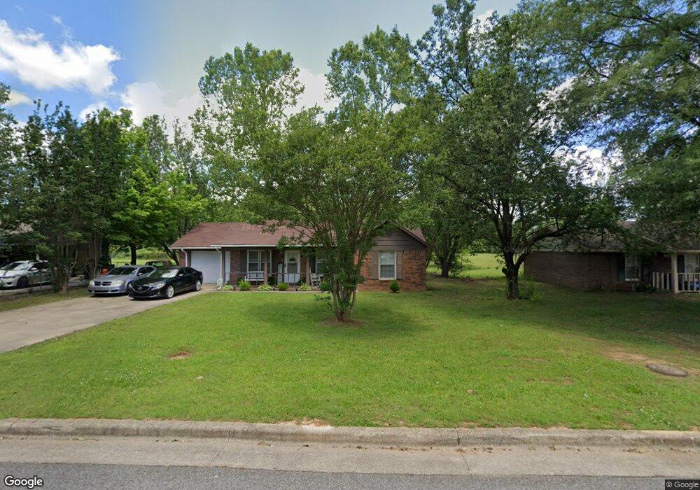
1008 Sommerest Dr Athens, AL 35611
Estimated Value: $175,296 - $200,000
--
Bed
--
Bath
1,101
Sq Ft
$169/Sq Ft
Est. Value
About This Home
This home is located at 1008 Sommerest Dr, Athens, AL 35611 and is currently estimated at $185,824, approximately $168 per square foot. 1008 Sommerest Dr is a home with nearby schools including Julian Newman Elementary School, Athens Intermediate School, and Athens Middle School.
Ownership History
Date
Name
Owned For
Owner Type
Purchase Details
Closed on
Sep 9, 2005
Sold by
Fannie Mae
Bought by
Green Casterderial and Green Ardean
Current Estimated Value
Home Financials for this Owner
Home Financials are based on the most recent Mortgage that was taken out on this home.
Original Mortgage
$43,200
Outstanding Balance
$23,127
Interest Rate
5.86%
Estimated Equity
$162,697
Purchase Details
Closed on
Feb 17, 2005
Sold by
Gray Kenetra N and Federal National Mortgage Asso
Bought by
Federal National Mortgage Association
Create a Home Valuation Report for This Property
The Home Valuation Report is an in-depth analysis detailing your home's value as well as a comparison with similar homes in the area
Home Values in the Area
Average Home Value in this Area
Purchase History
| Date | Buyer | Sale Price | Title Company |
|---|---|---|---|
| Green Casterderial | -- | -- | |
| Federal National Mortgage Association | -- | -- |
Source: Public Records
Mortgage History
| Date | Status | Borrower | Loan Amount |
|---|---|---|---|
| Open | Green Casterderial | $43,200 |
Source: Public Records
Tax History Compared to Growth
Tax History
| Year | Tax Paid | Tax Assessment Tax Assessment Total Assessment is a certain percentage of the fair market value that is determined by local assessors to be the total taxable value of land and additions on the property. | Land | Improvement |
|---|---|---|---|---|
| 2024 | $954 | $23,840 | $0 | $0 |
| 2023 | $954 | $23,840 | $0 | $0 |
| 2022 | $771 | $19,280 | $0 | $0 |
| 2021 | $635 | $15,880 | $0 | $0 |
| 2020 | $606 | $15,160 | $0 | $0 |
| 2019 | $548 | $13,700 | $0 | $0 |
| 2018 | $461 | $11,520 | $0 | $0 |
| 2017 | $461 | $11,520 | $0 | $0 |
| 2016 | $461 | $57,580 | $0 | $0 |
| 2015 | $461 | $11,520 | $0 | $0 |
| 2014 | $453 | $0 | $0 | $0 |
Source: Public Records
Map
Nearby Homes
- 1925 Cain Dr Unit 280
- 1817 Hine St S
- 325 Hine St S
- 1112 Hine St S
- 28.35 Hine St S
- 1505 Nella Dr
- 1709 Lillian Dr
- 1509 Nella Dr
- 8336 Us Highway 72 W
- 955 W Sanderfer Rd
- Lot 1 Browns Ferry St
- 15287 Lapwing Cove
- 15279 Lapwing Cove
- 15271 Lapwing Cove
- 15261 Lapwing Cove
- 15307 Lapwing Cove
- 15327 Lapwing Cove
- 15284 Lapwing Cove
- 15503 Lapwing Cove
- 15298 Lapwing Cove
- 1006 Sommerest Dr
- 1010 Sommerest Dr
- 1004 Sommerest Dr
- 1012 Sommerest Dr
- 2100 Stanford St
- 2101 Stanford St
- 1002 Sommerest Dr
- 1014 Sommerest Dr
- 2102 Stanford St
- 2103 Stanford St
- 2101 Aretha St
- 2104 Stanford St
- 1000 Sommerest Dr
- 1100 Sommerest Dr
- 2103 Aretha St
- 2105 Stanford St
- 2004 Hine St S
- 2100 Hine St S
- 2105 Aretha St
- 2106 Stanford St