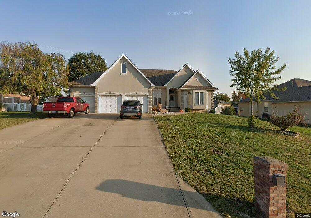
1008 SW Foxtail Dr Grain Valley, MO 64029
Estimated Value: $371,000 - $437,000
4
Beds
2
Baths
2,183
Sq Ft
$182/Sq Ft
Est. Value
About This Home
This home is located at 1008 SW Foxtail Dr, Grain Valley, MO 64029 and is currently estimated at $397,996, approximately $182 per square foot. 1008 SW Foxtail Dr is a home located in Jackson County with nearby schools including Grain Valley High School.
Ownership History
Date
Name
Owned For
Owner Type
Purchase Details
Closed on
Jan 17, 2003
Sold by
Combs Norman G and Combs Ernestene E
Bought by
Combs Norman G and Combs Ernestene E
Current Estimated Value
Home Financials for this Owner
Home Financials are based on the most recent Mortgage that was taken out on this home.
Original Mortgage
$124,400
Interest Rate
5.45%
Mortgage Type
Purchase Money Mortgage
Purchase Details
Closed on
Feb 2, 1998
Sold by
Peterson Richard A and Peterson Beverly J
Bought by
Combs Norman G and Combs Ernestine E
Home Financials for this Owner
Home Financials are based on the most recent Mortgage that was taken out on this home.
Original Mortgage
$130,000
Interest Rate
6.98%
Mortgage Type
Purchase Money Mortgage
Purchase Details
Closed on
Sep 9, 1997
Sold by
Combs Norman G and Combs Ernestene E
Bought by
Peterson Richard A and Peterson Beverly J
Purchase Details
Closed on
May 20, 1997
Sold by
R P M Enterprises Inc
Bought by
Combs Norman G and Combs Ernestene E
Create a Home Valuation Report for This Property
The Home Valuation Report is an in-depth analysis detailing your home's value as well as a comparison with similar homes in the area
Home Values in the Area
Average Home Value in this Area
Purchase History
| Date | Buyer | Sale Price | Title Company |
|---|---|---|---|
| Combs Norman G | -- | -- | |
| Combs Norman G | -- | Stewart Title | |
| Peterson Richard A | -- | Stewart Title | |
| Combs Norman G | -- | Stewart Title |
Source: Public Records
Mortgage History
| Date | Status | Borrower | Loan Amount |
|---|---|---|---|
| Closed | Combs Norman G | $124,400 | |
| Closed | Combs Norman G | $130,000 |
Source: Public Records
Tax History
| Year | Tax Paid | Tax Assessment Tax Assessment Total Assessment is a certain percentage of the fair market value that is determined by local assessors to be the total taxable value of land and additions on the property. | Land | Improvement |
|---|---|---|---|---|
| 2025 | $3,979 | $55,554 | $9,099 | $46,455 |
| 2024 | $3,830 | $48,309 | $8,033 | $40,276 |
| 2023 | $3,830 | $48,310 | $5,953 | $42,357 |
| 2022 | $5,047 | $55,670 | $6,316 | $49,354 |
| 2021 | $4,928 | $55,670 | $6,316 | $49,354 |
| 2020 | $4,753 | $52,963 | $6,316 | $46,647 |
| 2019 | $4,657 | $52,963 | $6,316 | $46,647 |
| 2018 | $4,338 | $46,095 | $5,497 | $40,598 |
| 2017 | $3,977 | $46,095 | $5,497 | $40,598 |
| 2016 | $3,977 | $42,287 | $3,607 | $38,680 |
| 2014 | $3,929 | $41,458 | $3,536 | $37,922 |
Source: Public Records
Map
Nearby Homes
- 913 SW Abar Dr
- 900 SW Shorthorn Dr
- Tract 11 W Ryan Rd
- 1010 SW Cross Creek Dr
- Tract 10 W Ryan Rd
- Tract 10 W Ryan Rd
- Tract 11 W Ryan Rd
- Tract 8 W Ryan Rd
- Tract 8 W Ryan Rd
- 1219 SW Windcrest Ct
- 1214 SW Windcrest Ct
- 1204 SW Cross Creek Dr
- 1400 SW Cross Creek Dr
- 521 SW Lakeview Dr
- 1220 SW Dakota Star Ct
- 115 E Old Us 40 Hwy N A
- 1306 SW Addie Ln
- 1506 SW Cross Creek Dr
- 600 SW Valley Dr
- TBD E Stony Point School Rd
- 1006 SW Foxtail Dr
- 1010 SW Foxtail Dr
- 914 SW Abar Dr
- 912 SW Abar Dr
- 910 SW Abar Dr
- 1012 SW Foxtail Dr
- 1011 SW Foxtail Dr
- 1007 SW Foxtail Dr
- 1009 SW Foxtail Dr
- 908 SW Abar Dr
- 1005 SW Foxtail Dr
- 1001 SW Stoney Point Dr
- 906 SW Abar Dr
- 1000 SW Foxtail Dr
- 1003 SW Foxtail Dr
- 915 SW Abar Dr
- 911 SW Abar Dr
- 909 SW Abar Dr
- 1014 SW Foxtail Dr
- 1001 SW Foxtail Dr
Your Personal Tour Guide
Ask me questions while you tour the home.