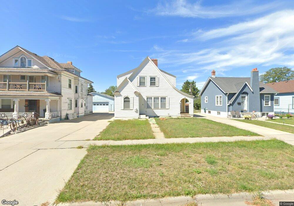
1008 Toluca Ave Alliance, NE 69301
Estimated Value: $101,000 - $156,927
3
Beds
1
Bath
1,277
Sq Ft
$103/Sq Ft
Est. Value
About This Home
This home is located at 1008 Toluca Ave, Alliance, NE 69301 and is currently estimated at $131,232, approximately $102 per square foot. 1008 Toluca Ave is a home located in Box Butte County with nearby schools including Alliance High School, St. Agnes Academy, and Immanuel Evangelical Lutheran School.
Ownership History
Date
Name
Owned For
Owner Type
Purchase Details
Closed on
Dec 3, 2024
Sold by
Freedom Mortgage Corporation
Bought by
Rasmussen Garry and Rasmussen Kelly
Current Estimated Value
Purchase Details
Closed on
Aug 26, 2024
Sold by
Halliday Watkins & Mann Pc
Bought by
Platte Valley Bank and Freedom Mortgage Corporation
Purchase Details
Closed on
Sep 10, 2015
Sold by
Schommer David A
Bought by
Plotnikov Edward
Create a Home Valuation Report for This Property
The Home Valuation Report is an in-depth analysis detailing your home's value as well as a comparison with similar homes in the area
Home Values in the Area
Average Home Value in this Area
Purchase History
| Date | Buyer | Sale Price | Title Company |
|---|---|---|---|
| Rasmussen Garry | $79,000 | Kunzman Title | |
| Rasmussen Garry | $79,000 | Kunzman Title | |
| Platte Valley Bank | $81,250 | None Listed On Document | |
| Plotnikov Edward | $110,000 | -- |
Source: Public Records
Tax History Compared to Growth
Tax History
| Year | Tax Paid | Tax Assessment Tax Assessment Total Assessment is a certain percentage of the fair market value that is determined by local assessors to be the total taxable value of land and additions on the property. | Land | Improvement |
|---|---|---|---|---|
| 2024 | $1,496 | $119,465 | $6,300 | $113,165 |
| 2023 | $2,054 | $119,465 | $6,300 | $113,165 |
| 2022 | $1,987 | $109,095 | $5,670 | $103,425 |
| 2021 | $2,011 | $109,095 | $5,670 | $103,425 |
| 2020 | $2,005 | $109,095 | $5,670 | $103,425 |
| 2019 | $1,959 | $109,095 | $5,670 | $103,425 |
| 2018 | $1,949 | $109,095 | $5,670 | $103,425 |
| 2017 | $1,972 | $106,237 | $4,095 | $102,142 |
| 2016 | $1,949 | $106,237 | $4,095 | $102,142 |
| 2015 | $1,275 | $65,370 | $4,095 | $61,275 |
| 2014 | $1,275 | $65,195 | $4,095 | $61,100 |
Source: Public Records
Map
Nearby Homes
- 911 Emerson Ave
- 924 Big Horn Ave
- 907 Toluca Ave
- 936 Platte Ave
- 819 Black Hills Ave
- 719 Toluca Ave
- 1232 Emerson Ave
- 1239 Toluca Ave
- 904 Laramie Ave
- 1232 Cheyenne Ave
- 621 Emerson Ave
- 1019 Laramie Ave
- 1021 Dakota Ave
- 420 Laramie Ave
- 316 Big Horn Ave
- 615 Sweetwater Ave
- 20th St Emerson Ave To Colorado Ave
- 1004 Missouri Ave
- 917 Missouri Ave
- 672 W 20th St
- 1012 Toluca Ave
- 1004 Toluca Ave
- 1016 Toluca Ave
- 1020 Toluca Ave
- 516 W 10th St
- 1024 Toluca Ave
- 520 W 10th St
- 936 Toluca Ave
- 515 W 11th St
- 1009 Toluca Ave
- 519 W 11th St
- 524 W 10th St
- 1003 Toluca Ave
- 1015 Toluca Ave
- 932 Toluca Ave
- 935 Emerson Ave
- 1019 Toluca Ave
- 1017 Emerson Ave
- 1011 Emerson Ave
- 523 W 11th St