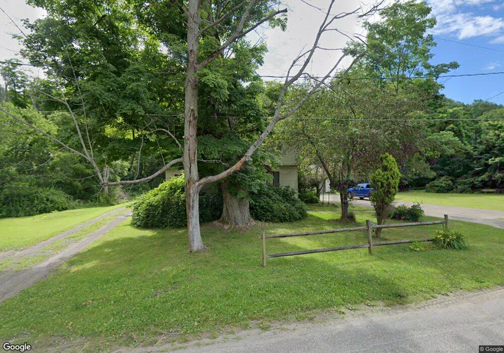
10083 Old Route 99 Mc Kean, PA 16426
Estimated Value: $209,587 - $265,000
3
Beds
1
Bath
1,684
Sq Ft
$136/Sq Ft
Est. Value
About This Home
This home is located at 10083 Old Route 99, Mc Kean, PA 16426 and is currently estimated at $229,647, approximately $136 per square foot. 10083 Old Route 99 is a home located in Erie County with nearby schools including McKean Elementary School, James W. Parker Middle School, and General McLane High School.
Ownership History
Date
Name
Owned For
Owner Type
Purchase Details
Closed on
Jul 31, 2007
Sold by
Va
Bought by
Smith Linda R
Current Estimated Value
Purchase Details
Closed on
Feb 12, 2007
Sold by
Edinger Robert E and Edinger Robin M
Bought by
Va
Purchase Details
Closed on
Jul 25, 2002
Sold by
Williams David R and Williams Linda
Bought by
Edinger Robert E and Edinger Robin M
Home Financials for this Owner
Home Financials are based on the most recent Mortgage that was taken out on this home.
Original Mortgage
$137,700
Interest Rate
6.73%
Mortgage Type
VA
Create a Home Valuation Report for This Property
The Home Valuation Report is an in-depth analysis detailing your home's value as well as a comparison with similar homes in the area
Home Values in the Area
Average Home Value in this Area
Purchase History
| Date | Buyer | Sale Price | Title Company |
|---|---|---|---|
| Smith Linda R | $120,000 | None Available | |
| Va | $1,840 | None Available | |
| Edinger Robert E | $135,000 | -- |
Source: Public Records
Mortgage History
| Date | Status | Borrower | Loan Amount |
|---|---|---|---|
| Previous Owner | Edinger Robert E | $137,700 |
Source: Public Records
Tax History Compared to Growth
Tax History
| Year | Tax Paid | Tax Assessment Tax Assessment Total Assessment is a certain percentage of the fair market value that is determined by local assessors to be the total taxable value of land and additions on the property. | Land | Improvement |
|---|---|---|---|---|
| 2025 | $2,373 | $104,200 | $24,100 | $80,100 |
| 2024 | $2,298 | $104,200 | $24,100 | $80,100 |
| 2023 | $2,162 | $104,200 | $24,100 | $80,100 |
| 2022 | $2,100 | $104,200 | $24,100 | $80,100 |
| 2021 | $2,073 | $104,200 | $24,100 | $80,100 |
| 2020 | $2,046 | $104,200 | $24,100 | $80,100 |
| 2019 | $2,033 | $104,200 | $24,100 | $80,100 |
| 2018 | $1,989 | $104,200 | $24,100 | $80,100 |
| 2017 | $1,989 | $104,200 | $24,100 | $80,100 |
| 2016 | $2,318 | $104,200 | $24,100 | $80,100 |
| 2015 | $2,292 | $104,200 | $24,100 | $80,100 |
| 2014 | $1,126 | $104,200 | $24,100 | $80,100 |
Source: Public Records
Map
Nearby Homes
- 11060 Edinboro Rd
- 702 Skyline Dr
- 4919 Old State Rd
- 209 Timberlake Dr
- 5115 West Rd
- 11897 Silverthorn (Tr 86 Rt T438) Rd
- 9731 Silverthorn Rd
- 4954 East Ave
- 0 Edinboro Rd Unit 182375
- 4854 N Main St
- 11261 Lay Rd
- 8580 Rick Rd
- 6330 Rick Rd
- 8389 Edinboro Rd
- TBD1 Silverthorn Rd
- 00 Silverthorn Rd
- 6797 Sterrettania Rd
- 15 Woodside Dr
- 0 Leacock Rd
- 29 Sharon Dr
- 0 Old Route 99 Unit 39584
- 0 Old Route 99 Unit 36274
- 0 Old Route 99 Unit 42821
- 0 Old Route 99 Unit 174397
- 10943 Old Route 99
- 0 Old Route 99
- 10071 Old Route 99
- 10094 Edinboro Rd
- 10074 Old Route 99
- 10061 Old Route 99
- 10100 Old Route 99
- 10050 Old Route 99
- 10041 Edinboro Rd
- 10070 Edinboro Rd
- 10050 Edinboro Rd
- 10041 Old Route 99
- 10090 Edinboro Rd
- 10098 Edinboro Rd
- 10141 Old Route 99