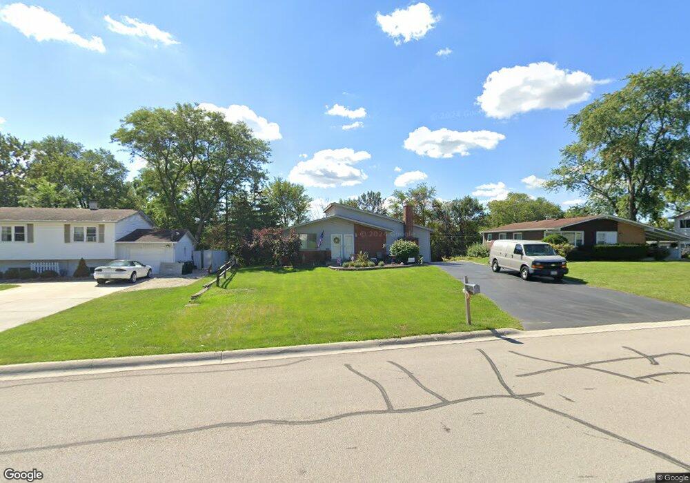
1009 79th St Darien, IL 60561
Estimated Value: $359,459 - $446,000
Studio
--
Bath
1,557
Sq Ft
$256/Sq Ft
Est. Value
About This Home
This home is located at 1009 79th St, Darien, IL 60561 and is currently estimated at $398,615, approximately $256 per square foot. 1009 79th St is a home located in DuPage County with nearby schools including Mark Delay School, Lace Elementary School, and Eisenhower Jr High School.
Ownership History
Date
Name
Owned For
Owner Type
Purchase Details
Closed on
Jul 12, 2021
Sold by
Sorenson Mary Ann
Bought by
West Suburban Bank and Trust Number 14620
Current Estimated Value
Create a Home Valuation Report for This Property
The Home Valuation Report is an in-depth analysis detailing your home's value as well as a comparison with similar homes in the area
Home Values in the Area
Average Home Value in this Area
Purchase History
| Date | Buyer | Sale Price | Title Company |
|---|---|---|---|
| West Suburban Bank | -- | None Available |
Source: Public Records
Tax History
| Year | Tax Paid | Tax Assessment Tax Assessment Total Assessment is a certain percentage of the fair market value that is determined by local assessors to be the total taxable value of land and additions on the property. | Land | Improvement |
|---|---|---|---|---|
| 2024 | $3,665 | $114,382 | $41,249 | $73,133 |
| 2023 | $3,861 | $105,150 | $37,920 | $67,230 |
| 2022 | $4,143 | $98,170 | $35,400 | $62,770 |
| 2021 | $4,034 | $97,060 | $35,000 | $62,060 |
| 2020 | $4,065 | $95,140 | $34,310 | $60,830 |
| 2019 | $4,104 | $91,290 | $32,920 | $58,370 |
| 2018 | $4,071 | $84,390 | $32,820 | $51,570 |
| 2017 | $4,199 | $81,200 | $31,580 | $49,620 |
| 2016 | $4,298 | $77,500 | $30,140 | $47,360 |
| 2015 | $4,521 | $72,920 | $28,360 | $44,560 |
| 2014 | $4,315 | $69,220 | $27,570 | $41,650 |
| 2013 | $5,010 | $80,580 | $27,440 | $53,140 |
Source: Public Records
Map
Nearby Homes
- 7802 Warwick Ave
- 7706 Warwick Ave
- 1204 Sleepy Hollow Ln
- Lot 1, 2, 3, 4 & 5 Nantucket Dr
- 17W435 Concord Place
- 801 79th St Unit 310
- 709 79th St Unit 408
- 7816 Dorchester Ln
- 7800 Dorchester Ln
- 7525 Nantucket Dr Unit 210
- 7725 Sawyer Rd
- 8167 Ripple Ridge Unit 8167
- 1052 Ripple Ridge
- 7700 Apple Tree Ln
- 1501 Darien Lake Dr Unit A201
- 1370 Marco Ct
- 1390 Marco Ct
- 18W025 73rd St
- 1447 Coventry Ct
- 8313 Highpoint Cir Unit F
- 1013 79th St
- 1005 79th St
- 1017 79th St
- 1001 79th St
- 1006 79th St
- 1021 79th St
- 1014 79th St
- 933 79th St
- 9S006 Stratford Place
- 1002 79th St
- 1025 79th St
- 9S016 Stratford Place
- 7813 Warwick Ave
- 934 79th St
- 1005 Juniper Ln
- 1009 Juniper Ln
- 9S026 Stratford Place
- 1001 Juniper Ln
- 7809 Warwick Ave
- 17W555 Concord Place
Your Personal Tour Guide
Ask me questions while you tour the home.