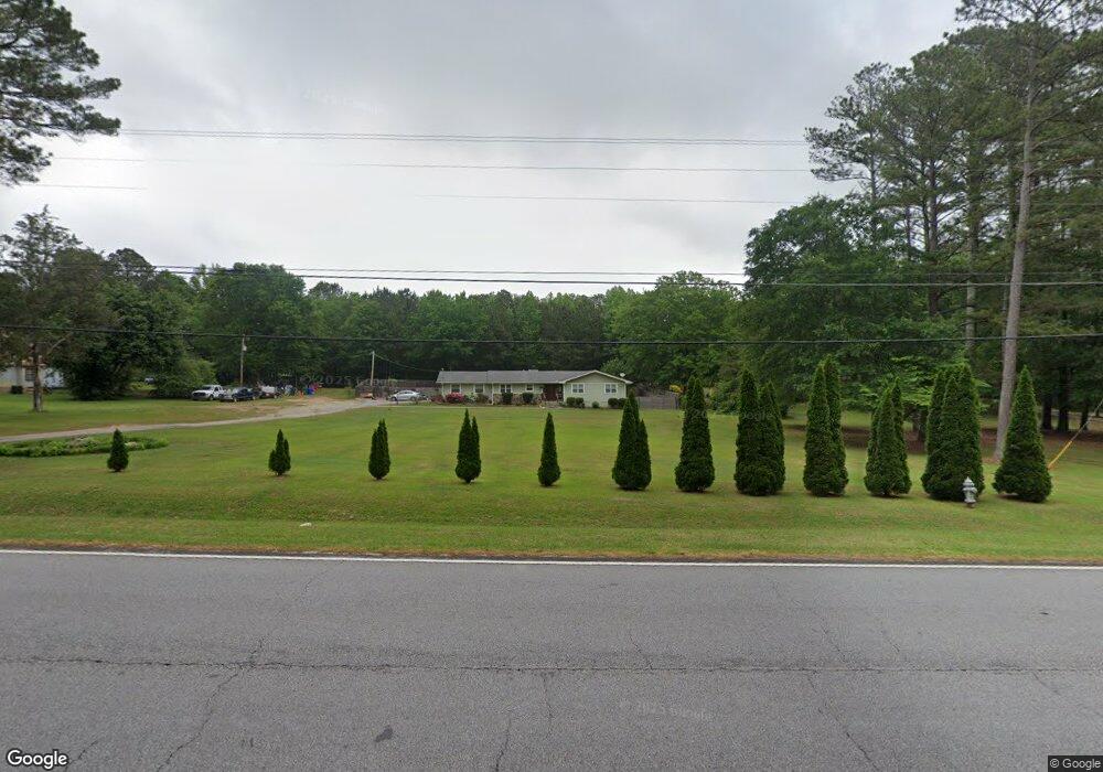
1009 Highway 92 N Fayetteville, GA 30214
Estimated Value: $326,470 - $408,000
--
Bed
2
Baths
2,056
Sq Ft
$187/Sq Ft
Est. Value
About This Home
This home is located at 1009 Highway 92 N, Fayetteville, GA 30214 and is currently estimated at $385,118, approximately $187 per square foot. 1009 Highway 92 N is a home located in Fayette County with nearby schools including North Fayette Elementary School, Bennett's Mill Middle School, and Fayette County High School.
Ownership History
Date
Name
Owned For
Owner Type
Purchase Details
Closed on
Apr 26, 2002
Sold by
Stringfellow Dougals M and Stringfellow Olivia C
Bought by
Laster James A
Current Estimated Value
Home Financials for this Owner
Home Financials are based on the most recent Mortgage that was taken out on this home.
Original Mortgage
$133,000
Outstanding Balance
$56,911
Interest Rate
7.12%
Mortgage Type
New Conventional
Estimated Equity
$328,207
Create a Home Valuation Report for This Property
The Home Valuation Report is an in-depth analysis detailing your home's value as well as a comparison with similar homes in the area
Home Values in the Area
Average Home Value in this Area
Purchase History
| Date | Buyer | Sale Price | Title Company |
|---|---|---|---|
| Laster James A | $133,000 | -- |
Source: Public Records
Mortgage History
| Date | Status | Borrower | Loan Amount |
|---|---|---|---|
| Open | Laster James A | $133,000 |
Source: Public Records
Tax History Compared to Growth
Tax History
| Year | Tax Paid | Tax Assessment Tax Assessment Total Assessment is a certain percentage of the fair market value that is determined by local assessors to be the total taxable value of land and additions on the property. | Land | Improvement |
|---|---|---|---|---|
| 2024 | $2,059 | $117,676 | $29,200 | $88,476 |
| 2023 | $1,670 | $113,360 | $29,200 | $84,160 |
| 2022 | $2,052 | $113,120 | $29,200 | $83,920 |
| 2021 | $1,731 | $76,860 | $10,500 | $66,360 |
| 2020 | $1,895 | $69,620 | $10,500 | $59,120 |
| 2019 | $1,820 | $66,300 | $10,500 | $55,800 |
| 2018 | $1,741 | $62,820 | $10,500 | $52,320 |
| 2017 | $1,528 | $55,260 | $10,500 | $44,760 |
| 2016 | $1,384 | $49,300 | $10,500 | $38,800 |
| 2015 | $1,308 | $45,940 | $10,500 | $35,440 |
| 2014 | $1,201 | $41,700 | $10,500 | $31,200 |
| 2013 | -- | $39,660 | $0 | $0 |
Source: Public Records
Map
Nearby Homes
- 220 Eastmark Way
- 120 Gentle Doe Dr
- 671 Ginger Cake Rd
- 100 Carlyle Ln
- 636 Ginger Cake Rd
- 210 New Oak Ridge Trail
- 0 Highway 92 N Unit 10594507
- 0 Highway 92 N Unit 7570733
- 615 New Hope Rd
- 615 New Hope Rd Unit NO SUBDIVISION
- 130 W Pier Way
- 150 Ashley Dr
- 145 Woodsong Dr
- 100 Thornton Ct
- 145 Walden Way Unit 2
- 190 Walden Way
- 550 Ginger Cake Rd
- 125 Sir Lancelot Ct
- 195 Blackberry Run
- 400 Benjamin Cir Unit 3
- 995 Highway 92 N
- 1017 Highway 92 N Unit 1
- 989 Highway 92 N
- 1025 Highway 92 N Unit 1
- 985 Highway 92 N Unit 1
- 1031 Highway 92 N
- 170 Briergate Place
- 180 Briergate Place Unit LOT 9
- 180 Briergate Place
- 975 Highway 92 N
- 185 Briergate Place Unit LOT 10
- 185 Briergate Place
- 0 Forrest Ave Unit 7002584
- 0 Forrest Ave Unit 10020997
- 0 Forrest Ave Unit 7344289
- 0 Forrest Ave Unit 7293548
- 0 Forrest Ave Unit 7169000
- 0 Forrest Ave Unit 7141339
- 0 Forrest Ave Unit 8872864
- 0 Forrest Ave Unit 8869809