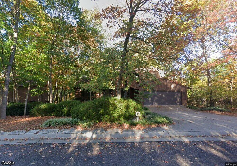
1009 Lagrange Ct Columbia, MO 65203
Old Southwest NeighborhoodEstimated Value: $550,362 - $649,000
4
Beds
4
Baths
3,236
Sq Ft
$182/Sq Ft
Est. Value
About This Home
This home is located at 1009 Lagrange Ct, Columbia, MO 65203 and is currently estimated at $587,341, approximately $181 per square foot. 1009 Lagrange Ct is a home located in Boone County with nearby schools including Grant Elementary School, West Middle School, and David H. Hickman High School.
Ownership History
Date
Name
Owned For
Owner Type
Purchase Details
Closed on
Jun 19, 2024
Sold by
Detert Thomas C and Detert Laura L
Bought by
Thomas C Detert And Laura L Detert Revocable and Detert
Current Estimated Value
Purchase Details
Closed on
Dec 18, 2015
Sold by
Rohlfing Herman E and Acton Rodney A
Bought by
Detert Thomas C and Detert Laura
Purchase Details
Closed on
Feb 28, 2011
Sold by
Whiteside John L and Whiteside Nancy L
Bought by
Detert Thomas C and Detert Laura L
Create a Home Valuation Report for This Property
The Home Valuation Report is an in-depth analysis detailing your home's value as well as a comparison with similar homes in the area
Home Values in the Area
Average Home Value in this Area
Purchase History
| Date | Buyer | Sale Price | Title Company |
|---|---|---|---|
| Thomas C Detert And Laura L Detert Revocable | -- | None Listed On Document | |
| Detert Thomas C | -- | None Available | |
| Detert Thomas C | -- | Boone Central Title Company |
Source: Public Records
Tax History
| Year | Tax Paid | Tax Assessment Tax Assessment Total Assessment is a certain percentage of the fair market value that is determined by local assessors to be the total taxable value of land and additions on the property. | Land | Improvement |
|---|---|---|---|---|
| 2025 | $4,197 | $64,087 | $9,842 | $54,245 |
| 2024 | $3,776 | $55,974 | $9,842 | $46,132 |
| 2023 | $3,745 | $55,974 | $9,842 | $46,132 |
| 2022 | $3,464 | $51,832 | $9,842 | $41,990 |
| 2021 | $3,471 | $51,832 | $9,842 | $41,990 |
| 2020 | $3,420 | $47,995 | $9,842 | $38,153 |
| 2019 | $3,420 | $47,995 | $9,842 | $38,153 |
| 2018 | $3,189 | $0 | $0 | $0 |
| 2017 | $2,989 | $44,441 | $9,842 | $34,599 |
| 2016 | $2,989 | $41,078 | $7,676 | $33,402 |
| 2015 | $2,757 | $41,078 | $7,676 | $33,402 |
| 2014 | -- | $41,078 | $7,676 | $33,402 |
Source: Public Records
Map
Nearby Homes
- 711 Thilly Ave
- 402 Thilly Ave
- 610 West Blvd S
- 203 Edgewood Ave
- 404 S Greenwood Ave
- 1020 Prospect St
- 1206 Frances Dr
- 304 Fredora Ave
- 1108 W Stewart Rd
- 1220 Ridge Rd
- 1402 W Rollins Rd
- 111 W Ash St Unit A - B
- 1109 Sunset Ln
- 501 Westridge Dr
- 4800 Stayton Ferry Loop
- 1705 Highridge Dr
- 122 N Greenwood Ave
- 302 Westridge Dr
- 2604 Vail Dr
- 405 Alexander Ave
- 1013 Lagrange Ct
- 1005 Lagrange Ct
- LOT 15 Lagrange Ct
- LOT 16 Lagrange Ct
- L15 & L16 Lagrange Ct
- 322 W Burnam Rd
- 1017 Lagrange Ct
- 1001 Lagrange Ct
- 1020 Lagrange Ct
- 320 W Burnam Rd
- 325 W Burnam Rd
- 1004 Lagrange Ct
- 1021 Lagrange Ct
- 1024 Lagrange Ct
- 923 Lagrange Rd
- 212 W Ridgeley Rd
- 1008 Lagrange Ct
- 1016 Lagrange Ct
- 1025 Lagrange Ct
- 321 W Burnam Rd
Your Personal Tour Guide
Ask me questions while you tour the home.