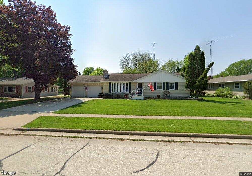
1009 Newton Ave Waupun, WI 53963
Estimated Value: $221,631 - $262,000
--
Bed
--
Bath
--
Sq Ft
0.32
Acres
About This Home
This home is located at 1009 Newton Ave, Waupun, WI 53963 and is currently estimated at $241,658. 1009 Newton Ave is a home located in Fond du Lac County with nearby schools including Meadow View Primary School, Rock River Intermediate School, and Waupun Area Junior High School.
Ownership History
Date
Name
Owned For
Owner Type
Purchase Details
Closed on
May 11, 2012
Sold by
Den Hartigh Susan A
Bought by
Deich David E and Deich Christine A
Current Estimated Value
Purchase Details
Closed on
Jul 29, 2010
Sold by
Kuzulka Michael and Estate Of Donald J Den Hartigh
Bought by
Hartigh Susan A Den
Purchase Details
Closed on
May 14, 2008
Sold by
Den Hartigh Susan A
Bought by
Den Hartigh Donald J
Purchase Details
Closed on
Jun 17, 2005
Sold by
Johnson Donna M
Bought by
Denhartigh Donald and Denhartigh Susan
Home Financials for this Owner
Home Financials are based on the most recent Mortgage that was taken out on this home.
Original Mortgage
$125,000
Interest Rate
5.82%
Mortgage Type
Future Advance Clause Open End Mortgage
Create a Home Valuation Report for This Property
The Home Valuation Report is an in-depth analysis detailing your home's value as well as a comparison with similar homes in the area
Home Values in the Area
Average Home Value in this Area
Purchase History
| Date | Buyer | Sale Price | Title Company |
|---|---|---|---|
| Deich David E | $127,000 | -- | |
| Hartigh Susan A Den | -- | None Available | |
| Den Hartigh Donald J | -- | None Available | |
| Denhartigh Donald | $125,000 | None Available |
Source: Public Records
Mortgage History
| Date | Status | Borrower | Loan Amount |
|---|---|---|---|
| Previous Owner | Denhartigh Donald | $125,000 |
Source: Public Records
Tax History Compared to Growth
Tax History
| Year | Tax Paid | Tax Assessment Tax Assessment Total Assessment is a certain percentage of the fair market value that is determined by local assessors to be the total taxable value of land and additions on the property. | Land | Improvement |
|---|---|---|---|---|
| 2024 | $3,031 | $175,600 | $29,500 | $146,100 |
| 2023 | $2,866 | $175,600 | $29,500 | $146,100 |
| 2022 | $2,835 | $175,600 | $29,500 | $146,100 |
| 2021 | $2,719 | $132,400 | $27,000 | $105,400 |
| 2020 | $4,137 | $132,400 | $27,000 | $105,400 |
| 2019 | $2,700 | $132,400 | $27,000 | $105,400 |
| 2018 | $2,611 | $132,400 | $27,000 | $105,400 |
| 2017 | $2,664 | $124,700 | $25,300 | $99,400 |
| 2016 | $2,500 | $124,700 | $25,300 | $99,400 |
| 2015 | $3,102 | $124,700 | $25,300 | $99,400 |
| 2014 | $2,564 | $124,700 | $25,300 | $99,400 |
| 2013 | $2,650 | $124,700 | $25,300 | $99,400 |
Source: Public Records
Map
Nearby Homes
- 736 Fern St
- 181 Harmsen Ave
- 709 W Jefferson St
- 307 Elm Ave
- 17.92 Ac Pattee Dr
- 231 Hillyer St
- 25 Taylor St
- 227 S State St
- 10 S Forest St
- 258 S Drummond St
- 315 E Main St
- 231 Woodland Dr
- 201 S Madison St
- 434 Jackson St
- 306 Rounsville St
- 595 Carrington St
- 516 E Lincoln St
- 618 Carrington St
- 613 Park St
- 609 E Franklin St
- 1008 Newton Ave
- 1012 Newton Ave
- 1013 Newton Ave
- 1005 Newton Ave
- 1004 Newton Ave
- 1016 Newton Ave
- 1017 Newton Ave
- 1000 Newton Ave
- 1013 Church St
- 1004 Rock Ave
- 1005 Church St
- 1020 Newton Ave
- 1000 Rock Ave
- 1001 Church St
- 1008 Rock Ave
- 1021 Newton Ave
- 1012 Rock Ave
- 1009 Church St
- 931 Newton Ave
- 1024 Newton Ave