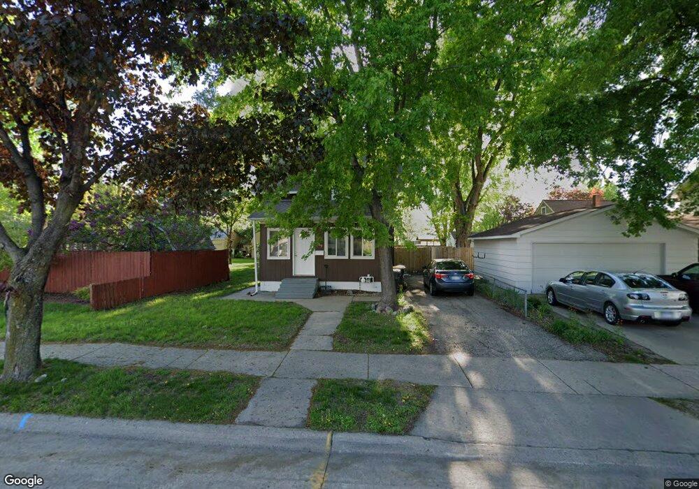
1009 Range St North Mankato, MN 56003
Estimated Value: $209,520 - $227,000
3
Beds
2
Baths
1,040
Sq Ft
$212/Sq Ft
Est. Value
About This Home
This home is located at 1009 Range St, North Mankato, MN 56003 and is currently estimated at $220,380, approximately $211 per square foot. 1009 Range St is a home located in Nicollet County with nearby schools including Monroe Elementary School, Dakota Meadows Middle School, and Mankato West Senior High School.
Ownership History
Date
Name
Owned For
Owner Type
Purchase Details
Closed on
Nov 30, 2023
Sold by
Forsyth Andrea and Forsyth David
Bought by
Ramirez Cantu Cristian and Ramirez Mazariegos Ingrid
Current Estimated Value
Home Financials for this Owner
Home Financials are based on the most recent Mortgage that was taken out on this home.
Original Mortgage
$163,975
Outstanding Balance
$160,212
Interest Rate
7.63%
Mortgage Type
New Conventional
Estimated Equity
$60,168
Purchase Details
Closed on
Mar 11, 2011
Sold by
Us Bank National Association
Bought by
Growth Holdings Llc
Create a Home Valuation Report for This Property
The Home Valuation Report is an in-depth analysis detailing your home's value as well as a comparison with similar homes in the area
Home Values in the Area
Average Home Value in this Area
Purchase History
We collect this data history from publicly available records. To have your information removed, we recommend requesting removal directly through your county’s website.
| Date | Buyer | Sale Price | Title Company |
|---|---|---|---|
| Ramirez Cantu Cristian | $167,000 | -- | |
| Growth Holdings Llc | $39,900 | -- |
Source: Public Records
Mortgage History
We collect this data history from publicly available records. To have your information removed, we recommend requesting removal directly through your county’s website.
| Date | Status | Borrower | Loan Amount |
|---|---|---|---|
| Open | Ramirez Cantu Cristian | $163,975 |
Source: Public Records
Tax History
| Year | Tax Paid | Tax Assessment Tax Assessment Total Assessment is a certain percentage of the fair market value that is determined by local assessors to be the total taxable value of land and additions on the property. | Land | Improvement |
|---|---|---|---|---|
| 2025 | $2,292 | $204,000 | $36,300 | $167,700 |
| 2024 | $2,164 | $204,000 | $36,300 | $167,700 |
| 2023 | $2,014 | $184,700 | $36,300 | $148,400 |
| 2022 | $1,886 | $173,400 | $36,300 | $137,100 |
| 2021 | $1,876 | $150,500 | $28,700 | $121,800 |
| 2020 | $1,690 | $145,500 | $28,700 | $116,800 |
| 2019 | $1,626 | $135,800 | $28,700 | $107,100 |
| 2011 | -- | $0 | $0 | $0 |
Source: Public Records
Map
Nearby Homes
- 349 Tyler Ave
- 0 Harrison Ave
- 532 Mckinley Ave
- 722 Range St
- 616 Range St
- 333 Page Ave
- 322 W Wheeler Ave
- 500 Brooks St
- 0 Belvista Dr
- 618 Park Ave
- 536 Belgrade Ave
- 114 E Elm St
- 501 Nicollet Ave
- 910 N 2nd St
- 1565 Commerce Dr
- 1605 Sherwood Dr
- 740 Belgrade Ave
- 1575 Sharon Dr
- 800 Belgrade Ave
- E E Spring St
- 305 Pierce Ave
- 301 Pierce Ave
- 309 Pierce Ave
- 310 Mckinley Ave
- 1021 Range St
- 1001 Range St
- 314 Mckinley Ave
- 318 Mckinley Ave
- 1016 Range St
- 1009 1009 Range
- 338 Pierce Ave
- 1012 Range St
- 327 Pierce Ave
- 340 Pierce Ave
- 1008 Range St
- 1008 1008 Range St
- 324 Mckinley Ave
- 301 Webster Ave
- 941 Range St
- 1004 Range St
Your Personal Tour Guide
Ask me questions while you tour the home.