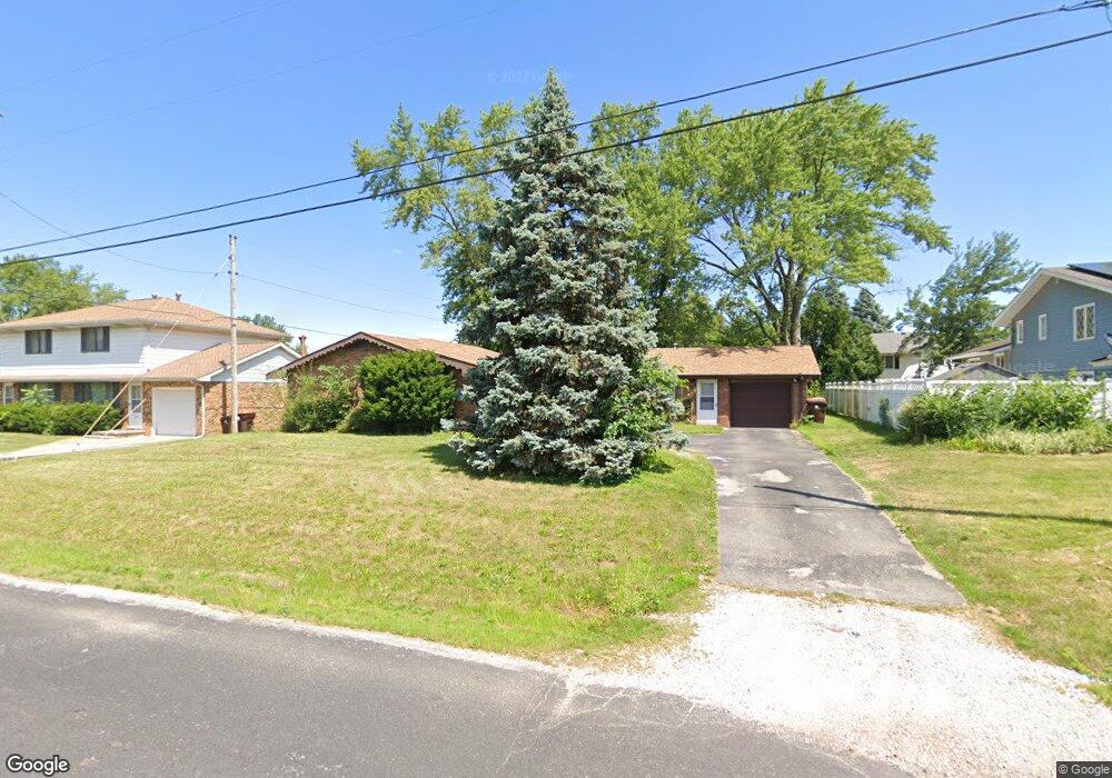
1009 W Wilshire Dr Peoria, IL 61614
North Peoria NeighborhoodEstimated Value: $181,056 - $229,000
4
Beds
3
Baths
1,512
Sq Ft
$133/Sq Ft
Est. Value
About This Home
This home is located at 1009 W Wilshire Dr, Peoria, IL 61614 and is currently estimated at $201,764, approximately $133 per square foot. 1009 W Wilshire Dr is a home with nearby schools including Kellar Primary School, Liberty Leadership Middle School, and Richwoods High School.
Ownership History
Date
Name
Owned For
Owner Type
Purchase Details
Closed on
Sep 24, 2020
Sold by
Glm Properties Llc
Bought by
Glm Real Estate Holdings Llc S
Current Estimated Value
Purchase Details
Closed on
Sep 15, 2020
Sold by
Glm Properties Llc
Bought by
Glm Real Estate Holdings Llc S
Purchase Details
Closed on
Dec 9, 2017
Sold by
Anton Phillip P and Anton Kasandra E
Bought by
Glm Properties Llc
Purchase Details
Closed on
Feb 12, 2007
Bought by
Anton Phillip P and Anton Kasandra E
Create a Home Valuation Report for This Property
The Home Valuation Report is an in-depth analysis detailing your home's value as well as a comparison with similar homes in the area
Home Values in the Area
Average Home Value in this Area
Purchase History
| Date | Buyer | Sale Price | Title Company |
|---|---|---|---|
| Glm Real Estate Holdings Llc S | -- | William C Connor Attorney At L | |
| Glm Real Estate Holdings Llc S | -- | William C Connor Attorney At L | |
| Glm Properties Llc | $110,000 | Hometown Title Inc | |
| Anton Phillip P | $142,000 | -- |
Source: Public Records
Tax History Compared to Growth
Tax History
| Year | Tax Paid | Tax Assessment Tax Assessment Total Assessment is a certain percentage of the fair market value that is determined by local assessors to be the total taxable value of land and additions on the property. | Land | Improvement |
|---|---|---|---|---|
| 2024 | $4,236 | $46,830 | $9,580 | $37,250 |
| 2023 | $4,042 | $42,960 | $8,790 | $34,170 |
| 2022 | $4,043 | $41,910 | $8,190 | $33,720 |
| 2021 | $3,968 | $39,910 | $7,800 | $32,110 |
| 2020 | $3,959 | $39,510 | $7,720 | $31,790 |
| 2019 | $4,017 | $40,320 | $7,880 | $32,440 |
| 2018 | $4,001 | $41,080 | $7,960 | $33,120 |
| 2017 | $4,000 | $41,490 | $8,040 | $33,450 |
| 2016 | $3,888 | $41,490 | $8,040 | $33,450 |
| 2015 | $3,665 | $40,670 | $7,880 | $32,790 |
| 2014 | $3,665 | $39,810 | $7,690 | $32,120 |
| 2013 | -- | $40,290 | $7,780 | $32,510 |
Source: Public Records
Map
Nearby Homes
- 7103 N Manning Dr
- 7120 N Manning Dr
- 6909 N Patricia Ln
- 7408 N Brittany Park Place Unit 8
- 7408 N Brittany Park Place
- 6217 N Knoll Aire Dr
- 801 W Shermoor St
- 1511 W Queens Court Rd
- 1720 W Willow Wood Dr
- 129 E High Point Rd
- 936 W Trailcreek Dr Unit 936
- 7610 Walnut Bend Dr Unit 27
- 1320 W Cress Creek Ct
- 7615 Walnut Bend Dr Unit 30
- 1720 W Queens Court Rd
- 6017 N Trenton Ln
- 1001 W Burnside Dr
- 202 W Wolf Rd
- 4600 N University St
- Lot 18 W Woods Edge Dr
- 6905 St Marys
- 6905 N Saint Marys Rd
- 6915 N Saint Marys Rd
- 1017 W Wilshire Dr
- 1015 W Wilshire Dr
- 6906 N Flamingo Ct
- 1014 W Wilshire Dr
- 6919 N Saint Marys Rd
- 6914 N Flamingo Ct Unit 1
- 6912 N Saint Marys Rd
- 6906 N Saint Marys Rd
- 6918 N Flamingo Ct
- 6924 N Flamingo Ct
- 6923 N Flamingo Ct
- 1020 W Wilshire Dr
- 906 W Saint Marys Ct
- 6811 N Bobolink Rd
- 6923 N Saint Marys Rd
- 6923 N St Marys
- 6925 N St Marys