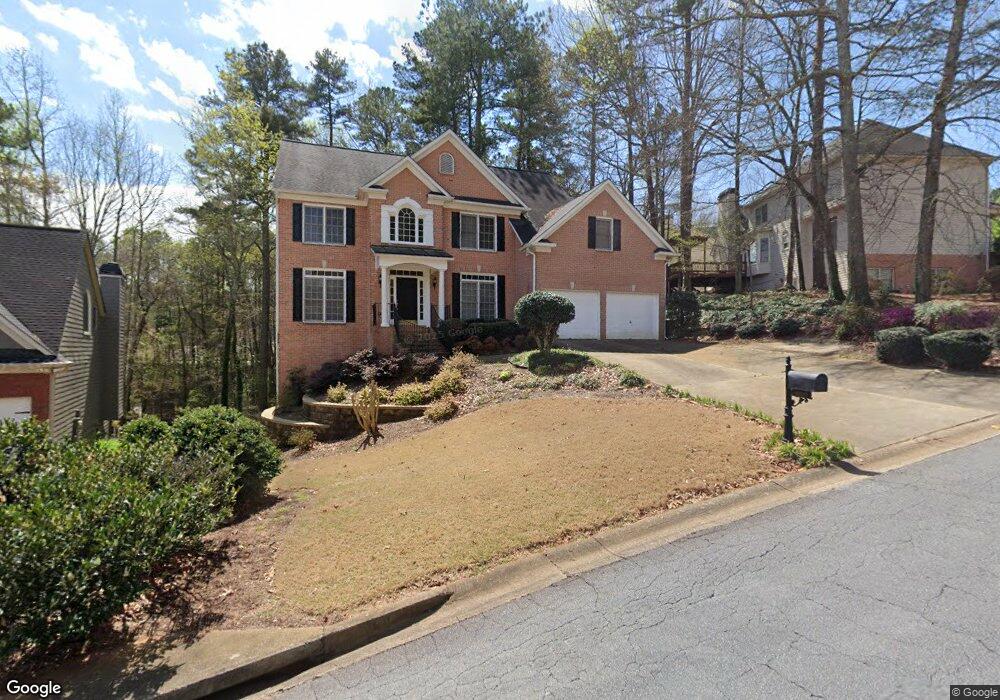
1009 Wellesley Crest Dr Unit 1 Woodstock, GA 30189
Oak Grove NeighborhoodEstimated Value: $632,228 - $682,000
6
Beds
4
Baths
3,158
Sq Ft
$208/Sq Ft
Est. Value
About This Home
This home is located at 1009 Wellesley Crest Dr Unit 1, Woodstock, GA 30189 and is currently estimated at $657,114, approximately $208 per square foot. 1009 Wellesley Crest Dr Unit 1 is a home located in Cherokee County with nearby schools including Bascomb Elementary School, E. T. Booth Middle School, and Etowah High School.
Ownership History
Date
Name
Owned For
Owner Type
Purchase Details
Closed on
Oct 14, 2010
Sold by
Cox H Randolph and Cox Hershal W
Bought by
Cox Hershal W and Cox Marilyn B
Current Estimated Value
Home Financials for this Owner
Home Financials are based on the most recent Mortgage that was taken out on this home.
Original Mortgage
$204,600
Outstanding Balance
$129,444
Interest Rate
3.63%
Mortgage Type
New Conventional
Estimated Equity
$527,670
Purchase Details
Closed on
Dec 29, 1998
Sold by
John Wieland Homes & N'Borhood
Bought by
Cox Hershal R
Home Financials for this Owner
Home Financials are based on the most recent Mortgage that was taken out on this home.
Original Mortgage
$207,200
Interest Rate
6.8%
Mortgage Type
VA
Create a Home Valuation Report for This Property
The Home Valuation Report is an in-depth analysis detailing your home's value as well as a comparison with similar homes in the area
Home Values in the Area
Average Home Value in this Area
Purchase History
| Date | Buyer | Sale Price | Title Company |
|---|---|---|---|
| Cox Hershal W | -- | -- | |
| Cox Hershal R | $259,900 | -- |
Source: Public Records
Mortgage History
| Date | Status | Borrower | Loan Amount |
|---|---|---|---|
| Open | Cox Hershal W | $204,600 | |
| Previous Owner | Cox Hershal R | $207,200 |
Source: Public Records
Tax History Compared to Growth
Tax History
| Year | Tax Paid | Tax Assessment Tax Assessment Total Assessment is a certain percentage of the fair market value that is determined by local assessors to be the total taxable value of land and additions on the property. | Land | Improvement |
|---|---|---|---|---|
| 2025 | $1,366 | $245,184 | $48,000 | $197,184 |
| 2024 | $2,041 | $240,392 | $46,000 | $194,392 |
| 2023 | $1,280 | $219,600 | $46,000 | $173,600 |
| 2022 | $1,179 | $177,280 | $30,560 | $146,720 |
| 2021 | $1,200 | $157,800 | $30,560 | $127,240 |
| 2020 | $1,156 | $144,920 | $27,800 | $117,120 |
| 2019 | $1,125 | $136,600 | $25,600 | $111,000 |
| 2018 | $1,122 | $130,320 | $23,200 | $107,120 |
| 2017 | $1,135 | $316,500 | $23,200 | $103,400 |
| 2016 | $1,136 | $301,200 | $23,200 | $97,280 |
| 2015 | $1,155 | $298,900 | $23,800 | $95,760 |
| 2014 | $1,162 | $300,300 | $23,800 | $96,320 |
Source: Public Records
Map
Nearby Homes
- 3007 Clove Tree Ln
- 3009 High Vista Walk
- 1086 Atherton Ln
- 509 Courtyard Way
- 2012 Spicers Ln
- 100 Eagle Glen Dr
- 2000 Spicers Ln
- 613 Sweet Basil Ln
- 125 Tambourine Trail
- 333 Ironhill Trace
- 243 Cordova St
- 327 Ironhill Trace
- 1113 Etowah Valley Ln
- 227 Strawberry Ln
- 321 Ironhill Trace
- 223 Strawberry Ln
- 159 W Putnam Ferry Rd
- Sanctuary Plan at Maple Grove at Towne Lake
- Stillhouse Plan at Maple Grove at Towne Lake
- Ridgeford Plan at Maple Grove at Towne Lake
- 1007 Wellesley Crest Dr Unit 1
- 301 Westbriar Way
- 303 Westbriar Way
- 1003 Wellesley Crest Dr Unit I
- 1006 Wellesley Crest Dr Unit 159
- 1006 Wellesley Crest Dr
- 1010 Wellesley Crest Dr
- 305 Westbriar Way
- 1013 Wellesley Crest Dr
- 203 Wellesley Ct
- 1012 Wellesley Crest Dr
- 302 Westbriar Way
- 200 Wellesley Ct Unit I
- 304 Westbriar Way Unit 1
- 1015 Wellesley Crest Dr Unit 1
- 202 Wellesley Ct
- 1014 Wellesley Crest Dr Unit 1
- 204 Wellesley Ct
- 207 Wellesley Ct Unit 1
- 2044 Cresthaven Walk