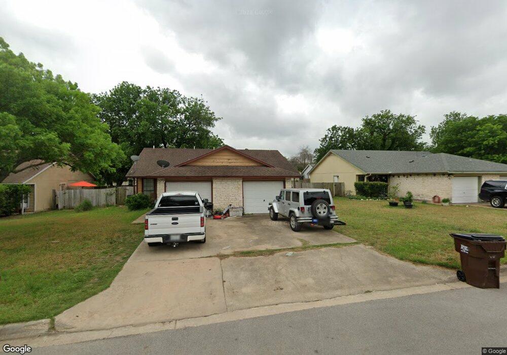
1009 Woodlief Trail Unit 1011 Round Rock, TX 78664
Stony Point NeighborhoodEstimated Value: $345,007 - $412,000
--
Bed
4
Baths
1,786
Sq Ft
$211/Sq Ft
Est. Value
About This Home
This home is located at 1009 Woodlief Trail Unit 1011, Round Rock, TX 78664 and is currently estimated at $377,252, approximately $211 per square foot. 1009 Woodlief Trail Unit 1011 is a home located in Williamson County with nearby schools including Union Hill Elementary School, Hernandez Middle School, and Stony Point High IB World School.
Ownership History
Date
Name
Owned For
Owner Type
Purchase Details
Closed on
Aug 5, 2008
Sold by
Us Bank Na
Bought by
Mcglamery Kirk
Current Estimated Value
Home Financials for this Owner
Home Financials are based on the most recent Mortgage that was taken out on this home.
Original Mortgage
$115,000
Outstanding Balance
$75,810
Interest Rate
6.42%
Mortgage Type
Purchase Money Mortgage
Estimated Equity
$301,442
Purchase Details
Closed on
May 6, 2008
Sold by
Mendez Marissa and Mendez Henry
Bought by
Us Bank Na and Asset Backed Pass Through Certificates S
Purchase Details
Closed on
Apr 18, 2006
Sold by
Campbell Curtis A and Campbell Nadja
Bought by
Mendez Henry
Home Financials for this Owner
Home Financials are based on the most recent Mortgage that was taken out on this home.
Original Mortgage
$123,200
Interest Rate
8.67%
Mortgage Type
Purchase Money Mortgage
Create a Home Valuation Report for This Property
The Home Valuation Report is an in-depth analysis detailing your home's value as well as a comparison with similar homes in the area
Home Values in the Area
Average Home Value in this Area
Purchase History
| Date | Buyer | Sale Price | Title Company |
|---|---|---|---|
| Mcglamery Kirk | -- | Independence Title Company | |
| Us Bank Na | $120,000 | None Available | |
| Mendez Henry | -- | None Available |
Source: Public Records
Mortgage History
| Date | Status | Borrower | Loan Amount |
|---|---|---|---|
| Open | Mcglamery Kirk | $115,000 | |
| Previous Owner | Mendez Henry | $123,200 |
Source: Public Records
Tax History Compared to Growth
Tax History
| Year | Tax Paid | Tax Assessment Tax Assessment Total Assessment is a certain percentage of the fair market value that is determined by local assessors to be the total taxable value of land and additions on the property. | Land | Improvement |
|---|---|---|---|---|
| 2025 | $7,093 | $370,538 | $77,000 | $293,538 |
| 2024 | $7,093 | $400,406 | $77,000 | $323,406 |
| 2023 | $6,956 | $396,564 | $77,000 | $319,564 |
| 2022 | $8,150 | $429,734 | $77,000 | $352,734 |
| 2021 | $7,349 | $327,391 | $59,000 | $268,391 |
| 2020 | $6,408 | $283,864 | $53,278 | $230,586 |
| 2019 | $6,216 | $269,256 | $48,600 | $220,656 |
| 2018 | $5,639 | $244,274 | $41,730 | $202,544 |
| 2017 | $5,033 | $213,620 | $39,000 | $174,620 |
| 2016 | $4,359 | $185,045 | $39,000 | $146,045 |
| 2015 | $3,241 | $180,806 | $33,000 | $147,806 |
| 2014 | $3,241 | $137,741 | $0 | $0 |
Source: Public Records
Map
Nearby Homes
- 2407 Curry Loop Unit A
- 800 Saunders Dr
- 1481 E Old Settlers Blvd Unit 1503
- 2123 Jester Farms
- 712 Clearwater Trail
- 2067 Buckley Ln
- 1008 Ridgeline Dr
- 609 Clearwater Trail
- 2700 Settlement Dr
- 2104 Andover Dr
- 1635 Sundance Dr
- 509 Andover Cove
- 903 Rolling Green Cir
- 1002 Outpost Cove
- 2471 Sunrise Rd Unit 35
- 2471 Sunrise Rd Unit 1
- 1301 Wayne Dr
- 1309 Wayne Dr
- 3000 Sunrise Rd
- 2006 Heathwood Cir
- 1011 Woodlief Trail
- 1013 Woodlief Trail Unit 1015
- 1005 Woodlief Trail Unit 1007
- 1007 Woodlief Trail
- 2400 Meadow Brook Dr
- 2402 Meadow Brook Dr
- 1019 Woodlief Trail
- 1017 Woodlief Trail Unit 1019
- 1008 Woodlief Trail Unit 1010
- 2306 Meadow Brook Dr
- 1001 Woodlief Trail Unit 1003
- 1012 Woodlief Trail Unit 1014
- 2404 Meadow Brook Dr
- 1010 Woodlief Trail
- 1018 Woodlief Trail
- 1004 Woodlief Trail Unit 1006
- 1016 Woodlief Trail
- 1103 Woodlief Trail
- 1101 Woodlief Trail Unit 1103
- 2304 Meadow Brook Dr