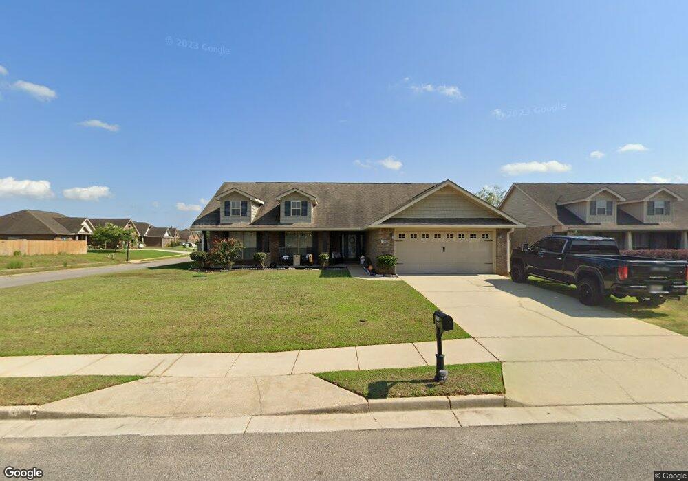
10099 Scott Plantation Dr N Mobile, AL 36695
Westlake NeighborhoodEstimated Value: $255,373 - $283,000
--
Bed
--
Bath
1,893
Sq Ft
$143/Sq Ft
Est. Value
About This Home
This home is located at 10099 Scott Plantation Dr N, Mobile, AL 36695 and is currently estimated at $271,093, approximately $143 per square foot. 10099 Scott Plantation Dr N is a home with nearby schools including Hutchens Elementary School, Dawes Intermediate School, and Bernice J Causey Middle School.
Ownership History
Date
Name
Owned For
Owner Type
Purchase Details
Closed on
Jan 4, 2011
Sold by
Adams Homes L L C
Bought by
Rivers Bridgette D
Current Estimated Value
Home Financials for this Owner
Home Financials are based on the most recent Mortgage that was taken out on this home.
Original Mortgage
$165,202
Outstanding Balance
$113,113
Interest Rate
4.87%
Mortgage Type
FHA
Estimated Equity
$157,980
Purchase Details
Closed on
Oct 6, 2008
Sold by
Plantation West Llc
Bought by
Adams Homes Llc
Create a Home Valuation Report for This Property
The Home Valuation Report is an in-depth analysis detailing your home's value as well as a comparison with similar homes in the area
Home Values in the Area
Average Home Value in this Area
Purchase History
| Date | Buyer | Sale Price | Title Company |
|---|---|---|---|
| Rivers Bridgette D | $169,500 | Slt | |
| Adams Homes Llc | -- | None Available |
Source: Public Records
Mortgage History
| Date | Status | Borrower | Loan Amount |
|---|---|---|---|
| Open | Rivers Bridgette D | $165,202 |
Source: Public Records
Tax History Compared to Growth
Tax History
| Year | Tax Paid | Tax Assessment Tax Assessment Total Assessment is a certain percentage of the fair market value that is determined by local assessors to be the total taxable value of land and additions on the property. | Land | Improvement |
|---|---|---|---|---|
| 2024 | $1,194 | $24,560 | $3,700 | $20,860 |
| 2023 | $1,194 | $22,300 | $3,700 | $18,600 |
| 2022 | $864 | $19,190 | $3,700 | $15,490 |
| 2021 | $855 | $19,000 | $3,700 | $15,300 |
| 2020 | $830 | $18,500 | $3,700 | $14,800 |
| 2019 | $790 | $17,660 | $0 | $0 |
| 2018 | $777 | $17,400 | $0 | $0 |
| 2017 | $828 | $17,000 | $0 | $0 |
| 2016 | $764 | $17,140 | $0 | $0 |
| 2013 | -- | $16,480 | $0 | $0 |
Source: Public Records
Map
Nearby Homes
- 10123 Scott Plantation Dr N
- 3050 Jersey Dr W
- 10351 Jeff Hamilton Rd
- 0 Jeff Hamilton Rd Unit 7613918
- The Lakeside Plan at Rossfield
- The Freeport Plan at Rossfield
- The Aria Plan at Rossfield
- The Cairn Plan at Rossfield
- The Denton Plan at Rossfield
- The Booth Plan at Rossfield
- 10482 Ellenton W
- 10494 Ellenton W
- 10506 Ellenton W
- 2751 Hamilton Creek Dr W
- 10394 Lowell St E
- 10595 Lowell St W
- 10565 Lowell St W
- 10575 Lowell St W
- 10585 Lowell St W
- 10414 Lowell St E
- 10111 Scott Plantation Dr N
- 101147 N Scott Plantation Dr
- 10087 Scott Plantation Dr N
- 10092 Jersey Ct
- 10102 Jersey Ct
- 10096 Scott Plantation Dr N
- 10088 Scott Plantation Dr N
- 2917 Jersey Dr E
- 10075 Scott Plantation Dr N
- 10078 Scott Plantation Dr N
- 10108 Scott Plantation Dr N
- 10112 Jersey Ct
- 10135 Scott Plantation Dr N
- 10068 Scott Plantation Dr N
- 2927 Jersey Dr E
- 10122 Scott Plantation Dr N
- 10063 Scott Plantation Dr N
- 10063 Scott Plantation Dr N Unit 8
- 10122 Jersey Ct
- 10093 Jersey Ct