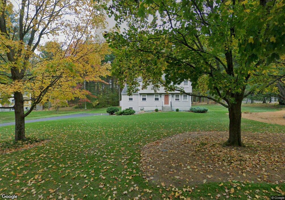
101 Austin Rd Sudbury, MA 01776
Estimated Value: $890,851 - $1,063,000
4
Beds
4
Baths
1,976
Sq Ft
$510/Sq Ft
Est. Value
About This Home
This home is located at 101 Austin Rd, Sudbury, MA 01776 and is currently estimated at $1,006,963, approximately $509 per square foot. 101 Austin Rd is a home located in Middlesex County with nearby schools including Peter Noyes Elementary School, Ephraim Curtis Middle School, and Lincoln-Sudbury Regional High School.
Ownership History
Date
Name
Owned For
Owner Type
Purchase Details
Closed on
Nov 29, 2022
Sold by
Zimmer Charles C and Zimmer Gladys E
Bought by
C and Zimmer G
Current Estimated Value
Purchase Details
Closed on
Jul 20, 1970
Bought by
Zimmer Charles C and Zimmer Gladys E
Create a Home Valuation Report for This Property
The Home Valuation Report is an in-depth analysis detailing your home's value as well as a comparison with similar homes in the area
Home Values in the Area
Average Home Value in this Area
Purchase History
| Date | Buyer | Sale Price | Title Company |
|---|---|---|---|
| C | -- | None Available | |
| Zimmer Charles C | -- | -- |
Source: Public Records
Mortgage History
| Date | Status | Borrower | Loan Amount |
|---|---|---|---|
| Previous Owner | Zimmer Charles C | $60,000 |
Source: Public Records
Tax History Compared to Growth
Tax History
| Year | Tax Paid | Tax Assessment Tax Assessment Total Assessment is a certain percentage of the fair market value that is determined by local assessors to be the total taxable value of land and additions on the property. | Land | Improvement |
|---|---|---|---|---|
| 2025 | $11,645 | $795,400 | $408,700 | $386,700 |
| 2024 | $11,345 | $776,500 | $396,700 | $379,800 |
| 2023 | $10,820 | $686,100 | $367,500 | $318,600 |
| 2022 | $10,798 | $598,200 | $337,200 | $261,000 |
| 2021 | $10,483 | $556,700 | $337,200 | $219,500 |
| 2020 | $10,271 | $556,700 | $337,200 | $219,500 |
| 2019 | $9,970 | $556,700 | $337,200 | $219,500 |
| 2018 | $9,960 | $555,500 | $354,800 | $200,700 |
| 2017 | $10,587 | $596,800 | $398,000 | $198,800 |
| 2016 | $10,251 | $575,900 | $382,800 | $193,100 |
| 2015 | $9,810 | $557,400 | $368,000 | $189,400 |
| 2014 | $9,787 | $542,800 | $357,200 | $185,600 |
Source: Public Records
Map
Nearby Homes
- 30 Rolling Ln
- 54 Stone Rd
- 21 Summer St
- 0 Robbins Rd
- 11 Winter St
- 0 Boston Post Rd
- 123 Dutton Rd
- 7 Adams Rd
- 24 Woodland Rd
- 30 Harness Ln
- 1011 Boston Post Rd
- 36 Thornberry Ln
- 16 Minehan Ln
- 6 Mountain View Dr
- 14 Turner Ridge Rd
- 32 Eaton Rd W
- 28 Stetson Dr
- 19 Nob Hill Dr
- 1224 Edgell Rd
- 55 Widow Rites Ln