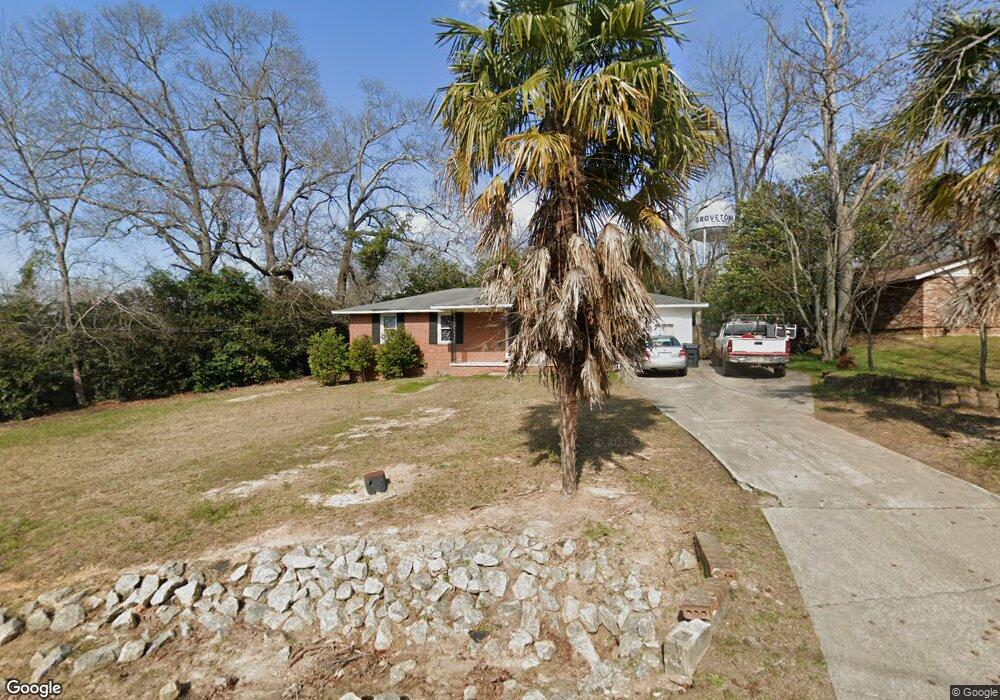
101 Barbara St Grovetown, GA 30813
Estimated Value: $162,000 - $196,782
3
Beds
2
Baths
1,107
Sq Ft
$165/Sq Ft
Est. Value
About This Home
This home is located at 101 Barbara St, Grovetown, GA 30813 and is currently estimated at $183,196, approximately $165 per square foot. 101 Barbara St is a home located in Columbia County with nearby schools including Grovetown Elementary School, Grovetown Middle School, and Grovetown High School.
Ownership History
Date
Name
Owned For
Owner Type
Purchase Details
Closed on
Jun 6, 2011
Sold by
Sec Of Housing & U
Bought by
Norman Walker
Current Estimated Value
Purchase Details
Closed on
Aug 29, 2008
Sold by
Gordon Dianne B
Bought by
Oleary Heather R
Home Financials for this Owner
Home Financials are based on the most recent Mortgage that was taken out on this home.
Original Mortgage
$93,003
Interest Rate
6.48%
Mortgage Type
FHA
Create a Home Valuation Report for This Property
The Home Valuation Report is an in-depth analysis detailing your home's value as well as a comparison with similar homes in the area
Home Values in the Area
Average Home Value in this Area
Purchase History
| Date | Buyer | Sale Price | Title Company |
|---|---|---|---|
| Norman Walker | $25,000 | -- | |
| Oleary Heather R | $94,000 | -- |
Source: Public Records
Mortgage History
| Date | Status | Borrower | Loan Amount |
|---|---|---|---|
| Previous Owner | Oleary Heather R | $93,003 |
Source: Public Records
Tax History Compared to Growth
Tax History
| Year | Tax Paid | Tax Assessment Tax Assessment Total Assessment is a certain percentage of the fair market value that is determined by local assessors to be the total taxable value of land and additions on the property. | Land | Improvement |
|---|---|---|---|---|
| 2025 | $1,492 | $53,276 | $17,404 | $35,872 |
| 2024 | $1,594 | $54,042 | $17,204 | $36,838 |
| 2023 | $1,594 | $46,244 | $16,304 | $29,940 |
| 2022 | $1,372 | $44,532 | $16,304 | $28,228 |
| 2021 | $1,166 | $36,225 | $9,404 | $26,821 |
| 2020 | $1,190 | $36,340 | $9,404 | $26,936 |
| 2019 | $1,136 | $34,344 | $6,704 | $27,640 |
| 2018 | $1,163 | $34,628 | $6,704 | $27,924 |
| 2017 | $1,133 | $34,758 | $6,804 | $27,954 |
| 2016 | $942 | $29,648 | $6,780 | $22,868 |
| 2015 | $1,005 | $31,497 | $7,680 | $23,817 |
| 2014 | $961 | $29,814 | $7,680 | $22,134 |
Source: Public Records
Map
Nearby Homes
- 201 Williams St
- 406 Williams St
- 100 Buck Ave
- 102 Walton Dr
- 104 Bennett St
- 4917 Cavan Place
- 106 Bennett St
- 100 Walton Dr
- 116 Bennett St
- 106 Walton Dr
- 118 Bennett St
- 321 Railroad Ave
- 1100 Durban Dr
- 4907 Selkirk Way
- 936 Bryan Cir
- 132 Summerfield Cir
- 141/137 Lewiston Rd
- 116 Summerfield Cir
- 211 Whiskey Rd
- 213 Whiskey Rd