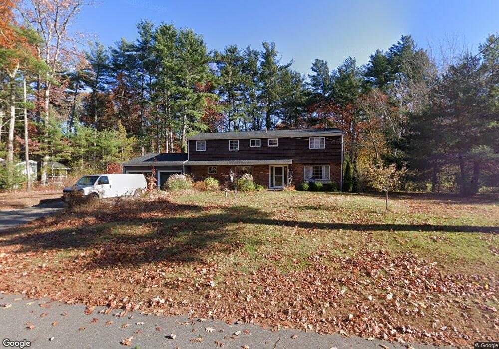
101 Barton Dr Sudbury, MA 01776
Estimated Value: $945,000 - $991,000
5
Beds
4
Baths
2,233
Sq Ft
$432/Sq Ft
Est. Value
About This Home
This home is located at 101 Barton Dr, Sudbury, MA 01776 and is currently estimated at $965,305, approximately $432 per square foot. 101 Barton Dr is a home located in Middlesex County with nearby schools including Peter Noyes Elementary School, Ephraim Curtis Middle School, and Lincoln-Sudbury Regional High School.
Ownership History
Date
Name
Owned For
Owner Type
Purchase Details
Closed on
Sep 4, 2007
Sold by
Stewart Kristen M and Rossi Peter A
Bought by
Rossi Peter A
Current Estimated Value
Purchase Details
Closed on
Oct 23, 1987
Sold by
Yokoyama Olga T
Bought by
Kiser Yoko T
Create a Home Valuation Report for This Property
The Home Valuation Report is an in-depth analysis detailing your home's value as well as a comparison with similar homes in the area
Home Values in the Area
Average Home Value in this Area
Purchase History
| Date | Buyer | Sale Price | Title Company |
|---|---|---|---|
| Rossi Peter A | -- | -- | |
| Kiser Yoko T | $260,000 | -- |
Source: Public Records
Tax History
| Year | Tax Paid | Tax Assessment Tax Assessment Total Assessment is a certain percentage of the fair market value that is determined by local assessors to be the total taxable value of land and additions on the property. | Land | Improvement |
|---|---|---|---|---|
| 2025 | $11,741 | $802,000 | $421,800 | $380,200 |
| 2024 | $11,307 | $773,900 | $409,500 | $364,400 |
| 2023 | $10,801 | $684,900 | $379,100 | $305,800 |
| 2022 | $10,585 | $586,400 | $347,900 | $238,500 |
| 2021 | $10,358 | $550,100 | $347,900 | $202,200 |
| 2020 | $10,149 | $550,100 | $347,900 | $202,200 |
| 2019 | $9,852 | $550,100 | $347,900 | $202,200 |
| 2018 | $9,980 | $556,600 | $371,000 | $185,600 |
| 2017 | $9,525 | $536,900 | $352,900 | $184,000 |
| 2016 | $9,229 | $518,500 | $339,500 | $179,000 |
| 2015 | $8,837 | $502,100 | $326,400 | $175,700 |
| 2014 | $8,820 | $489,200 | $316,800 | $172,400 |
Source: Public Records
Map
Nearby Homes
- 53 Pine St
- 30 Kendall Rd
- 557 Dutton Rd Unit 2
- 11 Great Lake Dr
- 15 Harness Ln
- 30 Harness Ln
- 22 Barracks Rd Unit 22
- 30 Rolling Ln
- 62 Churchill St
- 11 October Rd
- 45 Webster Cir
- 123 Dutton Rd
- 0 Robbins Rd
- 0 Boston Post Rd
- 15 Huckleberry Ln
- 725 Boston Post Rd Unit 12
- 788 Main St
- 786 Main St
- 8 Shoreline Dr Unit 11
- 14 Old County Rd Unit 21
Your Personal Tour Guide
Ask me questions while you tour the home.