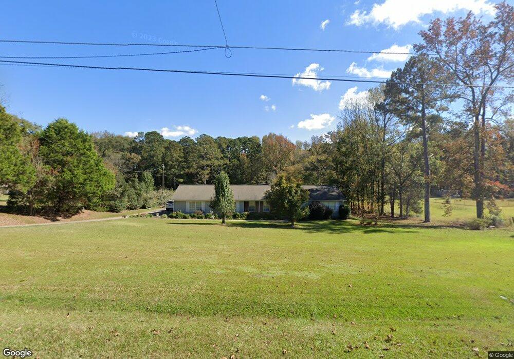
101 Bradfield Dr Lagrange, GA 30240
Estimated Value: $154,000 - $267,000
3
Beds
2
Baths
2,239
Sq Ft
$93/Sq Ft
Est. Value
About This Home
This home is located at 101 Bradfield Dr, Lagrange, GA 30240 and is currently estimated at $208,040, approximately $92 per square foot. 101 Bradfield Dr is a home located in Troup County with nearby schools including Berta Weathersbee Elementary School, Long Cane Elementary School, and Whitesville Road Elementary School.
Ownership History
Date
Name
Owned For
Owner Type
Purchase Details
Closed on
May 17, 2022
Sold by
White William Michael
Bought by
White Patrick Jonathan and White Michael Kerrick
Current Estimated Value
Purchase Details
Closed on
Mar 30, 1992
Sold by
Kirk Charles Wayne Etal
Bought by
White Wm M and White Reba
Purchase Details
Closed on
Mar 19, 1975
Bought by
Kirk Charles Wayne Etal
Purchase Details
Closed on
Jan 1, 1973
Purchase Details
Closed on
Jan 1, 1969
Create a Home Valuation Report for This Property
The Home Valuation Report is an in-depth analysis detailing your home's value as well as a comparison with similar homes in the area
Purchase History
We collect this data history from publicly available records. To have your information removed, we recommend requesting removal directly through your county’s website.
| Date | Buyer | Sale Price | Title Company |
|---|---|---|---|
| White Patrick Jonathan | -- | -- | |
| White Wm M | -- | -- | |
| Kirk Charles Wayne Etal | -- | -- | |
| -- | -- | -- | |
| -- | -- | -- |
Source: Public Records
Tax History
| Year | Tax Paid | Tax Assessment Tax Assessment Total Assessment is a certain percentage of the fair market value that is determined by local assessors to be the total taxable value of land and additions on the property. | Land | Improvement |
|---|---|---|---|---|
| 2025 | $1,525 | $55,920 | $8,040 | $47,880 |
| 2024 | $1,525 | $55,920 | $8,040 | $47,880 |
| 2023 | $1,296 | $55,920 | $8,040 | $47,880 |
| 2022 | $1,390 | $57,200 | $8,040 | $49,160 |
| 2021 | $1,010 | $41,240 | $7,960 | $33,280 |
| 2020 | $1,184 | $41,240 | $7,960 | $33,280 |
| 2019 | $1,140 | $39,778 | $6,178 | $33,600 |
| 2018 | $1,047 | $36,698 | $6,178 | $30,520 |
| 2017 | $1,047 | $36,698 | $6,178 | $30,520 |
| 2016 | $1,019 | $35,771 | $6,178 | $29,592 |
| 2015 | $1,021 | $35,771 | $6,178 | $29,592 |
| 2014 | $975 | $34,213 | $6,178 | $28,035 |
| 2013 | -- | $36,190 | $6,178 | $30,012 |
Source: Public Records
Map
Nearby Homes
- 0 Bradfield Dr Unit 10568803
- 53 Horace Carter Rd
- 22 Freeman Rd
- 245 Teaver Rd
- 20 Hill Rd
- 36 Hill Rd
- 105 Redwood Dr
- 0 Unit 10514554
- 3658 W Point Rd
- 227 W Lakeview Dr
- 205 Grady St
- 9 Crown St Unit LOT 4
- 3 Crown St Unit LOT 1
- 117 Brookwood Dr
- 802 Monroe St
- 903 Troup St
- 104 Spring Valley Dr
- 519 Freeman St
- 6 Hastings Ct
- 1015 Stonewall St
- 94 Bradfield Dr
- 250 Bradfield Dr
- 104 Bradfield Dr
- 84 Bradfield Dr
- 76 Bradfield Dr
- 85 Bradfield Dr
- 73 Bradfield Dr
- 65 Bradfield Dr
- 125 Bradfield Dr
- 54 Bradfield Dr
- 55 Bradfield Dr
- 134 Bradfield Dr
- 46 Bradfield Dr
- 47 Bradfield Dr
- 20 Bradfield Dr
- 45 Oakridge Dr
- 19 Bradfield Dr
- 2663 W Point Rd
- 2663 West Point Rd
- 109 Oakridge Dr
Your Personal Tour Guide
Ask me questions while you tour the home.