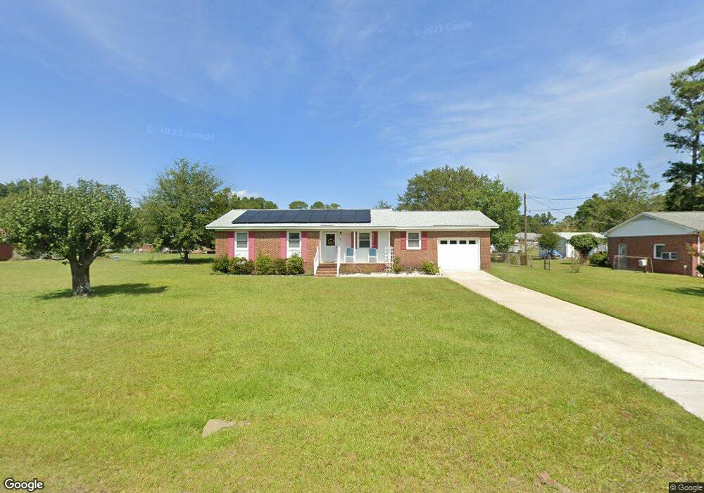
101 Briercrest Dr Wilmington, NC 28405
Estimated Value: $304,600 - $363,000
3
Beds
2
Baths
1,197
Sq Ft
$276/Sq Ft
Est. Value
About This Home
This home is located at 101 Briercrest Dr, Wilmington, NC 28405 and is currently estimated at $330,400, approximately $276 per square foot. 101 Briercrest Dr is a home located in New Hanover County with nearby schools including Wrightsboro Elementary School, Holly Shelter Middle School, and Emsley A. Laney High School.
Ownership History
Date
Name
Owned For
Owner Type
Purchase Details
Closed on
Aug 1, 2014
Sold by
Murph Betty Paynter
Bought by
Murph Betty Paynter and Benny Leonard Murph Revocable Trust
Current Estimated Value
Purchase Details
Closed on
Feb 12, 1999
Sold by
Murph Benny L Betty P
Bought by
Murph Betty P Rev Trust Etal
Purchase Details
Closed on
Nov 24, 1993
Sold by
Oberfield John J Rebecca
Bought by
Murph Benny L Betty P
Purchase Details
Closed on
Jul 1, 1977
Bought by
Oberfield John J Rebecca
Create a Home Valuation Report for This Property
The Home Valuation Report is an in-depth analysis detailing your home's value as well as a comparison with similar homes in the area
Home Values in the Area
Average Home Value in this Area
Purchase History
| Date | Buyer | Sale Price | Title Company |
|---|---|---|---|
| Murph Betty Paynter | -- | None Available | |
| Murph Betty P Rev Trust Etal | -- | -- | |
| Murph Betty Paynter Rev Trust | -- | -- | |
| Murph Benny L Betty P | $70,500 | -- | |
| Oberfield John J Rebecca | $10,000 | -- |
Source: Public Records
Tax History Compared to Growth
Tax History
| Year | Tax Paid | Tax Assessment Tax Assessment Total Assessment is a certain percentage of the fair market value that is determined by local assessors to be the total taxable value of land and additions on the property. | Land | Improvement |
|---|---|---|---|---|
| 2025 | $1,010 | $329,100 | $140,400 | $188,700 |
| 2023 | $1,010 | $179,200 | $83,700 | $95,500 |
| 2022 | $1,013 | $179,200 | $83,700 | $95,500 |
| 2021 | $993 | $179,200 | $83,700 | $95,500 |
| 2020 | $764 | $120,800 | $30,700 | $90,100 |
| 2019 | $764 | $120,800 | $30,700 | $90,100 |
| 2018 | $764 | $120,800 | $30,700 | $90,100 |
| 2017 | $782 | $120,800 | $30,700 | $90,100 |
| 2016 | $828 | $119,500 | $47,300 | $72,200 |
| 2015 | $770 | $119,500 | $47,300 | $72,200 |
| 2014 | $756 | $119,500 | $47,300 | $72,200 |
Source: Public Records
Map
Nearby Homes
- 129 Elder Dr
- 314 Brookfield Dr
- 1933 N Kerr Ave
- 318 Springdale Dr
- 1916 Simonton Dr
- 4418 Dewberry Rd
- 1571 Grey Cliff Run
- 1535 Grey Cliff
- 1527 Grey Cliff
- 4624 Runaway Bay Ln
- 4302 Reed Ct
- 4335 Reed Ct
- 136 Blount Dr
- 2104 Cornelius Moore Ave
- 2509 N Kerr Ave
- 4427 Deborah Ct
- 2016 Deer Creek Ln
- 141 Hargrove Dr
- 1658 Killdeer Ln
- 805 Spring Valley Rd
- 4320 Gordon Rd
- 4324 Gordon Rd
- 4324 Gordon Rd
- 4316 Gordon Rd
- 105 Briercrest Dr
- 105 Gladbrook Dr
- 106 Gladbrook Dr
- 106 Briercrest Dr
- 113 Gladbrook Dr
- 109 Briercrest Dr
- 110 Briercrest Dr
- 110 Gladbrook Dr
- 4312 Gordon Rd
- 117 Gladbrook Dr
- 114 Briercrest Dr
- 4336 Gordon Rd
- 113 Briercrest Dr
- 4317 Gordon Rd
- 114 Gladbrook Dr
- 4329 Gordon Rd