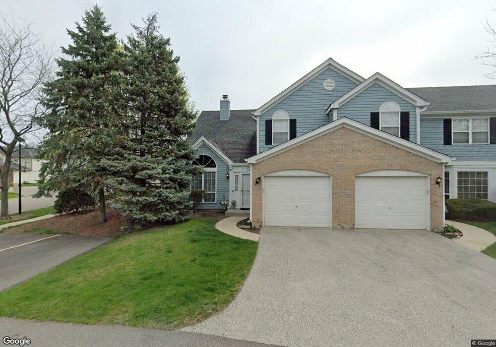
101 Bristol Ct Unit 2 Gurnee, IL 60031
Estimated Value: $240,659 - $261,000
2
Beds
2
Baths
1,364
Sq Ft
$184/Sq Ft
Est. Value
About This Home
This home is located at 101 Bristol Ct Unit 2, Gurnee, IL 60031 and is currently estimated at $251,165, approximately $184 per square foot. 101 Bristol Ct Unit 2 is a home located in Lake County with nearby schools including Spaulding Elementary School, Viking Middle School, and Warren Township High School.
Ownership History
Date
Name
Owned For
Owner Type
Purchase Details
Closed on
Aug 14, 2001
Sold by
Walters Arthur E and Walters Gloria E
Bought by
Bonilla Elizabeth A
Current Estimated Value
Home Financials for this Owner
Home Financials are based on the most recent Mortgage that was taken out on this home.
Original Mortgage
$100,000
Interest Rate
6.37%
Purchase Details
Closed on
Jun 19, 1995
Sold by
Cerese Georgiann
Bought by
Walters Arthur E and Walters Gloria E
Create a Home Valuation Report for This Property
The Home Valuation Report is an in-depth analysis detailing your home's value as well as a comparison with similar homes in the area
Home Values in the Area
Average Home Value in this Area
Purchase History
| Date | Buyer | Sale Price | Title Company |
|---|---|---|---|
| Bonilla Elizabeth A | $139,000 | -- | |
| Walters Arthur E | $114,000 | Chicago Title Insurance Co |
Source: Public Records
Mortgage History
| Date | Status | Borrower | Loan Amount |
|---|---|---|---|
| Previous Owner | Bonilla Elizabeth A | $100,000 |
Source: Public Records
Tax History Compared to Growth
Tax History
| Year | Tax Paid | Tax Assessment Tax Assessment Total Assessment is a certain percentage of the fair market value that is determined by local assessors to be the total taxable value of land and additions on the property. | Land | Improvement |
|---|---|---|---|---|
| 2024 | $4,805 | $62,659 | $8,227 | $54,432 |
| 2023 | $4,391 | $55,372 | $7,270 | $48,102 |
| 2022 | $4,391 | $49,698 | $7,271 | $42,427 |
| 2021 | $3,981 | $47,704 | $6,979 | $40,725 |
| 2020 | $3,852 | $46,531 | $6,807 | $39,724 |
| 2019 | $3,752 | $45,180 | $6,609 | $38,571 |
| 2018 | $3,442 | $41,649 | $4,331 | $37,318 |
| 2017 | $3,402 | $40,456 | $4,207 | $36,249 |
| 2016 | $3,288 | $38,655 | $4,020 | $34,635 |
| 2015 | $3,180 | $36,661 | $3,813 | $32,848 |
| 2014 | $3,695 | $42,818 | $3,740 | $39,078 |
| 2012 | $3,511 | $43,146 | $3,769 | $39,377 |
Source: Public Records
Map
Nearby Homes
- 93 Berkshire Ct Unit D
- 287 Kensington Ct Unit 4
- 3947 Blackstone Ave
- 450 Tanglewood Dr
- 4481 Country Trail Unit 1
- 00 Northwood Ave
- 0 Northwoods Ave Unit MRD11938775
- 4837 Middle Rd
- 662 Waterbury Ave
- 33564 Greenleaf St
- 3910 Ingleside Ave
- 4437-4495 W Kennedy Dr
- 3810 1st St
- 4506 W Forest Ave
- 4520 W Lawn Ave
- 963 Belle Plaine Ave
- 3503 Elaine Ave
- 3513 Barb Ave Unit 178
- 525 Lawrence Ave
- 4390 W Parkway Ave
- 97 Bristol Ct
- 93 Bristol Ct Unit C
- 124 Victoria Ct Unit D
- 89 Bristol Ct Unit D
- 120 Victoria Ct Unit C
- 116 Victoria Ct Unit B
- 106 Bristol Ct Unit E
- 102 Bristol Ct Unit D
- 98 Bristol Ct Unit C
- 98 Bristol Ct Unit 2
- 112 Victoria Ct Unit A
- 94 Bristol Ct Unit B
- 130 Heritage Ct Unit A
- 9999 Confidential Ave
- 134 Heritage Ct Unit B
- 125 Victoria Ct
- 131 Heritage Ct Unit D
- 121 Victoria Ct
- 138 Heritage Ct Unit C
- 113 Victoria Ct Unit D