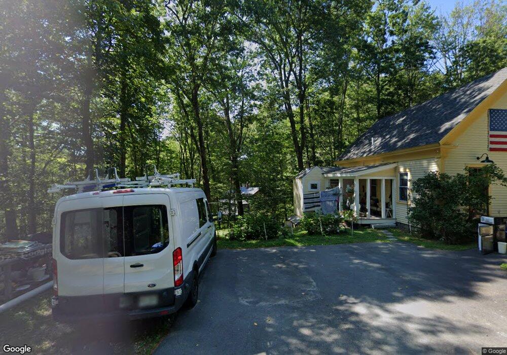
101 Brixham Rd Eliot, ME 03903
East Eliot NeighborhoodEstimated Value: $378,703 - $497,000
2
Beds
2
Baths
1,050
Sq Ft
$415/Sq Ft
Est. Value
About This Home
This home is located at 101 Brixham Rd, Eliot, ME 03903 and is currently estimated at $435,676, approximately $414 per square foot. 101 Brixham Rd is a home located in York County with nearby schools including Marshwood High School and Seacoast Waldorf School.
Ownership History
Date
Name
Owned For
Owner Type
Purchase Details
Closed on
May 27, 2022
Sold by
Moore Edward C
Bought by
Gambale Derek R and Azenaro Moore A
Current Estimated Value
Home Financials for this Owner
Home Financials are based on the most recent Mortgage that was taken out on this home.
Original Mortgage
$244,000
Outstanding Balance
$228,111
Interest Rate
4.13%
Mortgage Type
Purchase Money Mortgage
Estimated Equity
$207,565
Purchase Details
Closed on
May 17, 2010
Sold by
Uncapher Randall S and Uncapher Deirdre O
Bought by
Moore Edward C
Home Financials for this Owner
Home Financials are based on the most recent Mortgage that was taken out on this home.
Original Mortgage
$185,890
Interest Rate
5.5%
Mortgage Type
FHA
Create a Home Valuation Report for This Property
The Home Valuation Report is an in-depth analysis detailing your home's value as well as a comparison with similar homes in the area
Home Values in the Area
Average Home Value in this Area
Purchase History
| Date | Buyer | Sale Price | Title Company |
|---|---|---|---|
| Gambale Derek R | $305,000 | None Available | |
| Moore Edward C | -- | -- |
Source: Public Records
Mortgage History
| Date | Status | Borrower | Loan Amount |
|---|---|---|---|
| Open | Gambale Derek R | $244,000 | |
| Previous Owner | Moore Edward C | $185,890 |
Source: Public Records
Tax History
| Year | Tax Paid | Tax Assessment Tax Assessment Total Assessment is a certain percentage of the fair market value that is determined by local assessors to be the total taxable value of land and additions on the property. | Land | Improvement |
|---|---|---|---|---|
| 2024 | $2,935 | $247,700 | $130,000 | $117,700 |
| 2023 | $2,819 | $230,100 | $123,600 | $106,500 |
| 2022 | $2,723 | $225,000 | $123,600 | $101,400 |
| 2021 | $2,824 | $209,200 | $113,000 | $96,200 |
| 2020 | $2,512 | $195,600 | $107,600 | $88,000 |
| 2019 | $2,875 | $195,600 | $107,600 | $88,000 |
| 2018 | $2,875 | $195,600 | $107,600 | $88,000 |
| 2017 | $2,797 | $195,600 | $107,600 | $88,000 |
| 2016 | $2,748 | $195,600 | $107,600 | $88,000 |
| 2015 | $2,738 | $195,600 | $107,600 | $88,000 |
| 2014 | $2,699 | $195,600 | $107,600 | $88,000 |
| 2013 | $2,576 | $195,600 | $107,600 | $88,000 |
Source: Public Records
Map
Nearby Homes
- 10 Pasture Hill Dr
- Lot 2 Cedar Tbd
- 25 Heritage Dr
- Lot 4 Stonecrop Farm Ln
- Lot 1 Brixham (Stonecrop Farm Lot 1) Rd
- 1708 State Rd
- 116 Heron Cove Rd
- 4 Bhoireann Ln
- 3 Bhoireann Ln
- 708 River Rd Unit 2
- 708 River Rd Unit 3
- 0 Lindsay Ln
- 6 Isaac Lucas Cir
- 25 Fosters Dr
- 62 Village Dr Unit 62
- 8 Caslyn Dr
- 16 Witchtrot Rd
- 69 Polly Ann Trailer Park
- Slip B18 Little Bay
- 1128 State Rd
- 4 Wildbrook Ln
- 97 Brixham Rd
- 107 Brixham Rd
- 130 Brixham Rd
- 26 Wildbrook Ln
- 0 Wildbrook (Lot C)
- 0 Wildbrook (Lot B)
- 3 Wildbrook Ln
- 1 Wildbrook Ln
- 21 Wildlife Dr
- 21 Wildbrook Ln
- 114 Brixham Rd Lot 5
- Lot6 114 Brixham
- 114 Brixham Road Lot 5
- 114 Brixham Road Lot 6
- 114 Brixham Road Lot 4
- 77 Brixham Rd
- 114 Brixham Rd Unit 5
- 114 Brixham Rd
- 114 Brixham Rd Unit Lot 4
Your Personal Tour Guide
Ask me questions while you tour the home.