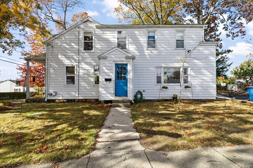

101 Carlisle St New Bedford, MA 02745
Acushnet Station NeighborhoodEstimated payment $2,092/month
Highlights
- Cape Cod Architecture
- Wooded Lot
- No HOA
- Property is near public transit
- Corner Lot
- Porch
About This Home
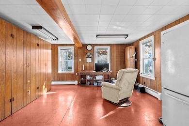
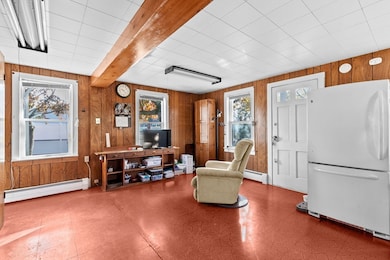
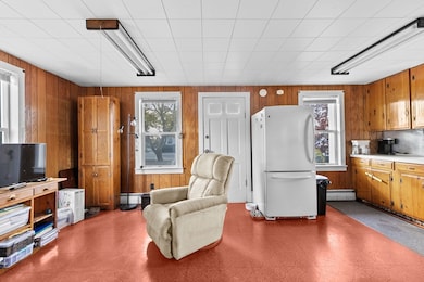
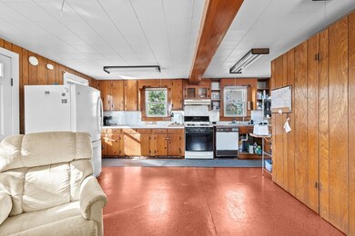
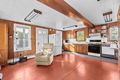
This home has plenty of space ready for your own vision and finishing touches! Large kitchen area, and big living room offer bright living spaces. Upstairs, the main bedroom has been tastefully redone with laminate flooring and walk-in closet. Bonus unfinished third room upstairs with heat attached to second bedroom. Bring your ideas! If you are looking for an ideal location in a great neighborhood, this spot is two blocks from the new commuter rail station in the north end of New Bedford. Also convenient to highways, and shopping! This corner-lot property also comes with an additional (unbuildable) lot to make your backyard even more expansive and private. Replacement windows already have been done. Off-street parking and sidewalks, convenient to schools. Come see this home and make it your own! Offer deadline 11/11 12PM.
Home Details
Home Type
- Single Family
Est. Annual Taxes
- $3,707
Year Built
- Built in 1947
Lot Details
- 3,428 Sq Ft Lot
- Corner Lot
- Wooded Lot
- Property is zoned RB
Home Design
- Cape Cod Architecture
- Cottage
- Frame Construction
- Shingle Roof
- Concrete Perimeter Foundation
Interior Spaces
- 1,480 Sq Ft Home
- Picture Window
- Dining Area
- Washer Hookup
Kitchen
- Range
- Dishwasher
Flooring
- Wall to Wall Carpet
- Laminate
- Ceramic Tile
- Vinyl
Bedrooms and Bathrooms
- 2 Bedrooms
- Primary bedroom located on second floor
- Walk-In Closet
- 1 Full Bathroom
- Bathtub with Shower
Basement
- Partial Basement
- Laundry in Basement
Parking
- 2 Car Parking Spaces
- Paved Parking
- Open Parking
- Off-Street Parking
Outdoor Features
- Porch
Location
- Property is near public transit
- Property is near schools
Schools
- Ashley Elementary School
- Normandin Middle School
- NBHS High School
Utilities
- No Cooling
- 1 Heating Zone
- Heating System Uses Natural Gas
- Baseboard Heating
- Gas Water Heater
Listing and Financial Details
- Assessor Parcel Number 2901826
- Tax Block 436
Community Details
Recreation
- Park
Additional Features
- No Home Owners Association
- Shops
Map
Home Values in the Area
Average Home Value in this Area
Tax History
| Year | Tax Paid | Tax Assessment Tax Assessment Total Assessment is a certain percentage of the fair market value that is determined by local assessors to be the total taxable value of land and additions on the property. | Land | Improvement |
|---|---|---|---|---|
| 2025 | $3,707 | $327,800 | $110,400 | $217,400 |
| 2024 | $3,364 | $280,300 | $110,400 | $169,900 |
| 2023 | $3,654 | $255,700 | $88,600 | $167,100 |
| 2022 | $3,388 | $218,000 | $84,400 | $133,600 |
| 2021 | $3,289 | $211,000 | $84,400 | $126,600 |
| 2020 | $3,290 | $203,600 | $84,400 | $119,200 |
| 2019 | $3,233 | $196,300 | $84,400 | $111,900 |
| 2018 | $3,048 | $183,300 | $84,400 | $98,900 |
| 2017 | $2,924 | $175,200 | $81,100 | $94,100 |
| 2016 | $2,722 | $165,100 | $77,900 | $87,200 |
| 2015 | $2,501 | $159,000 | $77,900 | $81,100 |
| 2014 | $2,316 | $152,800 | $74,600 | $78,200 |
Property History
| Date | Event | Price | List to Sale | Price per Sq Ft |
|---|---|---|---|---|
| 11/11/2025 11/11/25 | Pending | -- | -- | -- |
| 11/03/2025 11/03/25 | For Sale | $339,900 | -- | $230 / Sq Ft |
Purchase History
| Date | Type | Sale Price | Title Company |
|---|---|---|---|
| Personal Reps Deed | -- | None Available | |
| Personal Reps Deed | -- | None Available | |
| Personal Reps Deed | -- | None Available | |
| Deed | -- | -- | |
| Deed | -- | -- |
Source: MLS Property Information Network (MLS PIN)
MLS Number: 73450825
APN: NEWB-000113-000000-000436
Disclaimer: Certain information contained herein is derived from information provided by parties other than Homes.com. All information provided is deemed reliable, but is not guaranteed to be accurate and should be independently verified.
![]() The property listing data and information, or the Images, set forth herein were provided to MLS Property Information Network, Inc. from third party sources, including sellers, lessors and public records, and were compiled by MLS Property Information Network, Inc. The property listing data and information, and the Images, are for the personal, non-commercial use of consumers having a good faith interest in purchasing or leasing listed properties of the type displayed to them and may not be used for any purpose other than to identify prospective properties which such consumers may have a good faith interest in purchasing or leasing. MLS Property Information Network, Inc. and its subscribers disclaim any and all representations and warranties as to the accuracy of the property listing data and information, or as to the accuracy of any of the Images, set forth herein.
The property listing data and information, or the Images, set forth herein were provided to MLS Property Information Network, Inc. from third party sources, including sellers, lessors and public records, and were compiled by MLS Property Information Network, Inc. The property listing data and information, and the Images, are for the personal, non-commercial use of consumers having a good faith interest in purchasing or leasing listed properties of the type displayed to them and may not be used for any purpose other than to identify prospective properties which such consumers may have a good faith interest in purchasing or leasing. MLS Property Information Network, Inc. and its subscribers disclaim any and all representations and warranties as to the accuracy of the property listing data and information, or as to the accuracy of any of the Images, set forth herein.
