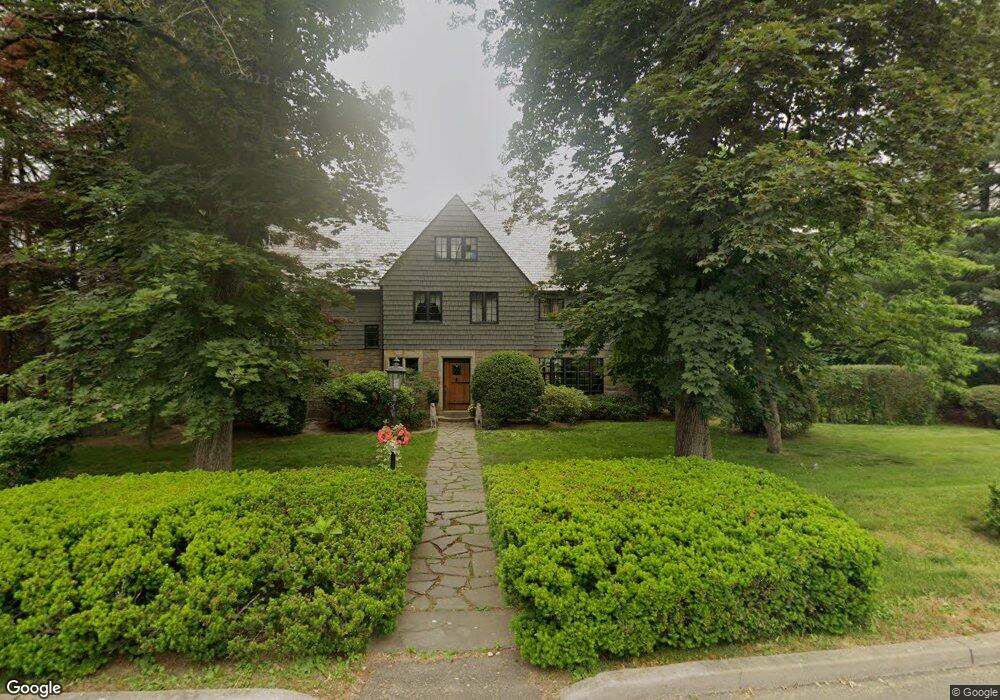
101 Collingwood Ave Fairfield, CT 06825
Stratfield Village NeighborhoodEstimated Value: $1,179,000 - $1,572,000
5
Beds
4
Baths
3,902
Sq Ft
$340/Sq Ft
Est. Value
About This Home
This home is located at 101 Collingwood Ave, Fairfield, CT 06825 and is currently estimated at $1,325,091, approximately $339 per square foot. 101 Collingwood Ave is a home located in Fairfield County with nearby schools including Stratfield Elementary School, Tomlinson Middle School, and Fairfield Warde High School.
Ownership History
Date
Name
Owned For
Owner Type
Purchase Details
Closed on
Jul 26, 2001
Sold by
Avery Daniel L and Avery Patricia A
Bought by
Devita Ennio M and Devita Melanie A
Current Estimated Value
Purchase Details
Closed on
May 31, 1996
Sold by
Reynolds David A and Reynolds Joann Bh
Bought by
Avery Daniel L and Avery Patricia A
Create a Home Valuation Report for This Property
The Home Valuation Report is an in-depth analysis detailing your home's value as well as a comparison with similar homes in the area
Home Values in the Area
Average Home Value in this Area
Purchase History
| Date | Buyer | Sale Price | Title Company |
|---|---|---|---|
| Devita Ennio M | $740,000 | -- | |
| Devita Ennio M | $740,000 | -- | |
| Avery Daniel L | $475,000 | -- | |
| Avery Daniel L | $475,000 | -- |
Source: Public Records
Mortgage History
| Date | Status | Borrower | Loan Amount |
|---|---|---|---|
| Open | Avery Daniel L | $200,000 | |
| Open | Avery Daniel L | $417,000 |
Source: Public Records
Tax History Compared to Growth
Tax History
| Year | Tax Paid | Tax Assessment Tax Assessment Total Assessment is a certain percentage of the fair market value that is determined by local assessors to be the total taxable value of land and additions on the property. | Land | Improvement |
|---|---|---|---|---|
| 2025 | $16,187 | $570,150 | $274,750 | $295,400 |
| 2024 | $15,907 | $570,150 | $274,750 | $295,400 |
| 2023 | $15,685 | $570,150 | $274,750 | $295,400 |
| 2022 | $15,531 | $570,150 | $274,750 | $295,400 |
| 2021 | $15,383 | $570,150 | $274,750 | $295,400 |
| 2020 | $15,796 | $589,610 | $235,760 | $353,850 |
| 2019 | $15,796 | $589,610 | $235,760 | $353,850 |
| 2018 | $15,542 | $589,610 | $235,760 | $353,850 |
| 2017 | $15,224 | $589,610 | $235,760 | $353,850 |
| 2016 | $15,006 | $589,610 | $235,760 | $353,850 |
| 2015 | $17,756 | $716,240 | $332,640 | $383,600 |
| 2014 | $17,476 | $716,240 | $332,640 | $383,600 |
Source: Public Records
Map
Nearby Homes
- 605 Brooklawn Ave
- 1213 Wood Ave
- 1473 Wood Ave
- 665 W Taft Ave
- 1480 Capitol Ave Unit 811
- 860 Briarwood Ave
- 2445 Park Ave Unit 23
- 90 White Oak Rd
- 2345 Park Ave
- 80 Cartright St Unit 8J
- 80 Cartright St Unit 2F
- 80 Cartright St Unit GC
- 80 Cartright St Unit 8B
- 80 Cartright St Unit GFA
- 184 Pacific St
- 2370 North Ave Unit 4C
- 2370 North Ave Unit 12G
- 2370 North Ave Unit 3F
- 2625 Park Ave Unit 12L
- 2625 Park Ave Unit 5S
- 127 Collingwood Ave
- 147 Collingwood Ave
- 16 Lookout Dr N
- 167 Collingwood Ave
- 170 Collingwood Ave
- 635 Brooklawn Ave
- 605 Club House Ln
- 32 Lookout Dr S
- 19 Collingwood Ave
- 615 Brooklawn Ave
- 79 Lookout Dr S
- 64 Lookout Dr N
- 630 Brooklawn Ave
- 171 Lookout Dr S
- 73 Lookout Dr N
- 652 Brooklawn Ave
- 666 Brooklawn Ave
- 636 Brooklawn Ave
- 650 Brooklawn Ave
- 750 Brooklawn Ave