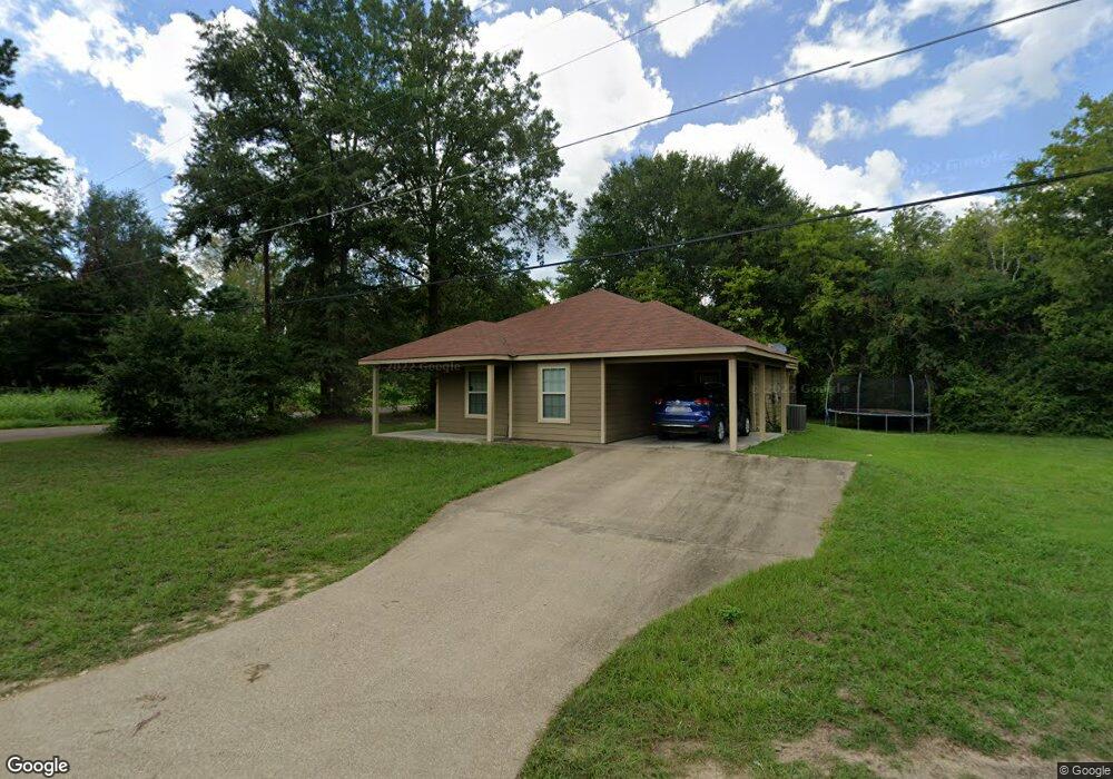
101 Collins St Lufkin, TX 75904
Estimated Value: $154,000 - $190,168
--
Bed
--
Bath
1,660
Sq Ft
$106/Sq Ft
Est. Value
About This Home
This home is located at 101 Collins St, Lufkin, TX 75904 and is currently estimated at $175,542, approximately $105 per square foot. 101 Collins St is a home located in Angelina County with nearby schools including Trout Primary School, Brookhollow Elementary School, and Lufkin Middle School.
Ownership History
Date
Name
Owned For
Owner Type
Purchase Details
Closed on
Jul 11, 2023
Sold by
Gibson Anthony Neal Brownie
Bought by
Stanley Quentin
Current Estimated Value
Home Financials for this Owner
Home Financials are based on the most recent Mortgage that was taken out on this home.
Original Mortgage
$168,547
Outstanding Balance
$164,526
Interest Rate
6.79%
Mortgage Type
VA
Estimated Equity
$11,016
Create a Home Valuation Report for This Property
The Home Valuation Report is an in-depth analysis detailing your home's value as well as a comparison with similar homes in the area
Home Values in the Area
Average Home Value in this Area
Purchase History
| Date | Buyer | Sale Price | Title Company |
|---|---|---|---|
| Stanley Quentin | -- | Security Guaranty Abstract |
Source: Public Records
Mortgage History
| Date | Status | Borrower | Loan Amount |
|---|---|---|---|
| Open | Stanley Quentin | $168,547 |
Source: Public Records
Tax History Compared to Growth
Tax History
| Year | Tax Paid | Tax Assessment Tax Assessment Total Assessment is a certain percentage of the fair market value that is determined by local assessors to be the total taxable value of land and additions on the property. | Land | Improvement |
|---|---|---|---|---|
| 2025 | $3,648 | $174,550 | $15,470 | $159,080 |
| 2024 | $3,599 | $172,210 | $15,470 | $156,740 |
| 2023 | $2,161 | $151,370 | $15,470 | $135,900 |
| 2022 | $2,251 | $98,950 | $4,510 | $94,440 |
| 2021 | $2,214 | $92,270 | $4,510 | $87,760 |
| 2020 | $2,008 | $81,690 | $3,530 | $78,160 |
| 2019 | $2,146 | $82,570 | $3,530 | $79,040 |
| 2018 | $1,541 | $80,560 | $3,530 | $77,030 |
| 2017 | $1,541 | $77,350 | $3,530 | $73,820 |
| 2016 | $1,790 | $75,080 | $3,530 | $71,550 |
| 2015 | -- | $76,650 | $3,530 | $73,120 |
| 2014 | -- | $77,290 | $3,530 | $73,760 |
Source: Public Records
Map
Nearby Homes
- 310 Brock St
- 2510 Jimmie St
- Lot 8 Minnie Lou St
- Lot 12 Minnie Lou St
- Lot 7 Minnie Lou St
- Lot 10 Minnie Lou St
- Lot 11 Minnie Lou St
- Lot 9 Minnie Lou St
- 2015, 2013 Culverhouse St
- 4000 Ellen Trout Dr
- 1712 Sayers St
- 1716 Sayers St
- TBD Kurth Dr
- 0 Kurth Dr
- North @ Sayers Sayers St
- 104 Peggy Ln
- 1702 Williams St
- 1602 Culverhouse St
- 3521 Old Union Rd
- 722 North Ave
- 101 Collins St
- 207 Ford Chapel Rd
- 122 Mcmullen St
- 107 Collins St
- 114 Brock St
- 115 Collins St
- 116 Mcmullen St
- 203 Ford St
- 110 Brock St
- 121 Mcmullen St
- 110 Collins St
- 204 Ford St
- 116 1/2 Mcmullen St
- 201 Ford St
- 114 1/2 Mcmullen St
- 114 Mcmullen St
- 207 Mcmullen St
- 202 Ford St
- 209 Mcmullen St
- 211 Mcmullen St