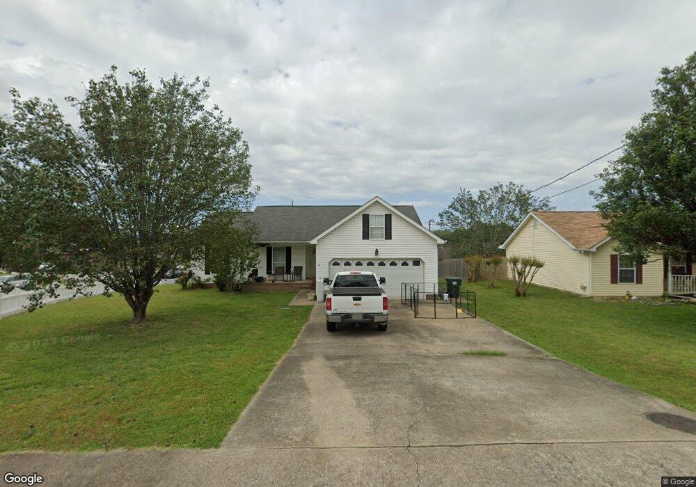
101 Colony Cir Fort Oglethorpe, GA 30742
Estimated Value: $267,000 - $290,000
--
Bed
2
Baths
1,260
Sq Ft
$221/Sq Ft
Est. Value
About This Home
This home is located at 101 Colony Cir, Fort Oglethorpe, GA 30742 and is currently estimated at $278,333, approximately $220 per square foot. 101 Colony Cir is a home located in Catoosa County with nearby schools including Battlefield Primary School, Battlefield Elementary School, and Lakeview Middle School.
Ownership History
Date
Name
Owned For
Owner Type
Purchase Details
Closed on
Apr 24, 2025
Sold by
Colony Property Management Llc
Bought by
Georgia State Dept Of Transportation
Current Estimated Value
Purchase Details
Closed on
Aug 17, 2020
Sold by
Lins Management Inc
Bought by
Colony Property Management Llc
Purchase Details
Closed on
Mar 1, 2016
Sold by
Moss Anne L
Bought by
Lins Management Inc
Home Financials for this Owner
Home Financials are based on the most recent Mortgage that was taken out on this home.
Original Mortgage
$420,000
Interest Rate
3.72%
Mortgage Type
New Conventional
Purchase Details
Closed on
Apr 10, 2013
Sold by
Volunteer Llc
Bought by
Moss Anne L
Purchase Details
Closed on
Dec 30, 2011
Sold by
Colony L P
Bought by
Volunteer Llc
Purchase Details
Closed on
Oct 27, 1998
Bought by
Colony L P
Create a Home Valuation Report for This Property
The Home Valuation Report is an in-depth analysis detailing your home's value as well as a comparison with similar homes in the area
Home Values in the Area
Average Home Value in this Area
Purchase History
| Date | Buyer | Sale Price | Title Company |
|---|---|---|---|
| Georgia State Dept Of Transportation | -- | -- | |
| Colony Property Management Llc | -- | -- | |
| Lins Management Inc | $830,000 | -- | |
| Moss Anne L | -- | -- | |
| Volunteer Llc | -- | -- | |
| Colony L P | $90,000 | -- |
Source: Public Records
Mortgage History
| Date | Status | Borrower | Loan Amount |
|---|---|---|---|
| Previous Owner | Lins Management Inc | $420,000 |
Source: Public Records
Tax History Compared to Growth
Tax History
| Year | Tax Paid | Tax Assessment Tax Assessment Total Assessment is a certain percentage of the fair market value that is determined by local assessors to be the total taxable value of land and additions on the property. | Land | Improvement |
|---|---|---|---|---|
| 2024 | $2,473 | $93,980 | $11,000 | $82,980 |
| 2023 | $1,955 | $74,324 | $11,000 | $63,324 |
| 2022 | $1,598 | $56,900 | $11,000 | $45,900 |
| 2021 | $1,515 | $56,900 | $11,000 | $45,900 |
| 2020 | $1,510 | $51,128 | $11,000 | $40,128 |
| 2019 | $1,466 | $49,128 | $9,000 | $40,128 |
| 2018 | $1,540 | $49,128 | $9,000 | $40,128 |
| 2017 | $1,451 | $46,296 | $7,200 | $39,096 |
| 2016 | $1,426 | $43,564 | $7,200 | $36,364 |
| 2015 | -- | $43,564 | $7,200 | $36,364 |
| 2014 | -- | $43,564 | $7,200 | $36,364 |
| 2013 | -- | $37,800 | $7,200 | $31,594 |
Source: Public Records
Map
Nearby Homes
- 6 Rocky Ford Rd
- 124 Colony Cir
- 351 Franklin Cir
- 183 McDonald Dr
- 1305 Park Forrest Dr
- 17 Southshore Dr
- 129 Cedar Grove Ln
- 180 Gem Dr
- 64 Stovall St
- 325 Mockingbird Ln
- 99 Battlewood Dr
- 300 Dogwood Ln
- 301 Dogwood Ln
- 504 Frieda Dr
- 1002 Cedar Creek Dr
- 0 Battlefield Pkwy Unit 129870
- 84 Elaine Cir
- 15 Evelyn Dr
- 2237 Cloud Springs Rd
- 17 Evergreen Cir
- 103 Colony Cir
- 1 Colony Cir
- 105 Colony Cir
- 105 Colony Cir
- 32 Savannah Way
- 100 Colony Cir
- 102 Colony Cir
- 104 Colony Cir
- 107 Colony Cir
- 106 Colony Cir
- 109 Colony Cir
- 108 Colony Cir
- 111 Colony Cir
- 110 Colony Cir
- 113 Colony Cir
- 112 Colony Cir
- 115 Colony Cir
- 114 Colony Cir
- 35 Savannah Way Unit 41Ashton
- 154 S Cedar Ln