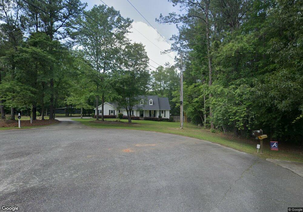
101 Creek Side Dr Macon, GA 31210
Estimated Value: $362,204 - $468,000
3
Beds
3
Baths
2,157
Sq Ft
$191/Sq Ft
Est. Value
About This Home
This home is located at 101 Creek Side Dr, Macon, GA 31210 and is currently estimated at $412,051, approximately $191 per square foot. 101 Creek Side Dr is a home located in Monroe County with nearby schools including T.G. Scott Elementary School, Mary Persons High School, and Academy for Classical Education.
Ownership History
Date
Name
Owned For
Owner Type
Purchase Details
Closed on
Dec 8, 2006
Sold by
Not Provided
Bought by
Burress Edward J and Burress Sharon T
Current Estimated Value
Home Financials for this Owner
Home Financials are based on the most recent Mortgage that was taken out on this home.
Original Mortgage
$197,600
Outstanding Balance
$118,141
Interest Rate
6.31%
Mortgage Type
New Conventional
Estimated Equity
$293,910
Create a Home Valuation Report for This Property
The Home Valuation Report is an in-depth analysis detailing your home's value as well as a comparison with similar homes in the area
Home Values in the Area
Average Home Value in this Area
Purchase History
| Date | Buyer | Sale Price | Title Company |
|---|---|---|---|
| Burress Edward J | $247,000 | -- |
Source: Public Records
Mortgage History
| Date | Status | Borrower | Loan Amount |
|---|---|---|---|
| Open | Burress Edward J | $197,600 |
Source: Public Records
Tax History Compared to Growth
Tax History
| Year | Tax Paid | Tax Assessment Tax Assessment Total Assessment is a certain percentage of the fair market value that is determined by local assessors to be the total taxable value of land and additions on the property. | Land | Improvement |
|---|---|---|---|---|
| 2024 | $2,275 | $99,720 | $11,280 | $88,440 |
| 2023 | $2,175 | $88,000 | $11,280 | $76,720 |
| 2022 | $1,876 | $87,960 | $11,280 | $76,680 |
| 2021 | $1,878 | $79,008 | $11,280 | $67,728 |
| 2020 | $1,925 | $79,008 | $11,280 | $67,728 |
| 2019 | $1,941 | $79,008 | $11,280 | $67,728 |
| 2018 | $1,946 | $79,008 | $11,280 | $67,728 |
| 2017 | $2,296 | $79,008 | $11,280 | $67,728 |
| 2016 | $1,852 | $79,008 | $11,280 | $67,728 |
| 2015 | $1,756 | $79,008 | $11,280 | $67,728 |
| 2014 | $1,694 | $79,008 | $11,280 | $67,728 |
Source: Public Records
Map
Nearby Homes
- 118 Weatherford Place
- 337 Searcy Dr
- 133 Searcy Dr
- 11 River Trace
- 0 Old Benton Rd Unit 179774
- 0 Old Benton Rd Unit 10523972
- 1301 Exchange Dr
- 1402 Cottage Hill Dr
- 0 Pea Ridge Rd Unit 10432504
- 0 Pea Ridge Rd Unit 177687
- 106 Whistler Ln
- 5609 Taylor Terrace
- 376 Providence Blvd
- 261 Providence Blvd
- 855 Tufthunter
- 135 Providence Blvd
- 906 Huntcliffe Dr
- 105 Creek Side Dr
- 253 Ridge Crest Dr
- 112 Creek Side Dr
- 110 Creek Side Dr
- 237 Ridge Crest Dr
- 60 Creek Side Dr
- 108 Creek Side Dr
- 236 Ridge Crest Dr
- 217 Ridge Crest Dr
- 40 Creek Side Dr
- 246 Ridge Crest Dr
- 234 Ridge Crest Dr
- 263 Ridge Crest Dr
- 318 Weatherford Place
- 319 Weatherford Place
- 37 Creek Side Dr
- 218 Ridge Crest Dr
- 185 Ridge Crest Dr
- 317 Weatherford Place
- 204 Ridge Crest Dr