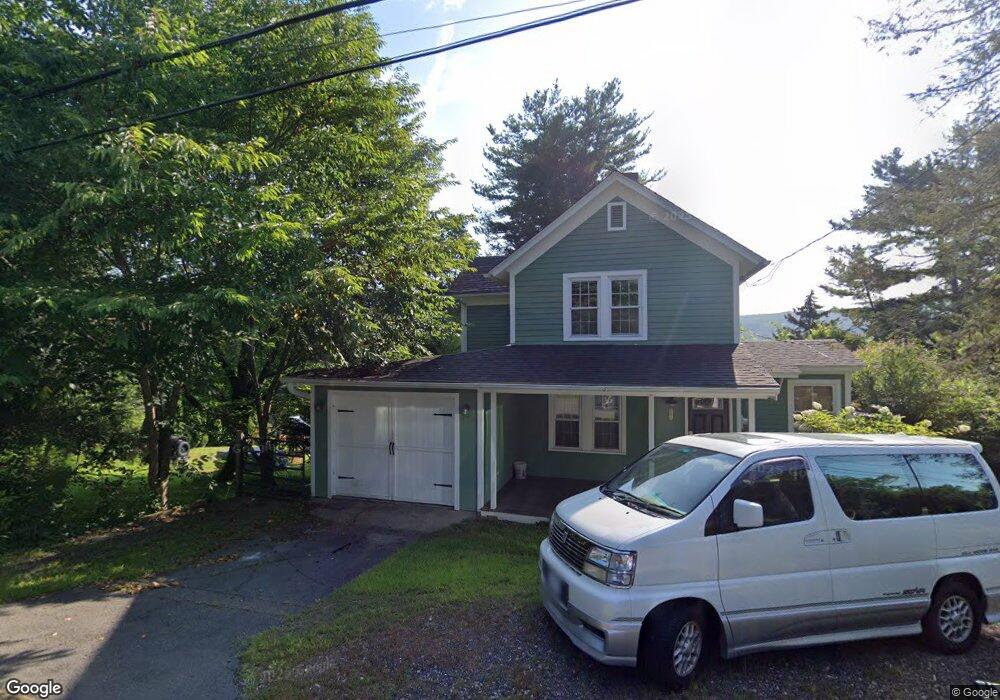
101 Dun 101 Dunne Ave Canton, CT 06019
Estimated Value: $243,000 - $290,000
2
Beds
2
Baths
1,066
Sq Ft
$248/Sq Ft
Est. Value
About This Home
This home is located at 101 Dun 101 Dunne Ave, Canton, CT 06019 and is currently estimated at $264,757, approximately $248 per square foot. 101 Dun 101 Dunne Ave is a home located in Hartford County with nearby schools including Cherry Brook Primary School, Canton Intermediate School, and Canton Middle School.
Ownership History
Date
Name
Owned For
Owner Type
Purchase Details
Closed on
Aug 12, 2021
Sold by
Consic Michael R and Consic Amy H
Bought by
Atkinson Denise
Current Estimated Value
Purchase Details
Closed on
Feb 20, 1997
Sold by
Goodyear Brian and Goodyear Kristen
Bought by
Consio Michael and Consio Amy
Home Financials for this Owner
Home Financials are based on the most recent Mortgage that was taken out on this home.
Original Mortgage
$113,500
Interest Rate
7.8%
Mortgage Type
Unknown
Purchase Details
Closed on
Sep 30, 1988
Sold by
Lewis Robert
Bought by
Goodyear Brian
Create a Home Valuation Report for This Property
The Home Valuation Report is an in-depth analysis detailing your home's value as well as a comparison with similar homes in the area
Home Values in the Area
Average Home Value in this Area
Purchase History
| Date | Buyer | Sale Price | Title Company |
|---|---|---|---|
| Atkinson Denise | $175,000 | None Available | |
| Atkinson Denise | $175,000 | None Available | |
| Consio Michael | $114,000 | -- | |
| Consio Michael | $114,000 | -- | |
| Goodyear Brian | $137,000 | -- |
Source: Public Records
Mortgage History
| Date | Status | Borrower | Loan Amount |
|---|---|---|---|
| Previous Owner | Goodyear Brian | $20,894 | |
| Previous Owner | Goodyear Brian | $113,500 | |
| Previous Owner | Goodyear Brian | $96,000 |
Source: Public Records
Tax History Compared to Growth
Tax History
| Year | Tax Paid | Tax Assessment Tax Assessment Total Assessment is a certain percentage of the fair market value that is determined by local assessors to be the total taxable value of land and additions on the property. | Land | Improvement |
|---|---|---|---|---|
| 2025 | $5,234 | $156,250 | $52,160 | $104,090 |
| 2024 | $5,336 | $156,250 | $52,160 | $104,090 |
| 2023 | $3,808 | $107,660 | $53,200 | $54,460 |
| 2022 | $3,627 | $107,660 | $53,200 | $54,460 |
| 2021 | $3,576 | $107,660 | $53,200 | $54,460 |
| 2020 | $3,509 | $107,660 | $53,200 | $54,460 |
| 2019 | $3,448 | $107,660 | $53,200 | $54,460 |
| 2018 | $4,058 | $132,170 | $56,000 | $76,170 |
| 2017 | $4,030 | $132,170 | $56,000 | $76,170 |
| 2016 | $3,933 | $132,170 | $56,000 | $76,170 |
| 2015 | $3,858 | $132,170 | $56,000 | $76,170 |
| 2014 | $3,775 | $132,170 | $56,000 | $76,170 |
Source: Public Records
Map
Nearby Homes
- 67 Torrington Ave Unit 69
- 9 Maple Ave
- 8 Town Bridge Rd
- 1 Blanchard Rd
- 60 Simonds Ave
- 25 Sheffield Ln
- 41 Verville Rd
- 3 E Hill Rd
- 9 Village Square
- 96 Dyer Ave
- 58 Weatherstone
- 48 Weatherstone
- 78 Deepwood Dr
- 44 Weatherstone
- 61 Weatherstone
- 20 Found Land Way
- 50 E Hill Rd Unit 3A
- 85 Dowd Ave Unit 89
- 114 Daniel Trace
- 28 Meadowview Ct Unit 28
- 80 Torrington Ave
- 101 Dunne Ave
- 82 Torrington Ave
- 95 Dunne Ave
- 76 Torrington Ave Unit 78
- 95 Dunne Ave
- 95-97 Dunne Ave
- 104 Dunne Ave
- 74 Torrington Ave
- 110 Dunne Ave
- 90 Dunne Ave
- 86 Dunne Ave
- 90 Dunne Ave Unit A
- 84 Torrington Ave
- 72 Torrington Ave Unit 74
- 81 Torrington Ave Unit 83
- 81 Torrington Ave
- 81-83 Torrington Ave
- 106 Dunne Ave
- 107 Dunne Ave