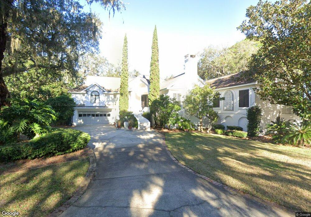
101 Egbert Point Saint Simons Island, GA 31522
Estimated Value: $1,252,000 - $1,844,000
4
Beds
4
Baths
3,700
Sq Ft
$390/Sq Ft
Est. Value
About This Home
This home is located at 101 Egbert Point, Saint Simons Island, GA 31522 and is currently estimated at $1,443,584, approximately $390 per square foot. 101 Egbert Point is a home located in Glynn County with nearby schools including St. Simons Elementary School, Glynn Middle School, and Glynn Academy.
Ownership History
Date
Name
Owned For
Owner Type
Purchase Details
Closed on
Jan 3, 2016
Sold by
Pipe Richard W
Bought by
Pipe Elizabeth S
Current Estimated Value
Purchase Details
Closed on
Jun 15, 2007
Sold by
Pipe Elizabeth S
Bought by
Pipe Elizabeth S and Pipe Richard W
Create a Home Valuation Report for This Property
The Home Valuation Report is an in-depth analysis detailing your home's value as well as a comparison with similar homes in the area
Home Values in the Area
Average Home Value in this Area
Purchase History
| Date | Buyer | Sale Price | Title Company |
|---|---|---|---|
| Pipe Elizabeth S | -- | -- | |
| Pipe Elizabeth S | -- | -- |
Source: Public Records
Tax History Compared to Growth
Tax History
| Year | Tax Paid | Tax Assessment Tax Assessment Total Assessment is a certain percentage of the fair market value that is determined by local assessors to be the total taxable value of land and additions on the property. | Land | Improvement |
|---|---|---|---|---|
| 2025 | $14,274 | $569,160 | $129,280 | $439,880 |
| 2024 | $10,852 | $432,720 | $114,880 | $317,840 |
| 2023 | $3,354 | $432,720 | $114,880 | $317,840 |
| 2022 | $3,811 | $282,040 | $57,440 | $224,600 |
| 2021 | $3,926 | $275,560 | $57,440 | $218,120 |
| 2020 | $3,960 | $275,560 | $57,440 | $218,120 |
| 2019 | $3,960 | $275,560 | $57,440 | $218,120 |
| 2018 | $3,960 | $275,560 | $57,440 | $218,120 |
| 2017 | $3,960 | $275,560 | $57,440 | $218,120 |
| 2016 | $3,671 | $275,560 | $57,440 | $218,120 |
| 2015 | $3,671 | $275,560 | $57,440 | $218,120 |
| 2014 | $3,671 | $275,560 | $57,440 | $218,120 |
Source: Public Records
Map
Nearby Homes
- 202 Vassar Point Dr
- 211 Mcintosh Ave
- 242 Mcintosh Ave
- 2404 Frederica Rd
- 295 Mcintosh Ave
- 121 Killgriffe St
- 524 Wesley Oak Cir
- 516 Postell Dr
- 104 Youngwood Dr
- 210 Settlers Rd
- 214 Hermitage Way
- 50 Frederica Oaks Ln
- 303 Wymberly Rd
- 217 Settlers Rd
- 302 Wymberly Rd
- 125 Worthing Rd
- 105 Ledbetter Ave
- 207 Military Rd
- 302 Wormslow Ct
- 10 Fern Ln
- 401 Vassar Point Dr
- 501 Vassar Point Dr
- 400 Vassar Point Dr
- 305 Vassar Point Dr
- 500 Vassar Pt Dr
- 500 Vassar Point Dr
- 503 Vassar Point Dr
- 302 Vassar Point
- 302 Vassar Point Dr
- 303 Vassar Point Dr
- 505 Vassar Point Dr
- 502 Vassar Point Dr
- 102 McCaskill Ln
- 103 McCaskill Ln
- 507 Vassar Point
- 300 Vassar Point Dr
- 128 Strother Place
- 504 Vassar Point Dr
- 192 Wildlife Dr
- 134 Strother Place