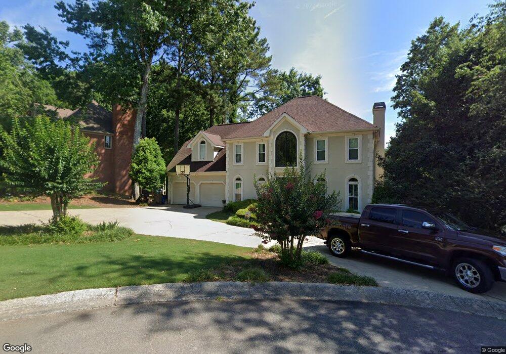
101 Enfield Trace Unit 1 Woodstock, GA 30189
Oak Grove NeighborhoodEstimated Value: $632,911 - $636,000
4
Beds
4
Baths
3,790
Sq Ft
$167/Sq Ft
Est. Value
About This Home
This home is located at 101 Enfield Trace Unit 1, Woodstock, GA 30189 and is currently estimated at $634,456, approximately $167 per square foot. 101 Enfield Trace Unit 1 is a home located in Cherokee County with nearby schools including Bascomb Elementary School, E. T. Booth Middle School, and Etowah High School.
Ownership History
Date
Name
Owned For
Owner Type
Purchase Details
Closed on
Apr 26, 2001
Sold by
Humber Julie B
Bought by
Bruggeman David M
Current Estimated Value
Home Financials for this Owner
Home Financials are based on the most recent Mortgage that was taken out on this home.
Original Mortgage
$239,200
Outstanding Balance
$87,686
Interest Rate
7.11%
Mortgage Type
New Conventional
Estimated Equity
$546,770
Purchase Details
Closed on
Sep 29, 1999
Sold by
Rozhon Jeffrey L and Rozhon Carol T
Bought by
Humber Julie B
Home Financials for this Owner
Home Financials are based on the most recent Mortgage that was taken out on this home.
Original Mortgage
$229,500
Interest Rate
9.25%
Mortgage Type
New Conventional
Create a Home Valuation Report for This Property
The Home Valuation Report is an in-depth analysis detailing your home's value as well as a comparison with similar homes in the area
Home Values in the Area
Average Home Value in this Area
Purchase History
| Date | Buyer | Sale Price | Title Company |
|---|---|---|---|
| Bruggeman David M | $299,000 | -- | |
| Humber Julie B | $255,000 | -- |
Source: Public Records
Mortgage History
| Date | Status | Borrower | Loan Amount |
|---|---|---|---|
| Open | Bruggeman David M | $239,200 | |
| Previous Owner | Humber Julie B | $229,500 |
Source: Public Records
Tax History Compared to Growth
Tax History
| Year | Tax Paid | Tax Assessment Tax Assessment Total Assessment is a certain percentage of the fair market value that is determined by local assessors to be the total taxable value of land and additions on the property. | Land | Improvement |
|---|---|---|---|---|
| 2025 | $5,979 | $227,668 | $56,000 | $171,668 |
| 2024 | $5,630 | $216,652 | $56,000 | $160,652 |
| 2023 | $5,397 | $207,672 | $56,000 | $151,672 |
| 2022 | $4,495 | $171,012 | $39,160 | $131,852 |
| 2021 | $4,219 | $148,624 | $39,160 | $109,464 |
| 2020 | $3,880 | $136,552 | $35,600 | $100,952 |
| 2019 | $3,829 | $134,760 | $32,800 | $101,960 |
| 2018 | $3,676 | $128,600 | $30,000 | $98,600 |
| 2017 | $4,057 | $352,000 | $30,000 | $110,800 |
| 2016 | $3,926 | $337,100 | $30,000 | $104,840 |
| 2015 | $3,354 | $285,200 | $24,000 | $90,080 |
| 2014 | $3,273 | $277,800 | $24,000 | $87,120 |
Source: Public Records
Map
Nearby Homes
- 2814 Andover Way
- 219 Morning Mist Way
- 2618 Gladstone Terrace
- 1404 Coventry Ct Unit 1
- 227 Morning Mist Way
- 2706 Hampton Trail Unit 1
- 819 Bermuda Run
- 608 Sagewood Ct Unit 3
- 302 Mosswood Ct
- 258 Strawberry Ln
- 250 Strawberry Ln
- 242 Strawberry Ln
- 542 Fairway Dr
- 559 Fairway Dr
- 308 Quiet Hill Ln
- 3525 Stone Cliff Way
- 1514 Mosswood Ln
- 159 W Putnam Ferry Rd
- 608 Wedgewood Dr
- 1722 Indian Ridge Dr
- 0 Dunhill Trail Unit 8010261
- 103 Enfield Trace
- 2910 Dunhill Trail
- 102 Enfield Trace Unit 1
- 104 Enfield Trace
- 2907 Dunhill Trail
- 2909 Dunhill Trail
- 2906 Dunhill Trail
- 2914 Dunhill Trail Unit 1
- 2905 Dunhill Trail Unit 1
- 2904 Dunhill Trail Unit I
- 2911 Dunhill Trail
- 3318 Rough Creek Dr
- 3316 Rough Creek Dr
- 2903 Dunhill Trail
- 2916 Dunhill Trail
- 303 Barclay Place
- 3314 Rough Creek Dr
- 3314 Rough
- 2902 Dunhill Trail