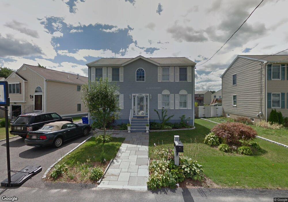
101 Family Dr Fall River, MA 02721
Maplewood NeighborhoodEstimated Value: $430,000 - $559,000
3
Beds
2
Baths
2,016
Sq Ft
$239/Sq Ft
Est. Value
About This Home
This home is located at 101 Family Dr, Fall River, MA 02721 and is currently estimated at $482,776, approximately $239 per square foot. 101 Family Dr is a home located in Bristol County with nearby schools including Henry Lord Community School, B M C Durfee High School, and Argosy Collegiate Charter School.
Ownership History
Date
Name
Owned For
Owner Type
Purchase Details
Closed on
Jan 15, 2008
Sold by
Andrade Jose M and Andrade Maria F
Bought by
Raposo Joao M and Andrade Jose M
Current Estimated Value
Purchase Details
Closed on
Dec 5, 2003
Sold by
Ft Homes Constr Co
Bought by
Laprise Stacey A and Laprise Thomas R
Home Financials for this Owner
Home Financials are based on the most recent Mortgage that was taken out on this home.
Original Mortgage
$207,920
Interest Rate
6.03%
Mortgage Type
Purchase Money Mortgage
Purchase Details
Closed on
Jul 22, 2003
Sold by
Ft Homes Constr Co Inc
Bought by
Delisle Cheryl A and Delisle Mark A
Home Financials for this Owner
Home Financials are based on the most recent Mortgage that was taken out on this home.
Original Mortgage
$174,000
Interest Rate
5.34%
Mortgage Type
Purchase Money Mortgage
Create a Home Valuation Report for This Property
The Home Valuation Report is an in-depth analysis detailing your home's value as well as a comparison with similar homes in the area
Home Values in the Area
Average Home Value in this Area
Purchase History
| Date | Buyer | Sale Price | Title Company |
|---|---|---|---|
| Raposo Joao M | -- | -- | |
| Laprise Stacey A | $259,900 | -- | |
| Delisle Cheryl A | $240,000 | -- |
Source: Public Records
Mortgage History
| Date | Status | Borrower | Loan Amount |
|---|---|---|---|
| Previous Owner | Delisle Cheryl A | $207,920 | |
| Previous Owner | Delisle Cheryl A | $174,000 |
Source: Public Records
Tax History Compared to Growth
Tax History
| Year | Tax Paid | Tax Assessment Tax Assessment Total Assessment is a certain percentage of the fair market value that is determined by local assessors to be the total taxable value of land and additions on the property. | Land | Improvement |
|---|---|---|---|---|
| 2025 | $4,601 | $401,800 | $116,800 | $285,000 |
| 2024 | $4,312 | $375,300 | $114,500 | $260,800 |
| 2023 | $4,485 | $365,500 | $103,200 | $262,300 |
| 2022 | $3,975 | $315,000 | $97,300 | $217,700 |
| 2021 | $3,762 | $272,000 | $93,000 | $179,000 |
| 2020 | $3,704 | $256,300 | $88,800 | $167,500 |
| 2019 | $3,681 | $252,500 | $92,800 | $159,700 |
| 2018 | $3,567 | $244,000 | $93,500 | $150,500 |
| 2017 | $3,378 | $241,300 | $93,500 | $147,800 |
| 2016 | $3,204 | $235,100 | $96,300 | $138,800 |
| 2015 | $3,120 | $238,500 | $96,300 | $142,200 |
| 2014 | $3,000 | $238,500 | $96,300 | $142,200 |
Source: Public Records
Map
Nearby Homes
- 217 Napoleon St
- 4 Bronson St
- 24 Bronson St
- 20 Bronson St
- 16 Bronson St
- 12 Bronson St
- 8 Bronson St
- 1441 Stafford Rd
- 125 Carl St
- 17 Lynwood St
- 415 Anthony St
- 478 Tucker St
- 495 Hooper St
- 0 Stafford Rd Unit 1393774
- 0 Stafford Rd Unit 73431501
- 142 Norman St
- 153 Fish Rd Unit 4
- 228 Dickinson St
- 256 Rhode Island Ave
- 539 Aetna St