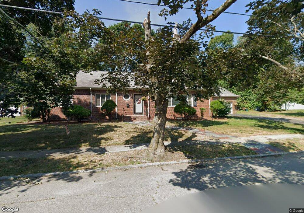
101 Florence Rd Lowell, MA 01851
Highlands NeighborhoodEstimated Value: $743,000 - $906,000
4
Beds
2
Baths
3,058
Sq Ft
$273/Sq Ft
Est. Value
About This Home
This home is located at 101 Florence Rd, Lowell, MA 01851 and is currently estimated at $834,001, approximately $272 per square foot. 101 Florence Rd is a home located in Middlesex County with nearby schools including Charles W. Morey Elementary School, Dr. Gertrude Bailey Elementary School, and Abraham Lincoln Elementary School.
Ownership History
Date
Name
Owned For
Owner Type
Purchase Details
Closed on
Nov 17, 2021
Sold by
Sta Ft and Armstrong
Bought by
Armstrong Susan T and Sousa Kerryn
Current Estimated Value
Purchase Details
Closed on
Jun 20, 2014
Sold by
Ruth H Coggan Ret
Bought by
Sta Ft
Create a Home Valuation Report for This Property
The Home Valuation Report is an in-depth analysis detailing your home's value as well as a comparison with similar homes in the area
Home Values in the Area
Average Home Value in this Area
Purchase History
| Date | Buyer | Sale Price | Title Company |
|---|---|---|---|
| Armstrong Susan T | -- | None Available | |
| Armstrong James | -- | None Available | |
| Armstrong Susan T | -- | None Available | |
| Sta Ft | $300,000 | -- |
Source: Public Records
Tax History
| Year | Tax Paid | Tax Assessment Tax Assessment Total Assessment is a certain percentage of the fair market value that is determined by local assessors to be the total taxable value of land and additions on the property. | Land | Improvement |
|---|---|---|---|---|
| 2025 | $8,812 | $767,600 | $226,400 | $541,200 |
| 2024 | $8,074 | $677,900 | $194,000 | $483,900 |
| 2023 | $7,761 | $624,900 | $168,600 | $456,300 |
| 2022 | $7,341 | $578,500 | $153,300 | $425,200 |
| 2021 | $7,193 | $534,400 | $133,200 | $401,200 |
| 2020 | $6,337 | $474,300 | $118,700 | $355,600 |
| 2019 | $6,927 | $493,400 | $118,900 | $374,500 |
| 2018 | $6,570 | $456,600 | $113,200 | $343,400 |
| 2017 | $6,248 | $418,800 | $102,900 | $315,900 |
| 2016 | $5,768 | $380,500 | $106,400 | $274,100 |
| 2015 | $5,723 | $369,700 | $102,700 | $267,000 |
| 2013 | $5,094 | $339,400 | $119,000 | $220,400 |
Source: Public Records
Map
Nearby Homes
- 142 Sanders Ave
- 694 Westford St
- 137 Pine St Unit 11
- 94 D St
- 11 Warwick St Unit 3
- 85 B St
- 108 Inland St
- 138 W Forest St
- 977 Westford St Unit 4
- 45 Harvard St Unit 5 3rd fl
- 18 Burgess St
- 312 Wilder St
- 186 Powell St
- 525 Chelmsford St
- 1311 Middlesex St
- 4 Tamarack St
- 49 Marginal St
- 15 Barclay St
- 3 Butman Place
- 28 Liberty St
- 182 Sanders Ave
- 115 Florence Rd
- 85 Florence Rd
- 170 Sanders Ave
- 110 Florence Rd
- 94 Florence Rd
- 194 Sanders Ave
- 118 Florence Rd
- 120 Florence Rd Unit 120
- 120 Florence Rd
- 84 Florence Rd
- 127 Florence Rd
- 61 Van Greenby Rd
- 162 Sanders Ave
- 49 Van Greenby Rd
- 75 Van Greenby Rd
- 190 Lincoln Pkwy
- 183 Sanders Ave
- 130 Florence Rd
- 69 Florence Rd
Your Personal Tour Guide
Ask me questions while you tour the home.