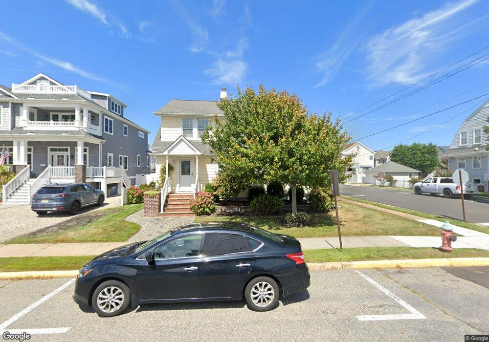
101 Forman Ave Point Pleasant Beach, NJ 08742
Point Pleasant Beach NeighborhoodEstimated Value: $1,261,000 - $1,489,000
4
Beds
2
Baths
1,980
Sq Ft
$677/Sq Ft
Est. Value
About This Home
This home is located at 101 Forman Ave, Point Pleasant Beach, NJ 08742 and is currently estimated at $1,340,265, approximately $676 per square foot. 101 Forman Ave is a home located in Ocean County with nearby schools including G Harold Antrim Elementary School, Point Pleasant Beach High School, and St. Peter School.
Ownership History
Date
Name
Owned For
Owner Type
Purchase Details
Closed on
Sep 22, 2006
Sold by
Hall Nancy E and Kelly James
Bought by
Fabiano Anthony James and Fabiano Rose Marie
Current Estimated Value
Purchase Details
Closed on
Nov 23, 2005
Sold by
Bell Andrew and Bell Debra
Bought by
Hall Nancy E and Kelly James
Home Financials for this Owner
Home Financials are based on the most recent Mortgage that was taken out on this home.
Original Mortgage
$649,500
Interest Rate
5%
Mortgage Type
Stand Alone First
Purchase Details
Closed on
Jul 24, 1996
Sold by
Sterling Land Dev
Bought by
Bell Andrew and Bell Debra
Home Financials for this Owner
Home Financials are based on the most recent Mortgage that was taken out on this home.
Original Mortgage
$125,000
Interest Rate
8.24%
Purchase Details
Closed on
Feb 8, 1996
Sold by
Berkeley Fed Bk & Trust
Bought by
Sterling Land Dev
Create a Home Valuation Report for This Property
The Home Valuation Report is an in-depth analysis detailing your home's value as well as a comparison with similar homes in the area
Home Values in the Area
Average Home Value in this Area
Purchase History
| Date | Buyer | Sale Price | Title Company |
|---|---|---|---|
| Fabiano Anthony James | $885,000 | Fidelity Natl Title Ins Co | |
| Hall Nancy E | $815,000 | Chicago Title Insurance Co | |
| Bell Andrew | $252,000 | -- | |
| Sterling Land Dev | $180,000 | -- |
Source: Public Records
Mortgage History
| Date | Status | Borrower | Loan Amount |
|---|---|---|---|
| Previous Owner | Hall Nancy E | $649,500 | |
| Previous Owner | Bell Andrew | $125,000 |
Source: Public Records
Tax History Compared to Growth
Tax History
| Year | Tax Paid | Tax Assessment Tax Assessment Total Assessment is a certain percentage of the fair market value that is determined by local assessors to be the total taxable value of land and additions on the property. | Land | Improvement |
|---|---|---|---|---|
| 2025 | $11,373 | $662,000 | $425,000 | $237,000 |
| 2024 | $11,029 | $662,000 | $425,000 | $237,000 |
| 2023 | $10,718 | $662,000 | $425,000 | $237,000 |
| 2022 | $10,718 | $662,000 | $425,000 | $237,000 |
| 2021 | $10,479 | $662,000 | $425,000 | $237,000 |
| 2020 | $10,466 | $662,000 | $425,000 | $237,000 |
| 2019 | $10,250 | $657,500 | $425,000 | $232,500 |
| 2018 | $10,093 | $657,500 | $425,000 | $232,500 |
| 2017 | $9,935 | $657,500 | $425,000 | $232,500 |
| 2016 | $9,981 | $657,500 | $425,000 | $232,500 |
| 2015 | $9,902 | $657,500 | $425,000 | $232,500 |
| 2014 | $9,856 | $657,500 | $425,000 | $232,500 |
Source: Public Records
Map
Nearby Homes
- 110 Trenton Ave
- 201 Forman Ave
- 900 Ocean Ave Unit 16
- 1008 Ocean Ave N
- 118 New York Ave
- 305 Chicago Ave
- 313 Washington Ave
- 106 Makin Ave
- 25 Niblick St
- 37 Arnold Ave
- 1322 Ocean Ave
- 503 Atlantic Ave
- 222 Ocean Ave
- 202 Homestead Ave
- 216 Ocean Ave
- 10 Brunswick Place
- 607 Richmond Ave Unit 4
- 303 Cooks Ln
- 1A Water St
- 331 Hawthorne Ave