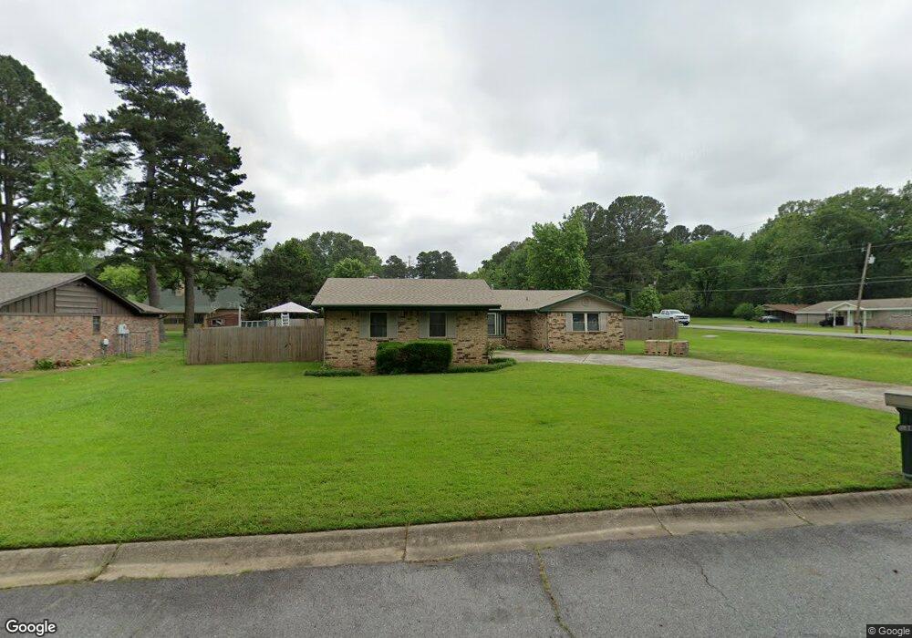
101 Foxdell Cir Jacksonville, AR 72076
Estimated Value: $186,433 - $200,000
--
Bed
2
Baths
1,698
Sq Ft
$114/Sq Ft
Est. Value
About This Home
This home is located at 101 Foxdell Cir, Jacksonville, AR 72076 and is currently estimated at $193,608, approximately $114 per square foot. 101 Foxdell Cir is a home located in Pulaski County with nearby schools including Jacksonville Elementary School, Jacksonville Middle School, and Jacksonville High School.
Ownership History
Date
Name
Owned For
Owner Type
Purchase Details
Closed on
Aug 27, 1999
Sold by
Ruston Peter A and Ruston Catherine M
Bought by
National Bank Of Arkansas
Current Estimated Value
Purchase Details
Closed on
Jul 15, 1997
Sold by
Hall William C and Hall Karen E
Bought by
Ruston Peter Andrew and Ruston Catherine Mary
Home Financials for this Owner
Home Financials are based on the most recent Mortgage that was taken out on this home.
Original Mortgage
$92,500
Interest Rate
7.72%
Mortgage Type
Purchase Money Mortgage
Create a Home Valuation Report for This Property
The Home Valuation Report is an in-depth analysis detailing your home's value as well as a comparison with similar homes in the area
Home Values in the Area
Average Home Value in this Area
Purchase History
| Date | Buyer | Sale Price | Title Company |
|---|---|---|---|
| National Bank Of Arkansas | -- | -- | |
| Ruston Peter Andrew | $109,000 | Beach Abstract & Guaranty Co |
Source: Public Records
Mortgage History
| Date | Status | Borrower | Loan Amount |
|---|---|---|---|
| Previous Owner | Ruston Peter Andrew | $92,500 |
Source: Public Records
Tax History Compared to Growth
Tax History
| Year | Tax Paid | Tax Assessment Tax Assessment Total Assessment is a certain percentage of the fair market value that is determined by local assessors to be the total taxable value of land and additions on the property. | Land | Improvement |
|---|---|---|---|---|
| 2025 | $1,628 | $35,752 | $5,600 | $30,152 |
| 2024 | $1,426 | $35,752 | $5,600 | $30,152 |
| 2023 | $1,426 | $35,752 | $5,600 | $30,152 |
| 2022 | $1,628 | $35,752 | $5,600 | $30,152 |
| 2021 | $1,628 | $26,510 | $4,700 | $21,810 |
| 2020 | $1,253 | $26,510 | $4,700 | $21,810 |
| 2019 | $1,253 | $26,510 | $4,700 | $21,810 |
| 2018 | $1,278 | $26,510 | $4,700 | $21,810 |
| 2017 | $1,278 | $26,510 | $4,700 | $21,810 |
| 2016 | $1,313 | $27,080 | $6,400 | $20,680 |
| 2015 | $1,457 | $27,080 | $6,400 | $20,680 |
| 2014 | $1,457 | $0 | $0 | $0 |
Source: Public Records
Map
Nearby Homes
- 104 Foxdell Cir
- 134 Foxdell Cir
- 24 Woodland Dr
- 3404 T P White Dr
- 10 Woodland Dr
- 7620 T P White Dr
- 110 Chickasaw Place
- 2800 Gray Fox Ln
- 2718 Gray Fox Ln
- 3005 T P White Dr
- 2706 Northeastern Ave
- 7824 T P White Dr
- 113 Shawnee Place
- 1 Foxboro Cove
- 1616 Plummer Dr
- 23 Club Rd
- 3636 T P White Dr
- 2405 Chapel Hill Rd
- 1 Club Ct
- 108 Dale Dr
- 103 Foxdell Cir
- 131 Foxdell Cir
- 129 Foxdell Cir
- 102 Foxdell Cir
- 105 Foxdell Cir
- 3116 Northeastern Ave
- 3100 Northeastern Ave
- 127 Foxdell Cir
- 3200 Northeastern Ave
- 3016 Northeastern Ave
- 106 Foxdell Cir
- 0 Northeastern Ave
- 3208 Northeastern Ave
- 107 Foxdell Cir
- 125 Foxdell Cir
- 146 Foxdell Cir
- 144 Foxdell Cir
- 108 Foxdell Cir
- 3001 Northeastern Ave
- 142 Foxdell Cir