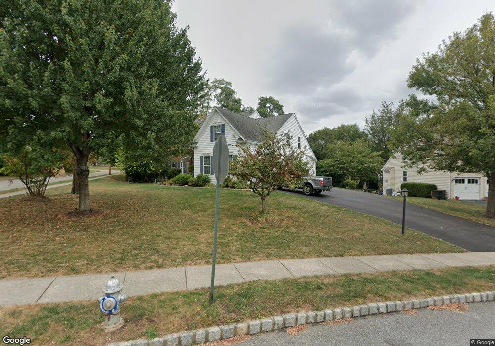
101 Gabrielle Ct Broomall, PA 19008
Marple Township Delaware NeighborhoodEstimated Value: $809,000 - $1,041,923
4
Beds
3
Baths
3,016
Sq Ft
$293/Sq Ft
Est. Value
About This Home
This home is located at 101 Gabrielle Ct, Broomall, PA 19008 and is currently estimated at $883,481, approximately $292 per square foot. 101 Gabrielle Ct is a home located in Delaware County with nearby schools including Loomis Elementary School, Paxon Hollow Middle School, and Marple Newtown Senior High School.
Ownership History
Date
Name
Owned For
Owner Type
Purchase Details
Closed on
Jul 7, 2006
Sold by
Delco Mather Associates Lp
Bought by
Benko Stephen P and Benko Christine A
Current Estimated Value
Home Financials for this Owner
Home Financials are based on the most recent Mortgage that was taken out on this home.
Original Mortgage
$350,000
Outstanding Balance
$208,016
Interest Rate
6.67%
Mortgage Type
Purchase Money Mortgage
Estimated Equity
$675,465
Purchase Details
Closed on
Mar 3, 2004
Sold by
Boas Katherine M
Bought by
Delco Mather Associates Lp
Home Financials for this Owner
Home Financials are based on the most recent Mortgage that was taken out on this home.
Original Mortgage
$3,500,000
Interest Rate
5.67%
Mortgage Type
Construction
Create a Home Valuation Report for This Property
The Home Valuation Report is an in-depth analysis detailing your home's value as well as a comparison with similar homes in the area
Home Values in the Area
Average Home Value in this Area
Purchase History
| Date | Buyer | Sale Price | Title Company |
|---|---|---|---|
| Benko Stephen P | $661,928 | Chicago Title Insurance Comp | |
| Delco Mather Associates Lp | $1,000,000 | Chicago Title Insurance Co |
Source: Public Records
Mortgage History
| Date | Status | Borrower | Loan Amount |
|---|---|---|---|
| Open | Benko Stephen P | $350,000 | |
| Previous Owner | Delco Mather Associates Lp | $3,500,000 |
Source: Public Records
Tax History Compared to Growth
Tax History
| Year | Tax Paid | Tax Assessment Tax Assessment Total Assessment is a certain percentage of the fair market value that is determined by local assessors to be the total taxable value of land and additions on the property. | Land | Improvement |
|---|---|---|---|---|
| 2025 | $11,317 | $654,890 | $137,170 | $517,720 |
| 2024 | $11,317 | $654,890 | $137,170 | $517,720 |
| 2023 | $10,958 | $654,890 | $137,170 | $517,720 |
| 2022 | $10,751 | $654,890 | $137,170 | $517,720 |
| 2021 | $16,224 | $654,890 | $137,170 | $517,720 |
| 2020 | $12,324 | $428,267 | $70,070 | $358,197 |
| 2019 | $12,175 | $428,267 | $70,070 | $358,197 |
| 2018 | $12,049 | $428,267 | $0 | $0 |
| 2017 | $12,055 | $428,267 | $0 | $0 |
| 2016 | $2,350 | $428,267 | $0 | $0 |
| 2015 | $2,350 | $428,267 | $0 | $0 |
| 2014 | $2,350 | $428,267 | $0 | $0 |
Source: Public Records
Map
Nearby Homes
- 300 Rock Run Cir
- 54 Sterner Ave
- 1 Lawrence Rd Unit A3A
- 1 Brighton Village Dr
- 7 Brighton Village Dr
- 306 Rock Run Cir
- 63 S Greenhill Rd
- 15 Oakland Rd
- 301 S New Ardmore Ave
- 88 4th Ave
- 1741 Lawrence Rd
- 127 Deerfield Rd
- 240 N Central Blvd
- 200 Marple Rd
- 106 2nd Ave
- Petersburg Plan at Cedar View
- Gilfillan Plan at Cedar View
- Balvenie Plan at Cedar View
- Bowmore Plan at Cedar View
- Clayton Plan at Cedar View
- 5 Mather Ave
- 105 Gabrielle Ct
- 7 Mather Ave
- 109 Gabrielle Ct
- 102 Gabrielle Ct
- 9 Mather Ave
- 113 Gabrielle Ct
- 106 Gabrielle Ct
- 8 Mather Ave
- 117 Gabrielle Ct
- 11 Mather Ave
- 21 Vassar Rd
- 110 Gabrielle Ct
- 25 Vassar Rd
- 10 Mather Ave
- 17 Vassar Rd
- 2178 Thomas Ave
- 13 Vassar Rd
- 12 Mather Ave
- 2193 W Chester Pike