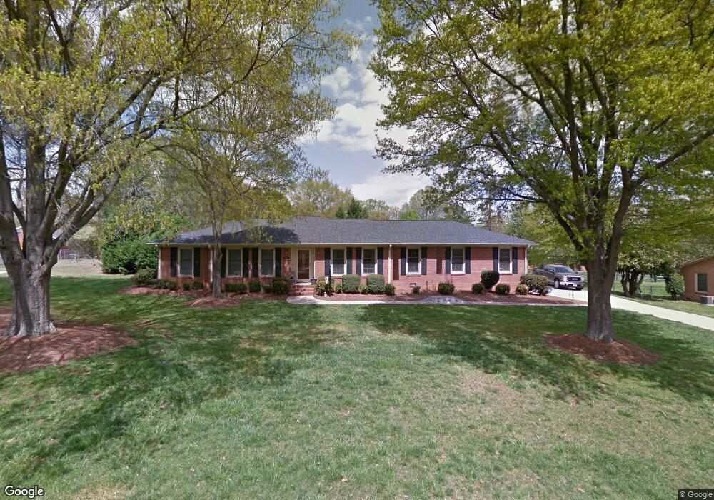
101 General Beauregard St Stanley, NC 28164
Estimated Value: $313,969 - $389,000
4
Beds
3
Baths
1,671
Sq Ft
$212/Sq Ft
Est. Value
About This Home
This home is located at 101 General Beauregard St, Stanley, NC 28164 and is currently estimated at $353,742, approximately $211 per square foot. 101 General Beauregard St is a home located in Gaston County with nearby schools including Springfield Primary School, Kiser Elementary School, and Stanley Middle School.
Ownership History
Date
Name
Owned For
Owner Type
Purchase Details
Closed on
Feb 27, 2006
Sold by
Beam Timothy W and Beam Elizabeth B
Bought by
Bowman Edwin J and Bowman Leslie S
Current Estimated Value
Home Financials for this Owner
Home Financials are based on the most recent Mortgage that was taken out on this home.
Original Mortgage
$128,800
Outstanding Balance
$72,405
Interest Rate
6.08%
Mortgage Type
Fannie Mae Freddie Mac
Estimated Equity
$281,337
Create a Home Valuation Report for This Property
The Home Valuation Report is an in-depth analysis detailing your home's value as well as a comparison with similar homes in the area
Home Values in the Area
Average Home Value in this Area
Purchase History
| Date | Buyer | Sale Price | Title Company |
|---|---|---|---|
| Bowman Edwin J | $161,000 | None Available |
Source: Public Records
Mortgage History
| Date | Status | Borrower | Loan Amount |
|---|---|---|---|
| Open | Bowman Edwin J | $128,800 | |
| Closed | Bowman Edwin J | $32,200 |
Source: Public Records
Tax History Compared to Growth
Tax History
| Year | Tax Paid | Tax Assessment Tax Assessment Total Assessment is a certain percentage of the fair market value that is determined by local assessors to be the total taxable value of land and additions on the property. | Land | Improvement |
|---|---|---|---|---|
| 2025 | $2,950 | $270,870 | $38,500 | $232,370 |
| 2024 | $2,950 | $270,870 | $38,500 | $232,370 |
| 2023 | $2,980 | $270,870 | $38,500 | $232,370 |
| 2022 | $2,418 | $179,110 | $20,000 | $159,110 |
| 2021 | $2,454 | $179,110 | $20,000 | $159,110 |
| 2019 | $2,472 | $179,110 | $20,000 | $159,110 |
| 2018 | $1,957 | $138,776 | $21,200 | $117,576 |
| 2017 | $1,957 | $138,776 | $21,200 | $117,576 |
| 2016 | $1,957 | $138,776 | $0 | $0 |
| 2014 | $2,116 | $150,106 | $30,000 | $120,106 |
Source: Public Records
Map
Nearby Homes
- 211 General Stonewall Jackson St
- 118 Durham Rd
- 2629 Dallas Stanley Hwy
- 3229 Bozeman Ct
- 3242 Bozeman Ct
- 132 General Pemberton St
- 1105 Leigh Ct
- 2119 Rolling Hills Ct
- 2123 Rolling Hills Ct
- 1505 Harper Landing Blvd
- 2611 Dallas Stanley Hwy
- 2215 Silverbell Ln
- 1987 Paddlewheel Dr
- Chatham Plan at Harper Landing
- Dakota Plan at Harper Landing
- Alexander Plan at Harper Landing
- Buchanan Plan at Harper Landing
- Brentwood Plan at Harper Landing
- Gibson Plan at Harper Landing
- Rockwell Plan at Harper Landing
- 102 General Stonewall Jackson St
- 201 General Beauregard St
- 104 Gen Stnwl Jcksn St
- 102 Gen Stnwl Jcksn St
- 5602 Hickory Grove Rd
- 106 Gen Stnwl Jcksn St
- 100 General Bragg St
- 5608 Hickory Grove Rd
- 5510 Hickory Grove Rd
- xxx Gen Stonewall Jackson Dr
- 203 General Beauregard St
- 108 General Stonewall Jackson St
- 0 Gen Stonewall Jackson Dr Unit 2217934
- 202 General Beauregard St
- 105 General Stonewall Jackson St
- 105 Gen Stnwl Jcksn St
- 103 Gen Stnwl Jcksn St
- 110 Gen Stnwl Jcksn St
- 5702 Hickory Grove Rd
- 205 General Beauregard St